Chasing the Tennessee River: The Road to My First Swim Marathon
After decades of marathons, triathlons, and a transcontinental cycling journey, I'm diving into an entirely new element. From the frigid 56°F waters of the San Francisco Bay to the stunning limestone cliffs of the Tennessee River Gorge, here is why I just signed up for my first 10-mile marathon swim.
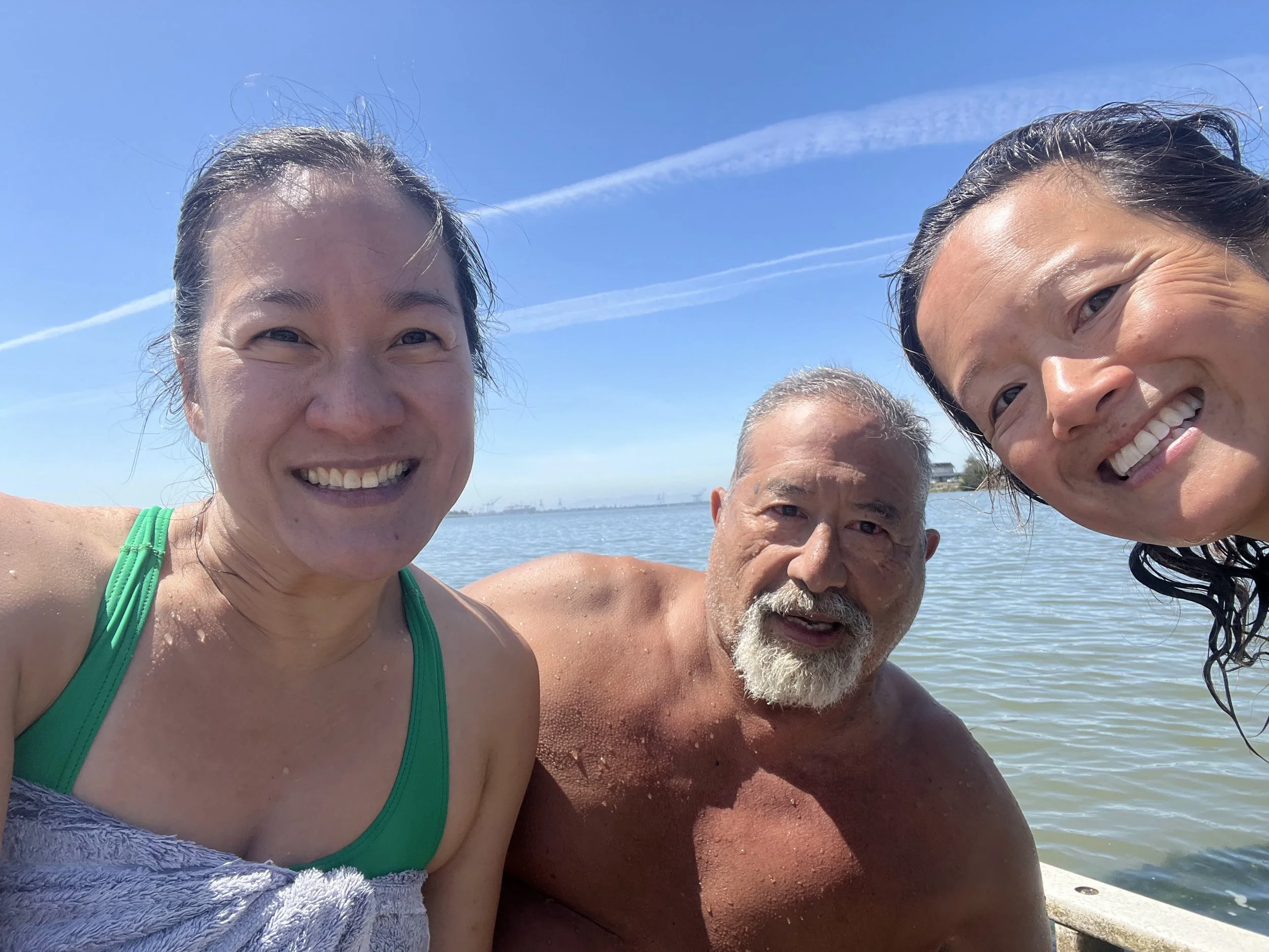
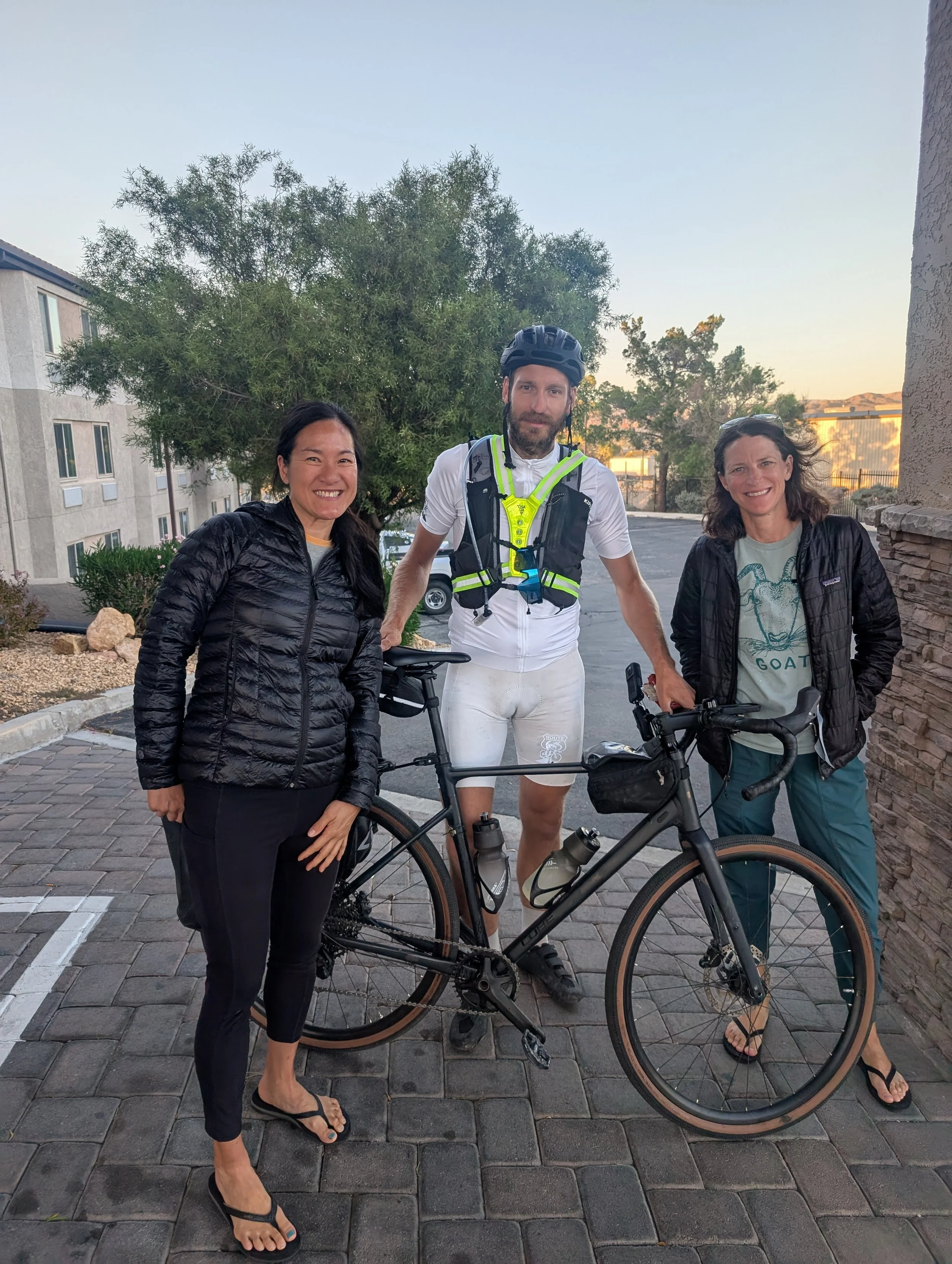
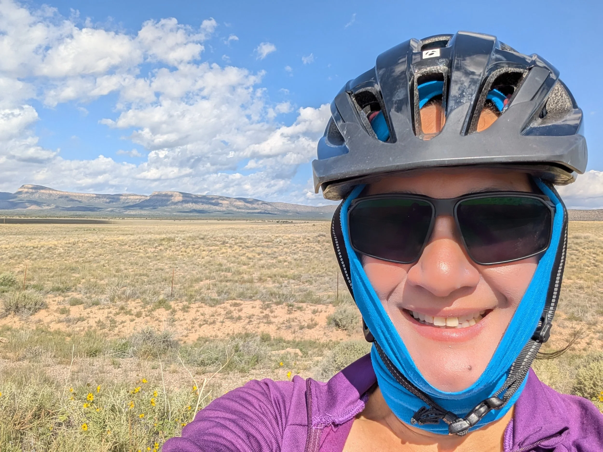
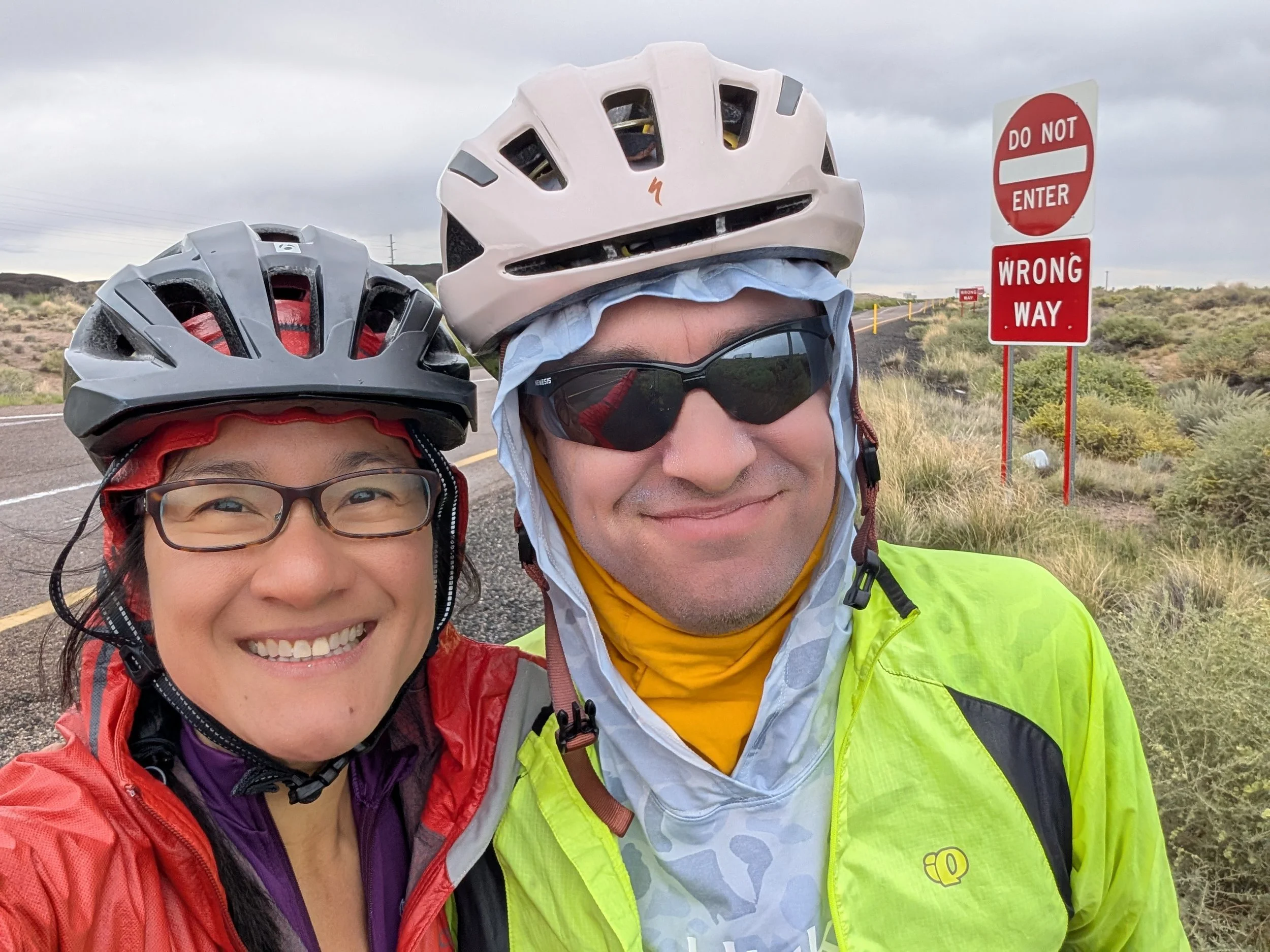
Three friends embarking on a chilly dip.
It’s 10:00 AM and the tide is slack. It is an exquisite morning at the Berkeley Marina, but as I stand on the floating pier waiting for my friends to arrive, my eyes are fixed on the frigid San Francisco Bay. No matter how warm the air temperature gets, 56°F water is always a violent shock to the system.
We swim for 847 yards over the course of 30 painstaking minutes. That breaks down to nearly a 3:30/100-yard pace. At this rate, it would take me an hour to swim a single mile, over six hours to complete a 10K, and more than ten hours to cover ten miles. Contrast that with my typical pool pace of 1:50/100 yards, and the math is humbling. When I finally emerge from the water, my lips are blue and my brain is delightfully loopy as mild hypothermia begins to set in.
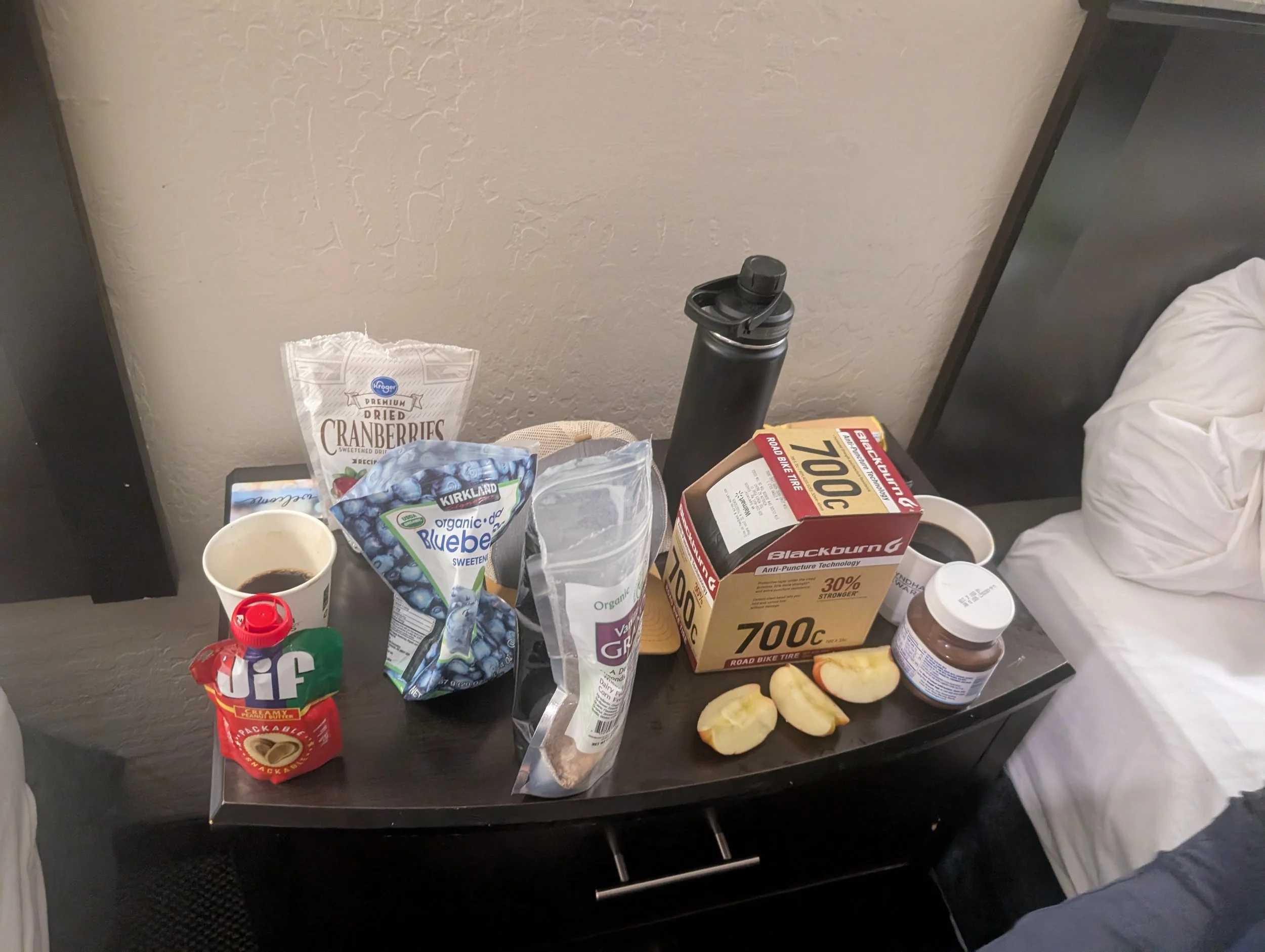
All year, I’ve been testing the waters for an aspirational goal that has haunted me for more than two decades: a true marathon swim. After a few punishing open-water sessions like this one, combined with a 5,000-yard benchmark set in the pool, I did what any worn-out, determined mom would do.
I signed up for Swim the Suck.
I’ve run more than 15 marathons, completed two Ironman triathlons, and biked across the country. Yet, I’ve never truly tested my limits in the alien world of marathon swimming. Now, with just three months left to train, I am staring down a 10-mile commitment. This isn't just about finishing; it’s an exploration of limits, rhythm, and what it means to keep moving forward when you can no longer see the shore. And I’m scared.
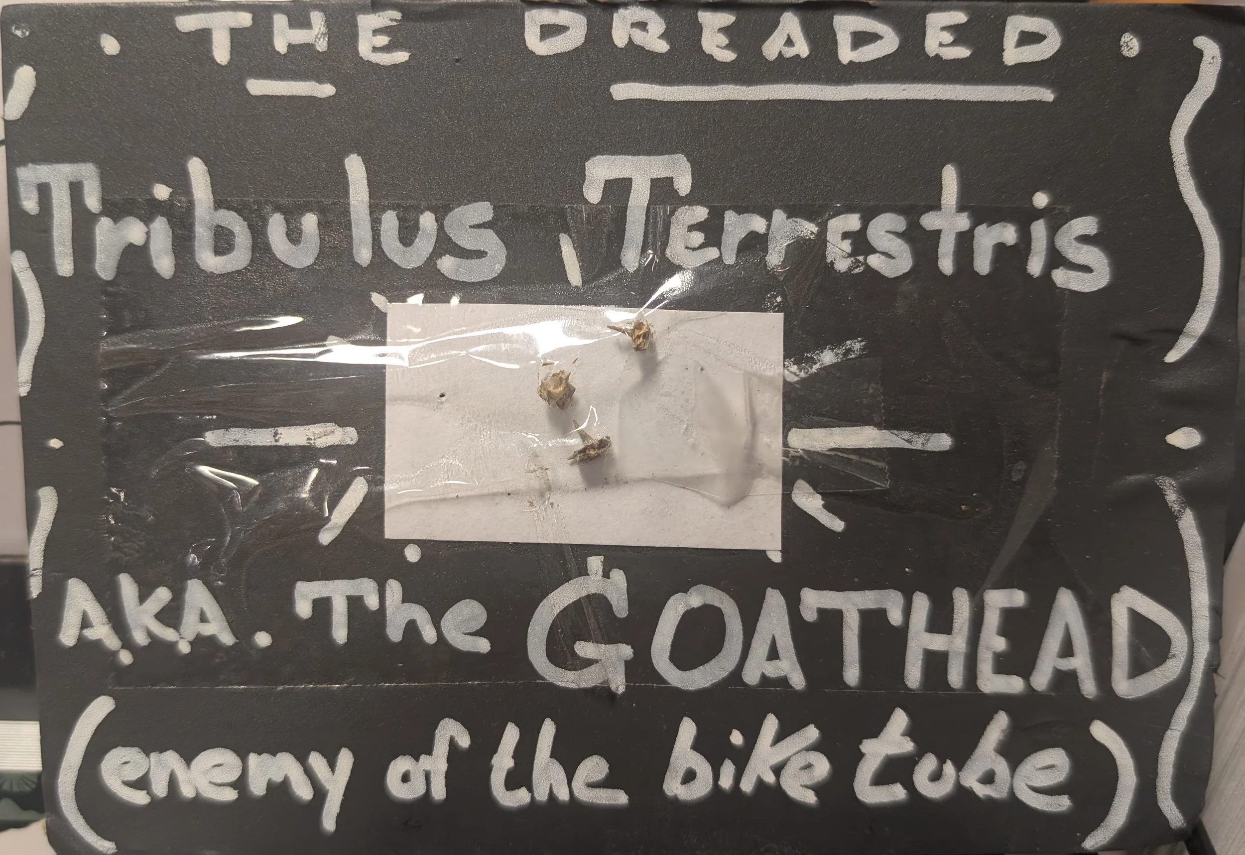
What is Swim the Suck?
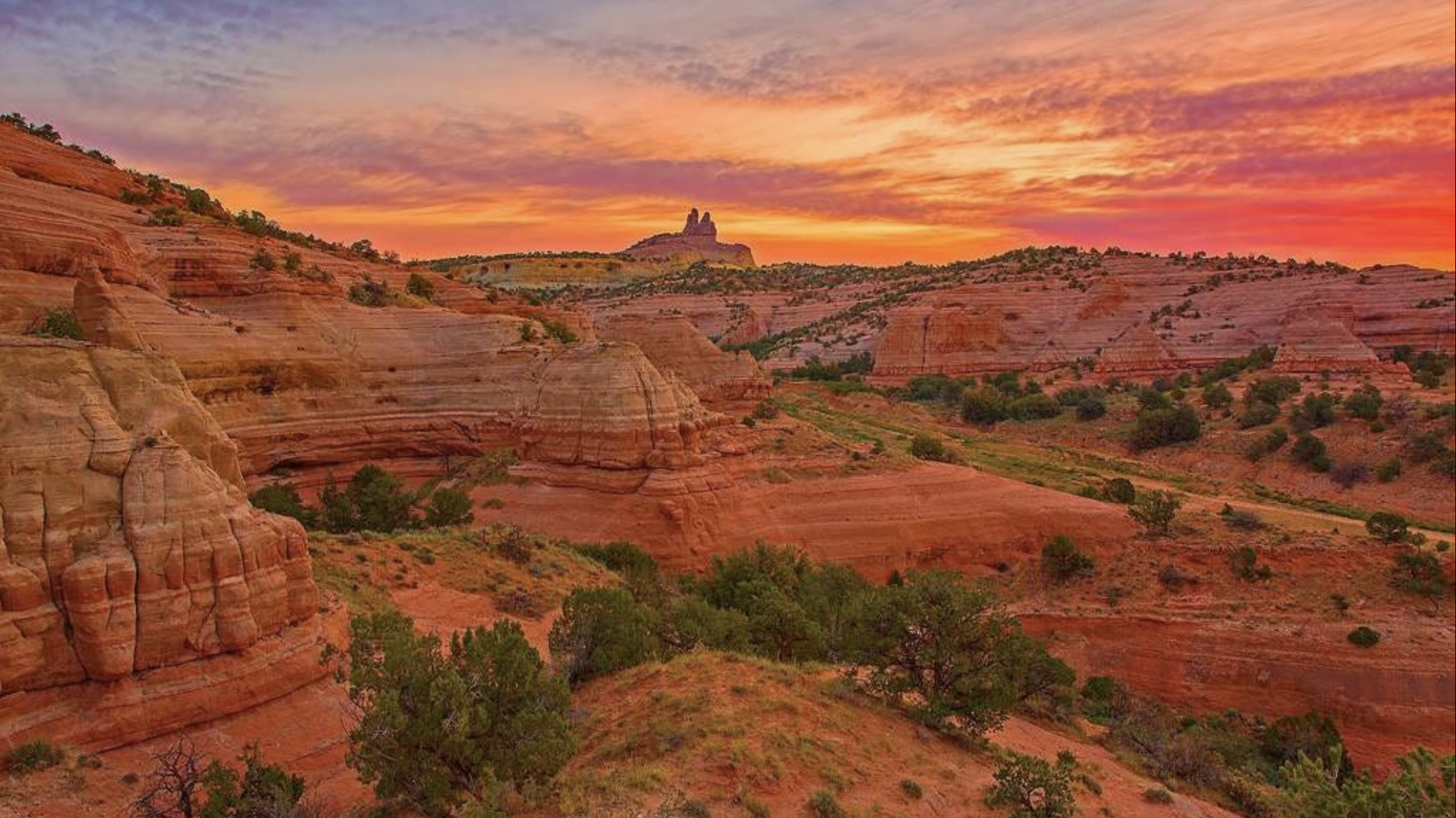
The race begins at the mouth of Suck Creek—hence the name—and winds in a serpentine S-pattern through the Tennessee River Gorge. Towering, forested limestone canyon walls rise hundreds of feet above the riverbanks, offering an immersive, linear tour of a massive wilderness ecosystem rather than the repetitive, dizzying loops of a traditional open-water course.
The 10-mile route runs entirely downstream. Participants generally benefit from a favorable tail current generated by upstream dam releases, with a six-hour cutoff to complete the course. However, the river environment remains highly unpredictable. Autumn winds blowing against the current can instantly transform glass-smooth water into a disorienting, choppy washing machine, forcing swimmers to constantly adapt their stroke during a three- to five-hour endurance test.
I chose this race because that downstream current offers a welcome safety net. Additionally, the autumn water temperatures hover comfortably between 74°F and 78°F. The finisher "medal" is actually a beautifully hand-crafted artisanal mug. And finally, the race organizers possess an excellent sense of humor—there is even an official prize for the person who manages to stay in the water the longest. Looking at my current open-water training pace, that prize might just be mine for the taking.
Over the coming weeks, I’ll be sharing my training architecture, progress updates, gear breakthroughs, and nutrition strategies. Stay tuned—the journey to Tennessee starts now.
Hi, I'm Moving Off Substack.
After months of developing my voice on Substack, I hit a structural roadblock: the platform’s walled garden heavily restricts SEO and discoverability. To truly own my digital footprint—and make my deeply researched content easily findable by the outside world—I am moving my writing to a new, open home. Here is why I'm making the leap to a self-owned platform and what is next for this journey.
I’ve recently made the decision to move my writing off Substack.
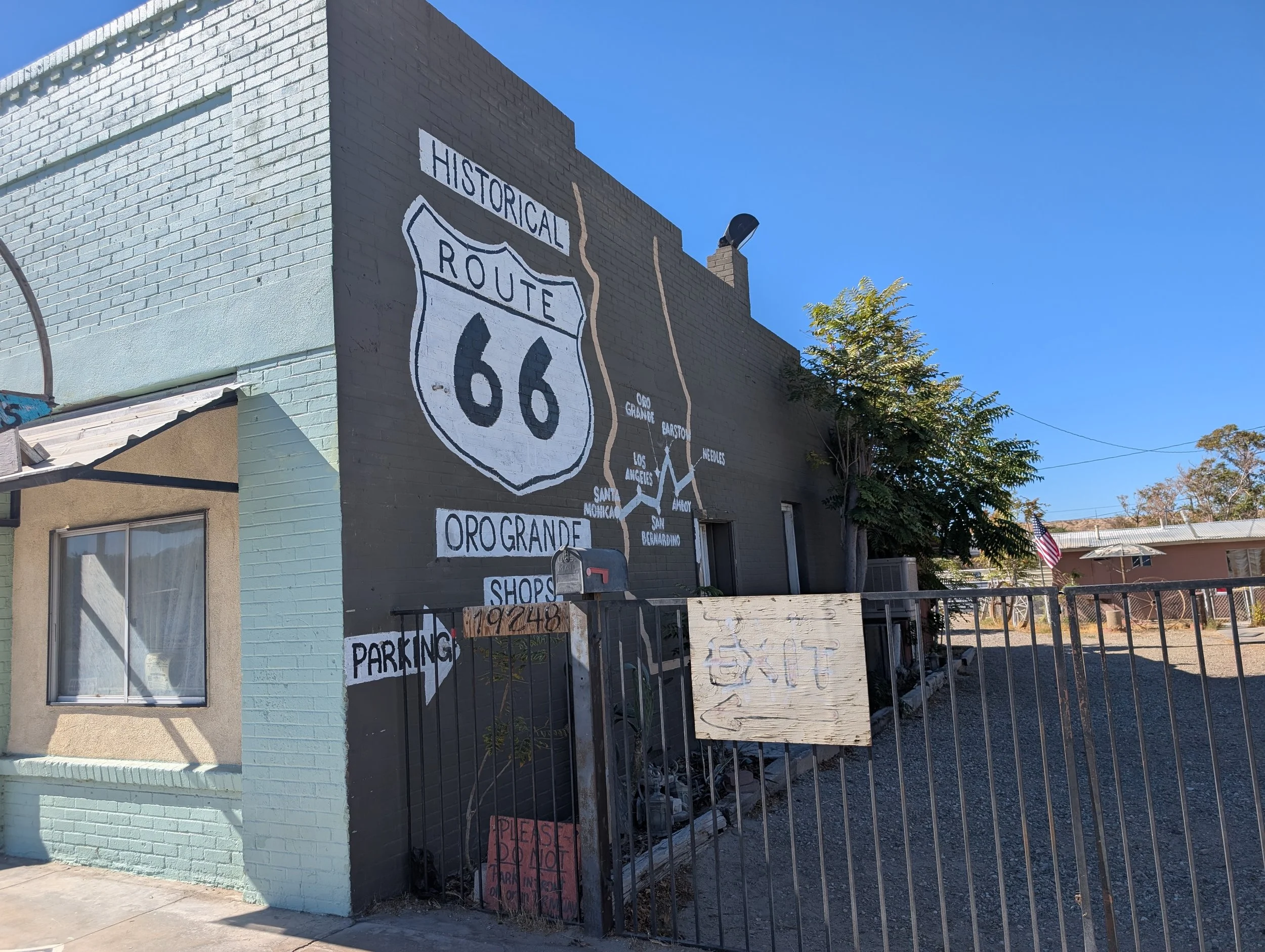
The platform has been a fantastic place for me to develop my voice, but I’ve hit a structural roadblock. Not long ago, I googled “cycling Route 66”—a topic I’ve written about extensively—and realized just how tightly Substack walls off its proverbial garden. Because of how the platform is structured, none of that deeply researched content is easily discoverable by the outside world.
Now, this isn’t to say I’ll suddenly rank at the top of Google overnight without doing some serious SEO tinkering. But to build something that actually has a chance to be found, I need to own my digital footprint. With that in mind, I’m leaving for greener, and more open pastures.
Thank you for joining me on the next leg of this journey. This is my new home where you can find all my archives, new updates, and future projects.

Del Valle—Derailed: What a Front-Steps Wipeout Means
I was supposed to tackle my first 10k marathon swim at Lake Del Valle this weekend. Instead, a split-second slip during the morning school run changed everything. Here is how a mom-reflex moment benched my race plans, what it takes to swallow that tough pill, and how I’m already pivoting the training block for the long game.
Sometimes the best-laid plans fail.
This post was supposed to be about tackling my first 10k marathon swim this Saturday, June 20, at the Del Valle Open Water Festival. Instead, a little slip means I’ll be cheering from the sidelines.
The Del Valle Open Water Festival is an annual staple held at Lake Del Valle in Livermore. It draws an incredible community of athletes, ranging from recreational open-water enthusiasts (read: amateurs like me!) to elite marathon swimmers and triathletes. Running across the entire weekend, it features everything from 1.5k sprints to the grueling 10k distance— I have several friends diving in this year.
For me, this weekend was supposed to be the ultimate early-season litmus test. I wanted to see how I’d handle marathon distance in a relatively controlled arena. The freshwater conditions mean no salt water (obviously!), the temperature is slated for a comfortable 70–74°F, and the water is reliably flat—a massive contrast to the brutal ebb and flow of the sea. Plus, there are zero sharks, a mental hurdle that haunts me more than I'd care to admit.
Because it resembles a massive pool more than the 60-65°F, choppy Berkeley Marina where I usually train, Del Valle would have been my perfect laboratory. It was my chance to focus strictly on distance endurance, event nutrition, and temperature management — in a race setting— all just an hour from home.
To prepare, I spent the last two months intensifying my yardage at the pool, ramping up my Masters sessions, and logging serious time acclimating to the frigid waters of the San Francisco Bay.
All of it was kaboshed by one tiny slip on a wet morning before school drop-off.
Watch the wipeout on the front steps, which derails my first swim marathon aspirations.
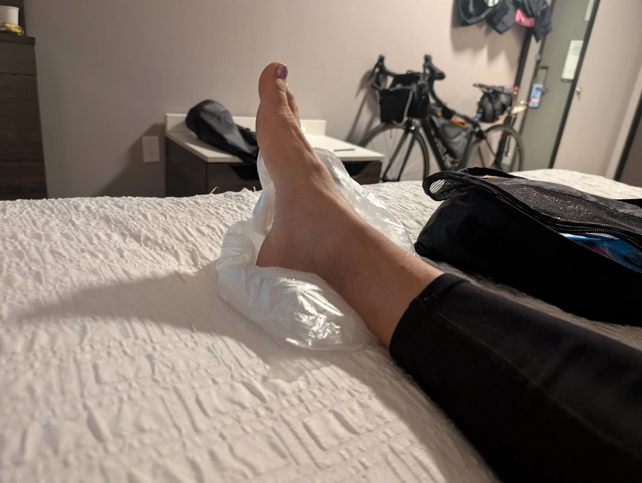
As a mom, you live your life responding to everyone else's crises, rarely your own. It is a massive shift from the carefree days when you were your own only limiting factor. On this day, I slipped while escorting my daughter down the front steps. As I went down, my brain didn't think about training blocks or race targets; all I could think was: Please don't let my daughter get hurt.
She was completely fine. I, on the other hand, severely sprained an already weak ankle (the same one from my previous post). The kids? Both of them cackled with laughter and utter delight.
Getting derailed like this is deeply discouraging. For a week, I benched myself entirely, terrified of making it worse. But once the initial shock wore off, I remembered that swimming is a non-impact sport. I got back in the pool, locked a pull buoy between my legs, and started grinding out 1,000-yard sets, alternating with and without paddles.
But a pull buoy only gets you so far. With race day tomorrow, I still can't kick properly, let alone for 10 kilometers.
It is with a heavy heart that I’ve decided to pull out of the race. It’s a tough pill to swallow, but hopefully, it's the smart play for the long game. Good luck to everyone racing out at the lake this weekend!
Stay tuned for how I’m pivoting my training strategy to include serious ankle rehab and strengthening. We aren't done yet.

Moving the Finish Line: Why Route 66 Was Just the Beginning
A funny thing happens when you start training your body and mind for the seemingly impossible: your horizon expands. Route 66 wasn't the final destination; it was just the first entry on a much longer, rowdier bucket list. From 10-mile marathon swims to the Boston Marathon, we’re changing the script. Welcome to the home for chasing massive endurance goals in midlife—as a mother of two, a non-natural athlete, and someone who refuses to let go of her immature dreams.
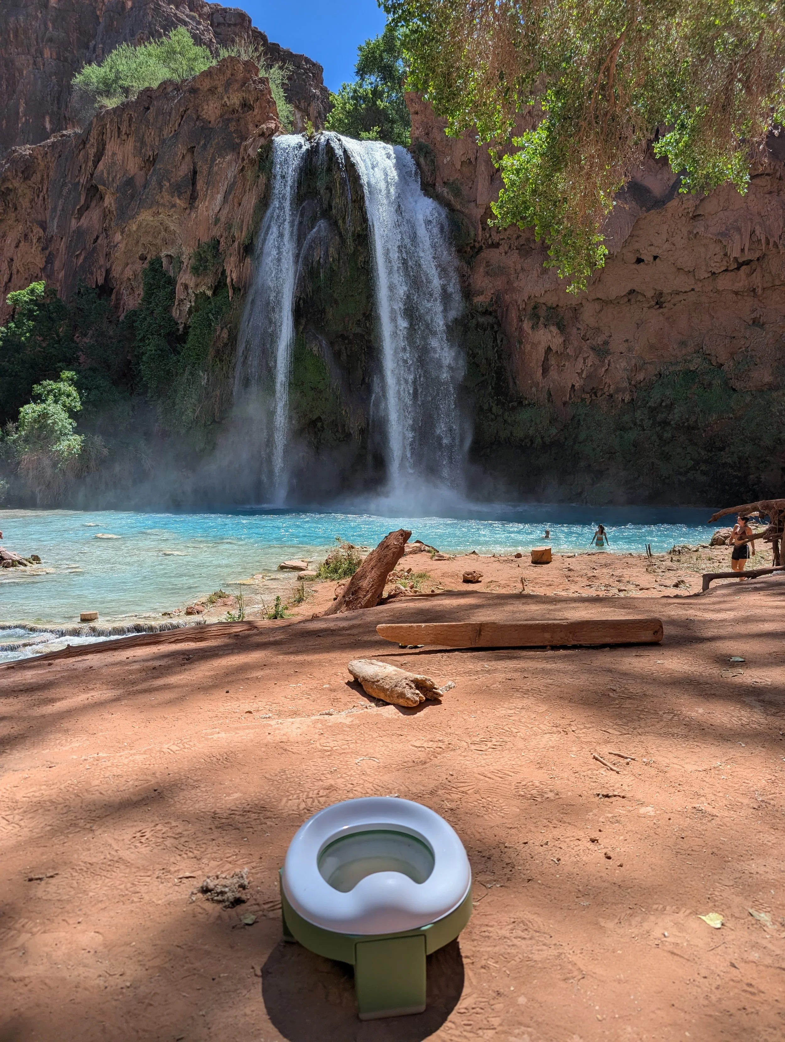
Havasu Falls: An ideal potty training destination?
Every project starts with a single spark. For me, that spark was Route 66—the sheer, audacious idea of mapping out a life across two thousand five hundred miles of asphalt from the saddle of a bike. I wanted to see if I could do it, sure. But more than that, I wanted to see who I would become on the other side of it.
But a funny thing happens when you start training your body and your mind for the seemingly impossible: your horizon expands.
As I logged the miles and mapped out the logistics, I realized that Route 66 wasn't the final destination. It was just the first entry on a much longer, much rowdier bucket list.
So, we’re changing the script. This space is evolving from a single-focus cycling chronicle into something bigger: a home for chasing bucket-list endurance goals in midlife.
Next up for me? Swapping the bike saddle for the open water to tackle Swim the Suck—a 10-mile marathon swim through the Tennessee River Gorge this October. And after that? The road to qualifying for the Boston Marathon. And who knows what the future holds?
The "Why Now?" (And the "How??")
Let’s be entirely honest for a second. The internet is flooded with fitness influencers who have genetic lottery tickets, twenty-somethings with infinite recovery time, and elite athletes who have been winning races since childhood.
That’s not me.
If you’re here, it’s probably not yours either. I am carving out this space because of three distinct realities:
I am in midlife. Recovery takes longer, joints are louder, and the stakes feel different. But the mental grit? That’s at an all-time high.
I am a mother of two young kids. My training plans don’t exist in a vacuum. They are constantly negotiated around bedtime routines, family logistics, and the beautiful, chaotic rhythm of raising small humans.
I am not naturally athletic. I wasn't the star track athlete or the high school swim champ. I am a "made" athlete, built entirely out of grit, stubbornness, and a refusal to let go of my immature dreams.
What We’re Diving Into Next
This blog isn't just a highlight reel of finish lines. It’s a tactical, unfiltered deep dive into what it actually takes to pull this off, hopefully without letting the rest of your life unravel.
Moving forward, we’ll be breaking things down into a few core pillars:
Deep-Dive Sport Training: The exact, gritty mechanics of transitioning from high-volume cycling to marathon swim yardage and marathon pacing. No fluff—just the data, the workouts, and the adaptations.
The Family/Adventure Balance: The real-world logistics of balancing peak training blocks with being a present parent and partner. How we make big adventures a family affair.
Nutrition & Midlife Physiology: Fueling a body that is working harder than ever, optimizing recovery, and respecting the unique hormonal and physical landscape of midlife endurance.
Gear & Event Logistics: From the specific tech required to navigate open water to the mind-bending logistics of crew support, road trips, and remote event planning.
Mental Wellness: The psychological shift required to stare down a 10-mile river swim or a multi-week endurance trek and say, "Yeah, I belong here."
Join the Chase
Whether you are looking at a map of Route 66, staring at a massive peak, or just wondering if, after kids, you’ve still got it—this is for you.
We aren't slowing down; we're just getting started.
Drop a comment below: What is the one "irrational" athletic goal you've been quietly harboring? Let's figure out how to build the engine to get you there.

What I Learned from Cycling Route 66
Perfect is the enemy of progress. If I had waited until I felt completely ready to cycle Route 66, I might never have left the driveway. But riding into a baking desert with zero training, a bike bought sight unseen, and five spare tubes in my bag? That wasn't exactly smart, either. From the brutal reality of California’s roads to the magic of small-town hospitality, here is everything I learned across two cross-country journeys—and exactly what I would do differently next time.
Bucket List Goal: Cycling the Length of Route 66 — Bam! Done!
This trip would not have been possible without the encouragement and support of my husband. From buying the maps back in 2015 to green-lighting my absence from not one but two young kids, he has mercifully allowed me to ease into adulthood at my own pace.
In that vein, I also have to thank my mother-in-law, who did the real work while I was away, and my dad, who accompanied me for half of the journey. Thanks also to my brother for outfitting my dad for his big adventure, and to my mom for cooking the food that fueled me.
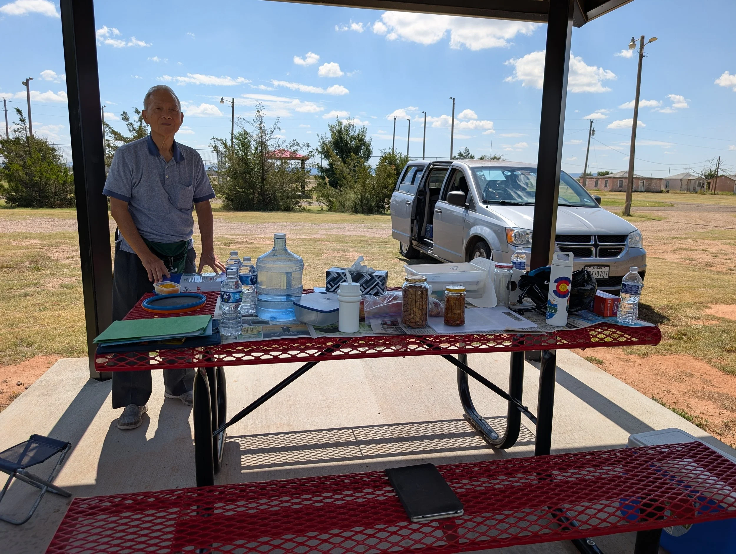
My dad and the spread waiting for me at a park.
To my friends Nelson and Marisa, thank you for inspiring me to actually do this trip. To Katy, thank you for showing me how to train for it. And to Dan and Sara, thank you for making the final stretch feel like a bike ride in the park with friends.
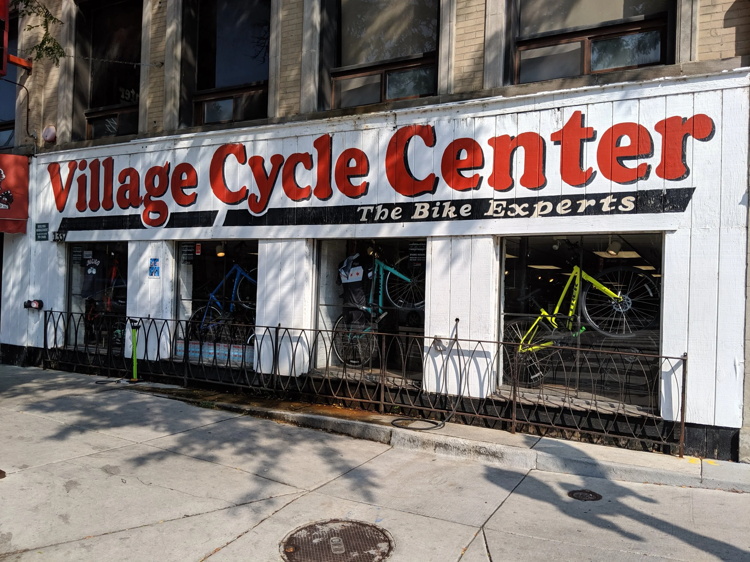
Outside Village Cycle Center in Chicago, IL.
I also want to express my gratitude for the amazing independent bike shops along the route, especially Village Cycle Center in Chicago; Sun Adventure Sports and Hill's Sport Shop in Amarillo; The SpokesMann in Kingman; and The Bike Shop Santa Monica. These businesses are the lifeblood of cycling. They serve cyclists without questioning the crazy adventures we dream up, and they're filled with people who have hard-earned experience and practical advice to share. This is especially valuable in smaller towns where there may not be many other resources available. I also want to give special recognition to Single Track Bikes in Flagstaff, whose service and expertise went above and beyond. I share more details in my Day 12 post.
Part of what made this trip such an incredible experience was the people living and working in the towns along Route 66. Yes, the route's heyday has passed, but there is still a tremendous amount of energy and enthusiasm surrounding it.
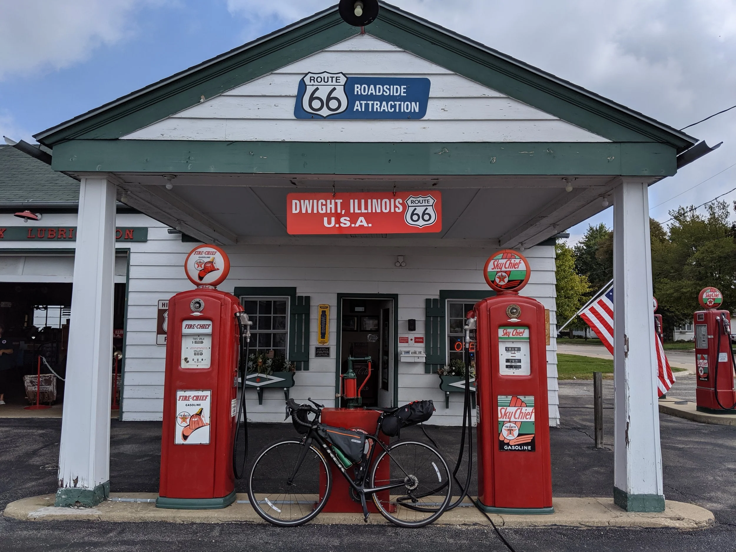
An adorable ‘Roadside Attraction’ in Dwight, IL
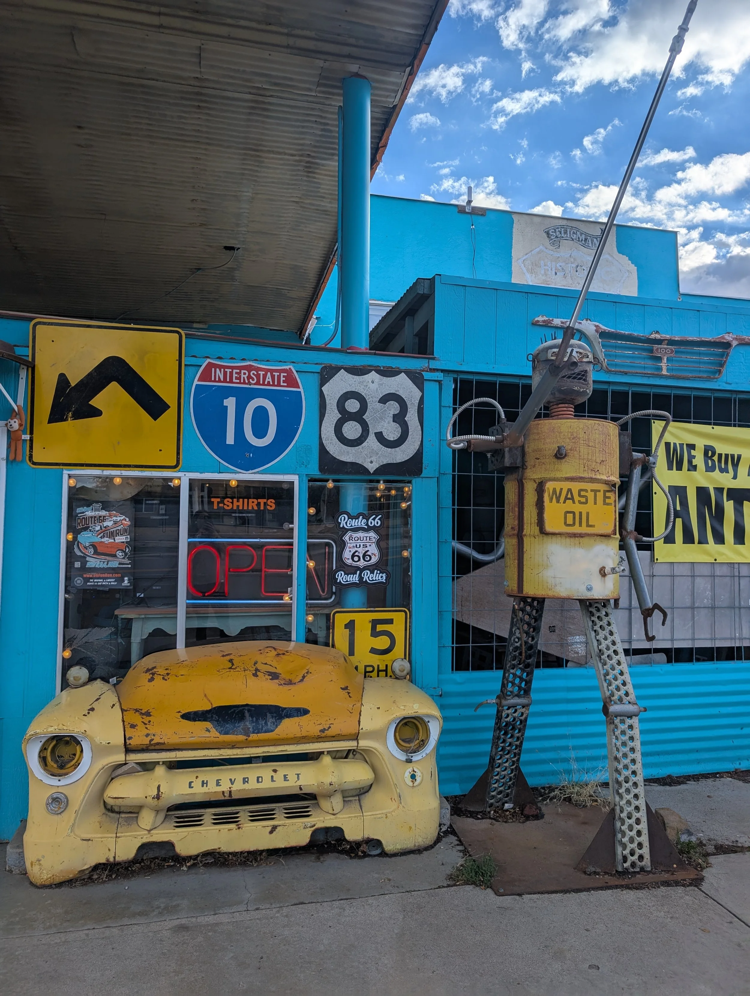
Seligman was a particular gem in my eyes. It felt like a town being lovingly rejuvenated by a younger generation invested in preserving and celebrating its history. The motel where I stayed was one example of that spirit. So was the roadside museum in Dwight, Illinois. The model train depot in McLean, Illinois, was another memorable stop.
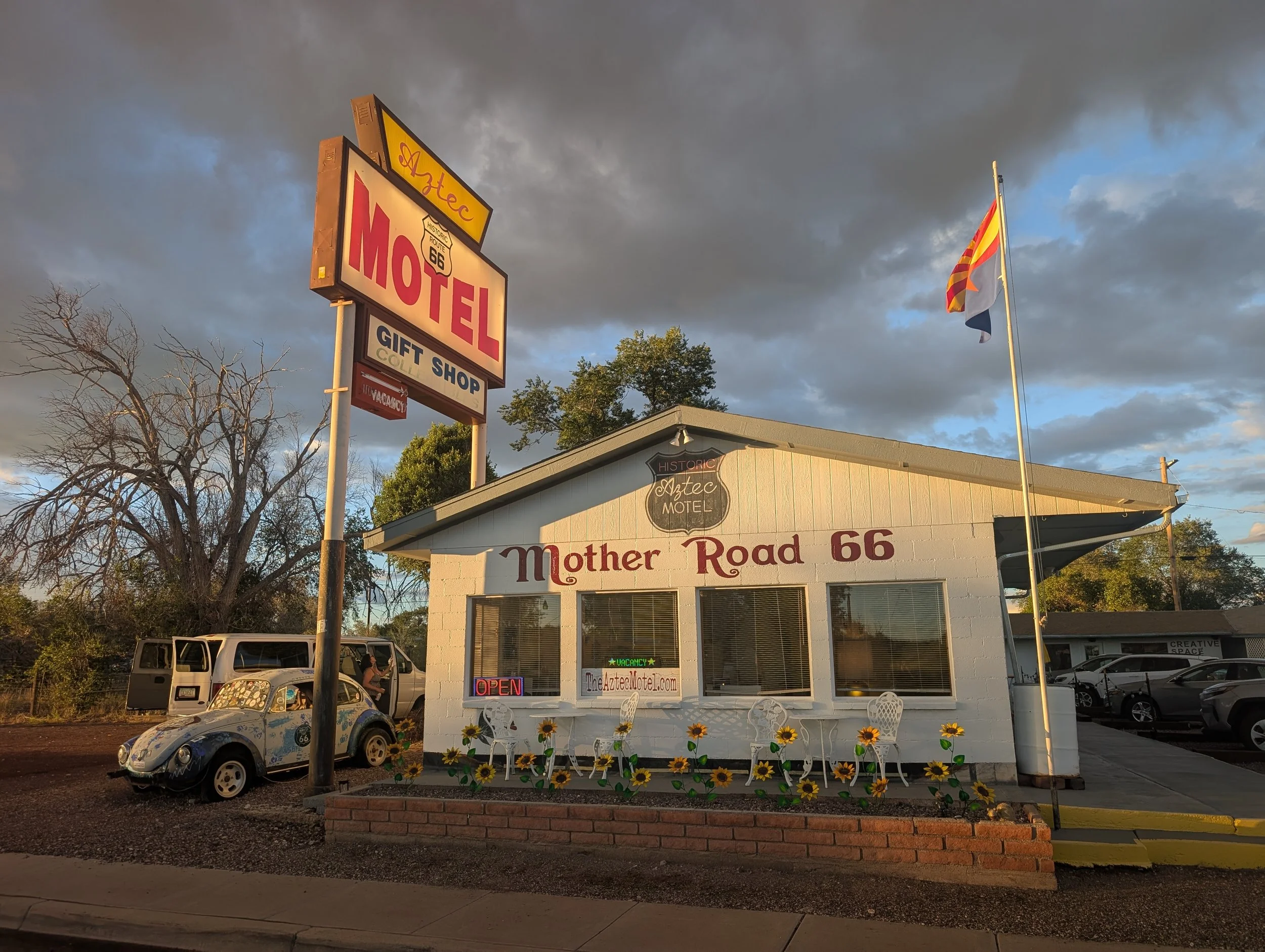
Aztec Hotel in Seligman, AZ
Two other places that stood out were Tulsa, Oklahoma, and Springfield, Missouri. Both cities felt youthful and energized. Possibilities seemed boundless, and there was a sense of optimism in the people I met that was genuinely contagious.
The thing that was most surprising to me? California has shit roads! New Mexico, surprisingly, has great roads!
What I would do differently
Perfect Is the Enemy of Progress
My friends Marisa and Nelson encouraged me to stop inventing roadblocks and excuses. Instead, they encouraged me to embrace my midlife crisis, which ultimately saw me buying a bike sight unseen and riding for the first time in six years the day I arrived in Chicago.
Was that intelligent? No.
Should I have trained? Absolutely.
But if I had waited until I felt completely ready, I might never have done the ride at all.
Training Is Not Cheating
That said, if I were to do this again, I would spend at least three to four months training, building up to 80–100-mile rides in windy, wet, and hot conditions.
When I look at photos from 2019, I see a lot of preventable suffering. For the 2025 ride, I spent several months riding distances of up to 60 miles with elevation gains that mirrored what I’d actually face on the road. It paid off. Despite riding through terrain that was far less hospitable, the trip itself felt much easier.
The First Half Is Better
While the desert offers undeniable desolation, isolation, and romance, the stretch from Chicago to Amarillo was a much better, more scenic ride. It features more parks, more water, and far better preservation of the historic route itself. Next time, I would allocate more time to enjoying this first half, despite the increased traffic and population density.
Tubeless Tires (Don’t think twice)
Get them.
Yes, you'll need to carry sealant and a few extra supplies. But you'll avoid repeatedly stopping on the highway to replace tubes punctured by the tiny steel wires shed from semi-truck tires.
At one point, I was carrying five spare tubes because I had no idea where the next bike shop would be.
Learn Basic Bike Maintenance
Which brings me to maintenance.
I am not a bike mechanic. I have very basic skills: I know what most of my tools do, and I can change a flat. On the road, I typically stopped into a bike shop every 400-500 miles. For my comfort level, it was okay not to be an expert; if I had waited to master mechanics, I would have never left the driveway.
However, that lack of confidence was the exact reason I initially skipped tubeless tires. I erred by sticking with what was familiar instead of adopting what was categorically better.
Pack Minimally, If You Can
This depends on your travel philosophy—and, frankly, your budget—but I found a minimalist setup to be ideal.
I rode a road bike rather than a traditional touring setup. I stayed in hotels, ate at restaurants, and carried only one change of clothes.
There was something incredibly liberating about it.
I didn't need racks or panniers. Instead, I used a frame bag, a handlebar bag, and a seatpost bag, all of which worked perfectly with a full carbon frame.
Nutrition Matters
In 2019, I fueled myself primarily with cola, Swedish Fish, ice cream, and burgers.
Six years later, I discovered that age has opinions.
For the second trip, I had to be much more intentional about nutrition and recovery. If you have the opportunity, I would recommend meeting with a sports nutritionist beforehand. Understanding the type and amount of fuel your body actually needs can make a significant difference over the course of a long ride.
Skip the SAG Wagon
For most riders, a support vehicle is unnecessary.
Unless you're attempting something highly specialized, Route 66 is accessible enough that you can travel self-supported and still find the services you need along the way.
Have Faith
Faith in people. Faith in yourself.
Pop culture—whether it’s the movie Se7en or True Detective—would have you believe that every small town is harboring a serial killer. Out on the road, that couldn't be further from the truth.
I found a world filled with kind, friendly, and generous people. Strangers routinely showed up right when I needed help the most, even if it wasn't the exact technical help I required.
Sometimes you are entirely capable of solving a problem on your own, but just having that first person pull over and ask, “Are you okay?” is all you need to remember that the world cares.
Finally, on a massive ride like this, things rarely go according to script. You will inevitably find yourself facing a brutal, 110-mile day through a baking desert. In those moments, you must maintain absolute faith in yourself. Doubting your capability when things look worst is a distraction at best—and at worst, it will eat you from the inside out.
Go out and see what you’re made of.
Lost photos from Robert F Scott’s last expedition to Antarctica. Source: The Map House
RT66 Day 20: The End.
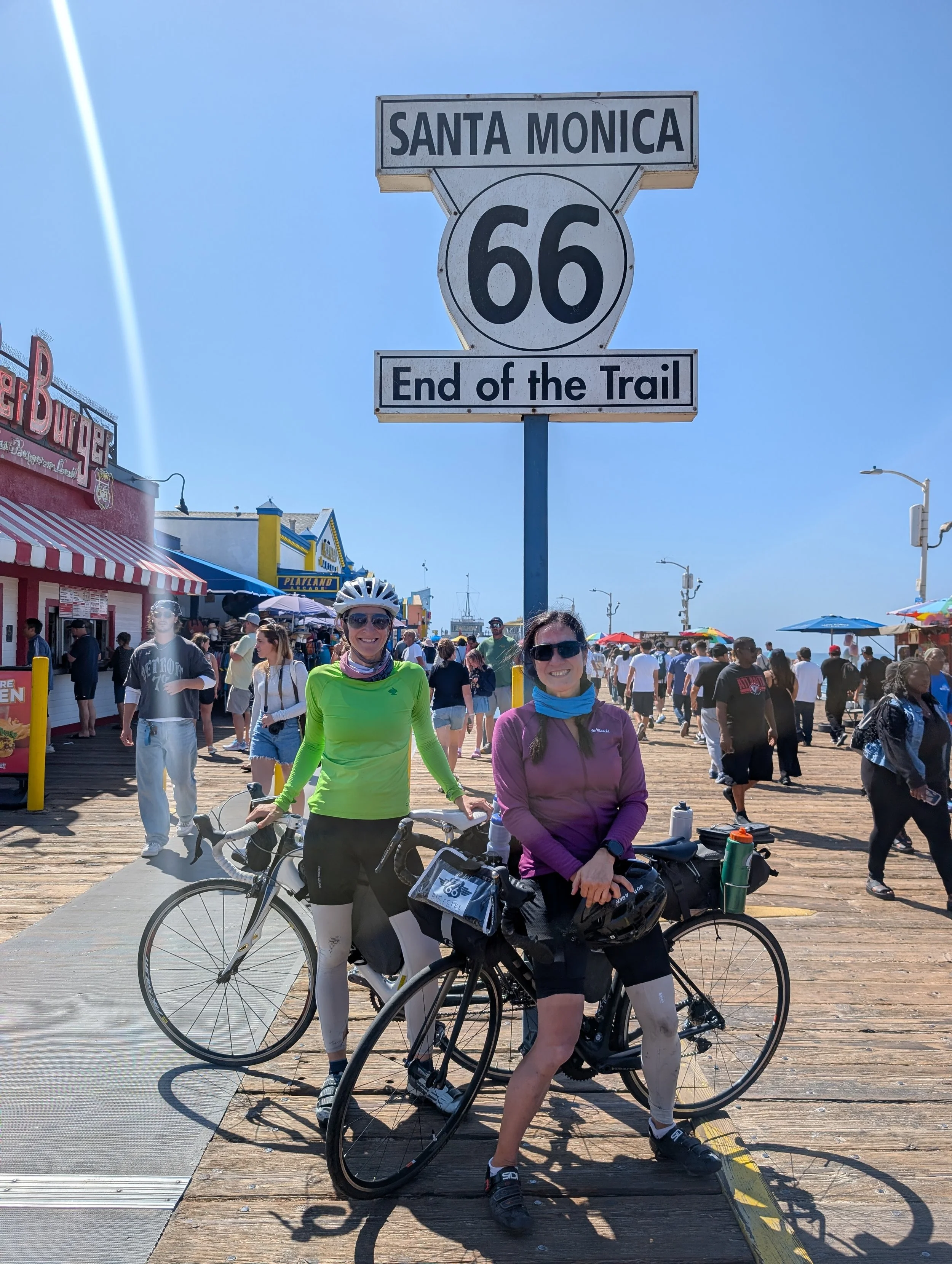
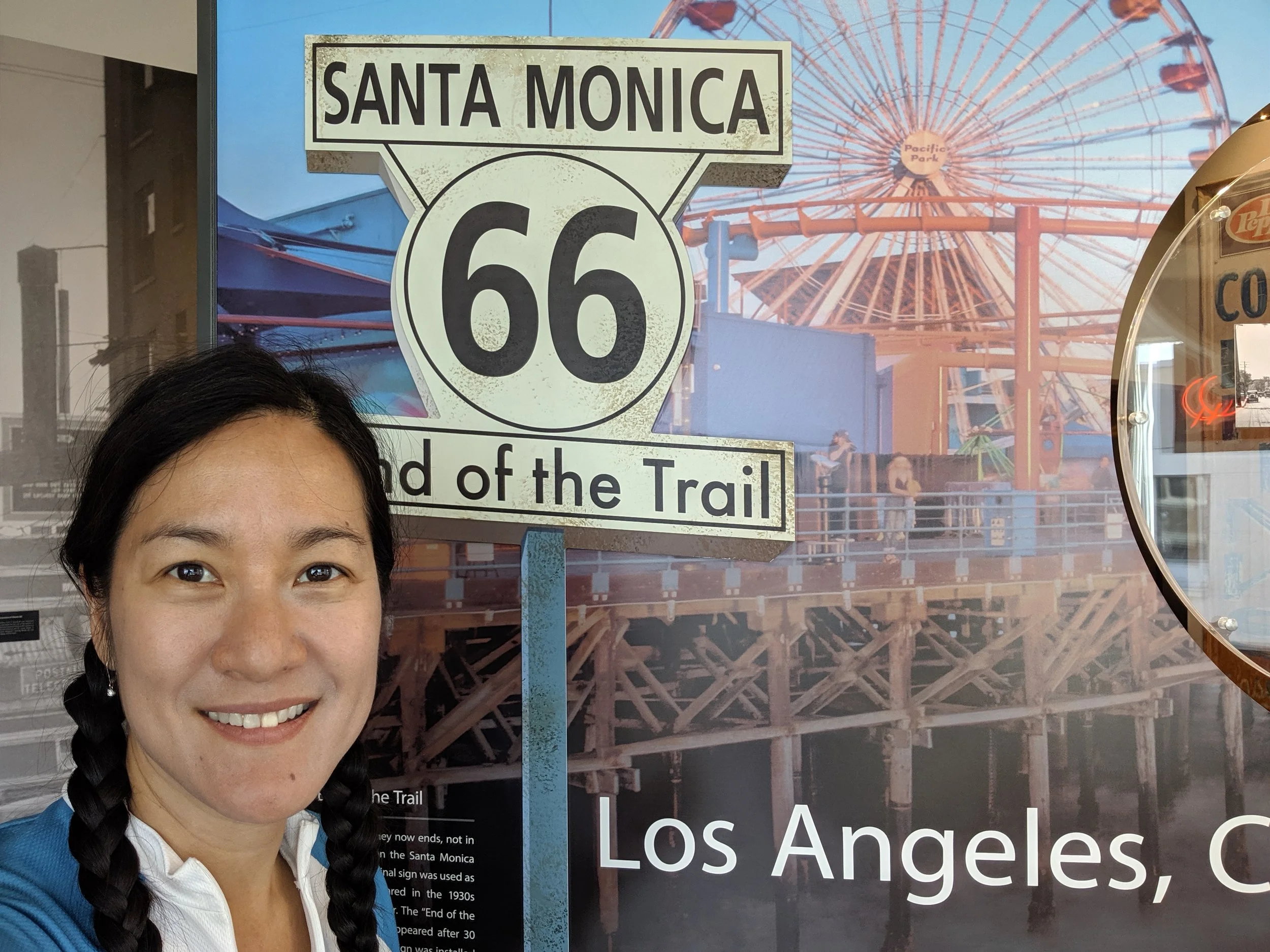
After five years, two children, and thousands of miles, I finally completed my Route 66 cycling journey at the Santa Monica Pier. From dramatic thunderstorms in 2019 to the quiet satisfaction of finishing the second half in 2025, this post reflects on adventure, motherhood, marriage, and what it means to keep pursuing big dreams while building a family. If you’re planning a Route 66 bike tour or dreaming about bicycling Route 66 yourself, this series shares the realities, logistics, and emotions of the journey.
Perfect conditions marked the end of a journey that has spanned five years and the birth of two children. The only question that remains: what’s next?
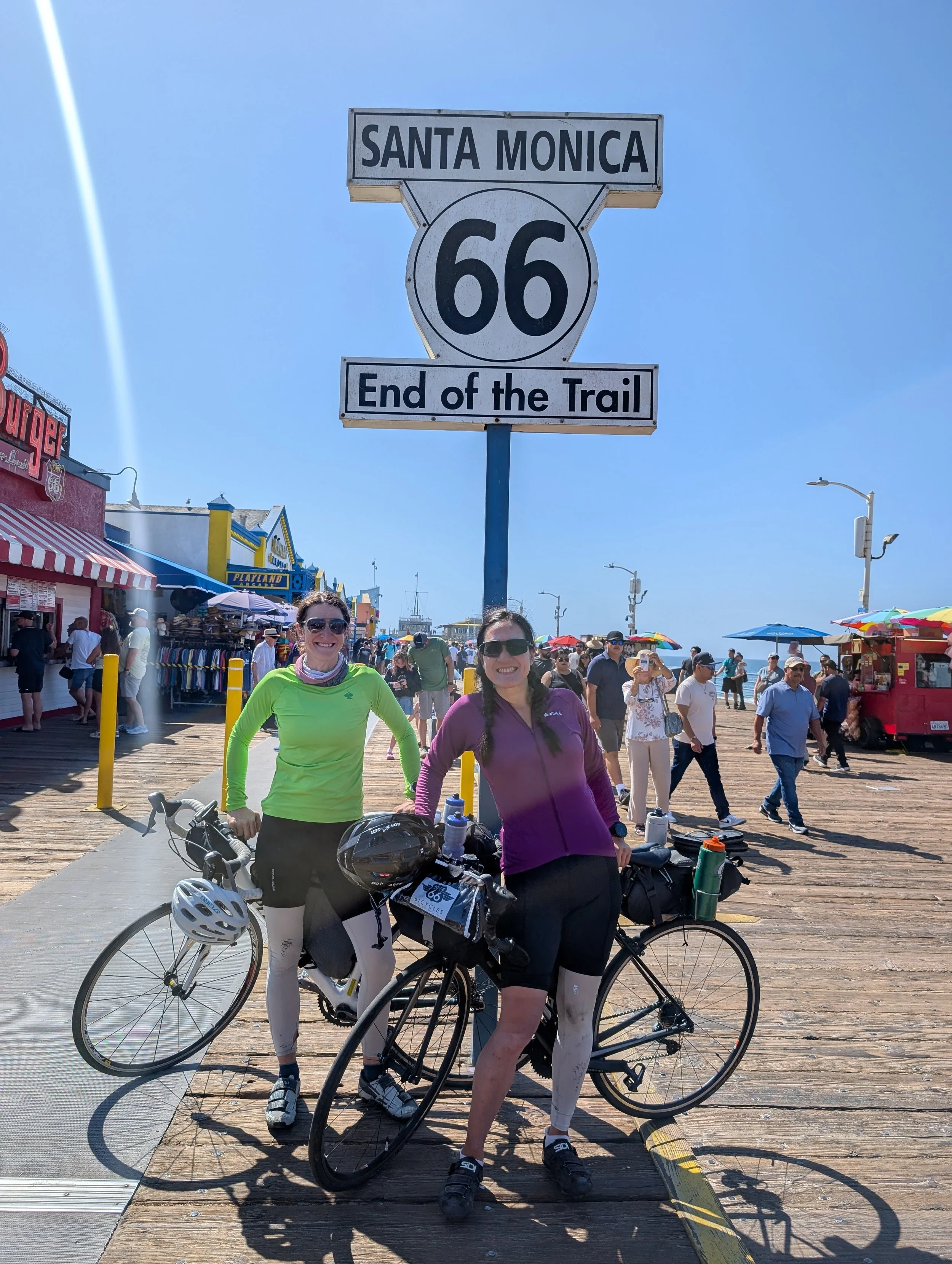
Santa Monica Pier: The End of Route 66 and a 5-year journey from Chicago to Los Angeles.
Day 20: Rancho Cucamonga, CA to Santa Monica, CA; 66 miles, 1,348 feet elevation gain
Day 20: Planned on Ride with GPS (Part 1) | (Part 2)
Intraday Stops: We have returned to civilization with coffee shops, restaurants, and services available throughout Los Angeles.
There isn’t much to say. We woke to one of those perfect Southern California days: 76°F, sunshine, no wind, and, since it was Sunday, no early morning traffic. Sara had an afternoon flight, so we raced to the pier and made it there in just over five hours.
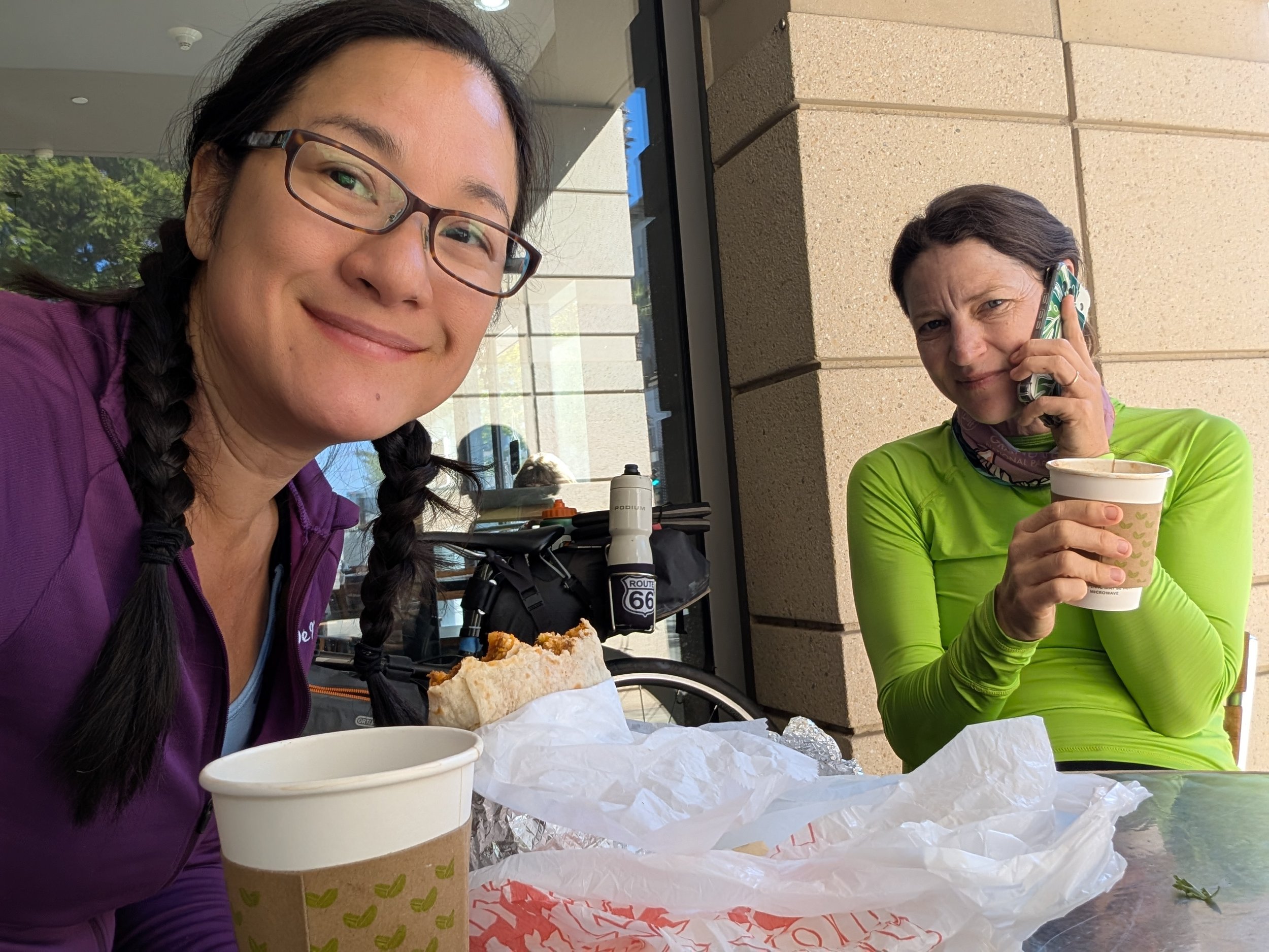
This is one of my favorite photos of Sara from the ride. Cool as a cucumber, she made the ride seem like a pleasure cruise through the desert and a muffin ride through LA. In this photo, she is on the phone, negotiating the sale of her house. I am, as usual, eating.
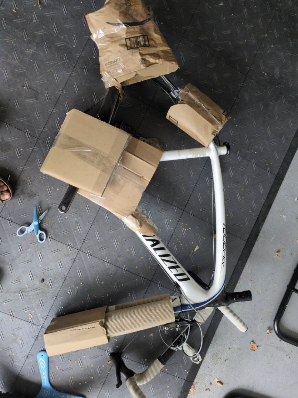
We dropped our bikes at a local shop, The Bike Shop Santa Monica, and they graciously boxed everything up for us. Tomorrow, before I head to the airport with the family, I’ll pick up the bikes on the way. We stayed at Shutters on the Beach, and I highly recommend it— it’s within walking distance of the pier, and the customer service is excellent.
My husband bought the Route 66 cycling maps as a gift in 2015, before our wedding. Back then, I hesitated to get married because I didn’t want to grow up. I suppose the maps were his way of showing me that I never had to.
In the end, I didn’t begin the first half of the ride until 2019, before my older child had even been conceived. The day I finished that ride, I pedaled through pelting rain, a flash flood, thunder booming, and lightning flashing all around me. It felt as though the heavens were celebrating the end of my journey with every epic firework nature could muster. It was a dramatic conclusion to the first half of a dream ride.
They say the days are long but the years are short. The last two weeks have been amazing but I’ve missed every moment without them.
I decided to undertake the second half in 2025, after my younger child had been weaned. This time, the journey ended quietly and without fanfare — what I now recognize as the marks of a well-planned, successfully executed, and luck-filled trip. How time has tempered my ideas about adventure and reshaped my priorities over these ten years. I’ve only been finished for an hour, and already I’m so thrilled to return home to them.
My mother-in-law once described life as an evolution from “me,” to “we,” to “them.” As I pack my bags to head home, I certainly feel the pull toward a supporting role in my family — how traditional. But now that I’ve become master of my body again, I feel an insistent pull toward adventure unlike anything I’ve experienced before. It’s as though my spirit knows this season of adventure may not last forever, and I have to squeeze in as much as possible while I can.
Stay with me until next time, when I’ll share the highlights of the trip and what I’d do differently.
I took this photo in 2019 at the History Museum on the Square in Springfield, MO never knowing when or if I’d ever ride the second half.
RT66 Day 19: A Devastating Realization
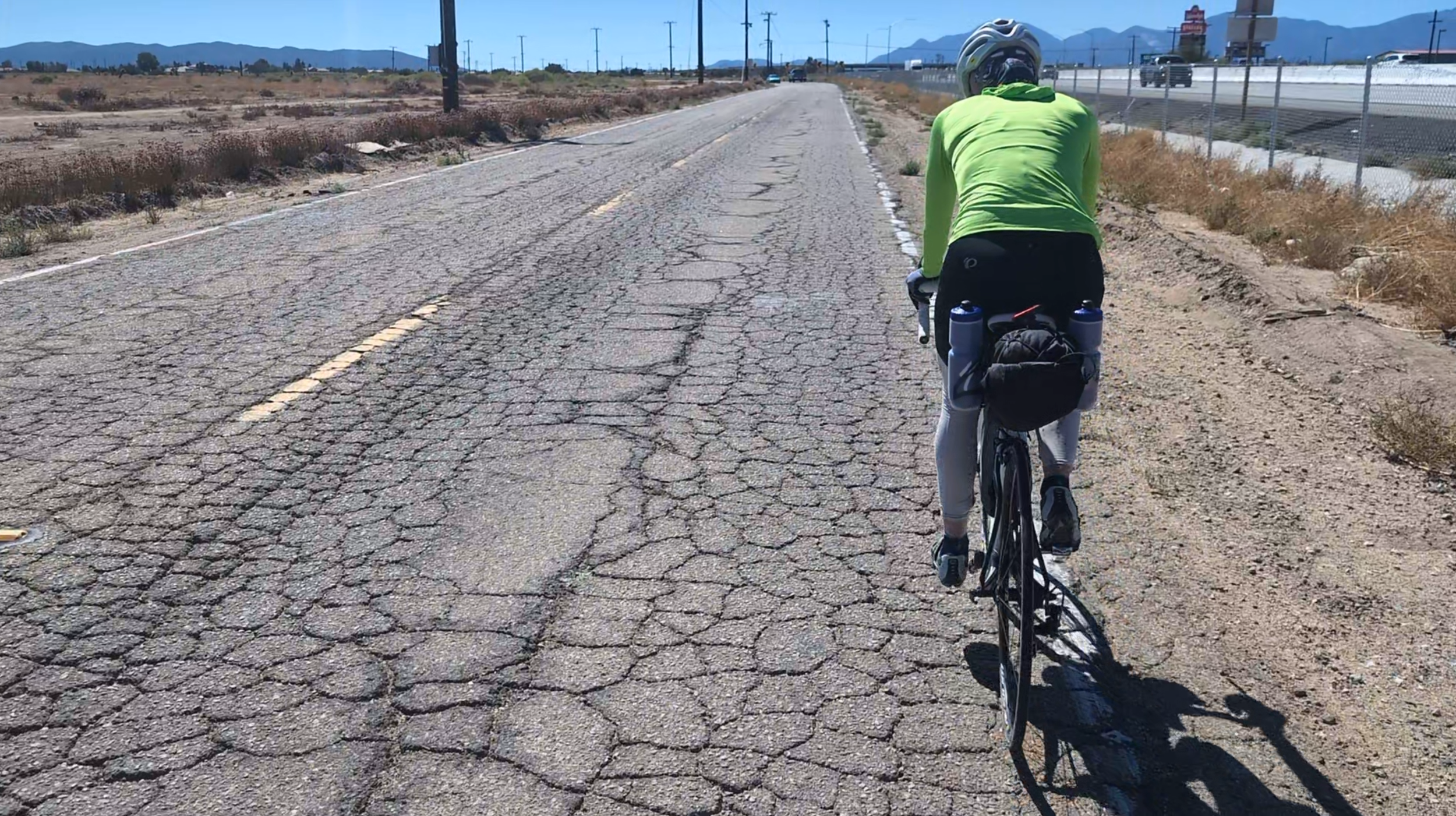
After more than 1,000 miles of cycling Route 66, I finally crossed back into California expecting smooth roads, ocean air, and the triumphant final stretch of a cross-country bicycle journey. Instead, I found brutal traffic, rough pavement, industrial rail towns, and an unexpected realization about the kind of person I really am. This entry follows the penultimate day of my Route 66 bike tour through Barstow, Victorville, Cajon Pass, and Rancho Cucamonga — and reflects on adventure, labor, history, and what it means to leave something behind.
Only two more days of riding left, and it’s finally starting to weigh on our bodies as our speed indicates. Mercifully, the wind is insignificant after yesterday’s disaster.

I’ll never be a princess.
Day 19: Barstow, CA to Rancho Cucamonga, CA; 82 miles, 3,481 feet elevation gain
6 miles on I-15
Day 19: Planned on Ride with GPS
Intraday Stops: Red Hen Cafe (22 miles), Emma’s Jeans (11 miles), then you are back in civilization again.
I’ve been biking, on this trip, for over 1,000 miles. Most of it is through isolated desert areas where dilapidation reigns. All the while, I’ve been waiting to return to California, the beacon and bastion of civilization. Where the famed Highway 1 winds its way down the coast, where going to a grocery store is an elevated experience, and where diversity strengthens communities. It’s home to the world-famous film industry, wine regions, and a technology industry that is changing the trajectory of the future. There is so much to be excited about when thinking about my home, where I live, California!!
But, f*ck, the roads really suck. Like next level bad — even worse than Arizona!
And the driving culture here is real. In Victorville, the bike lane is next to the curb and is the de facto street parking area. Now, I’m not saying this has to be transformed into the shit-show that is Telegraph Ave in Oakland, CA, or the comical center bike lane on Valencia St. in San Francisco, but something which accommodates both needs seems reasonable.
Sorry, this seems whiny, especially as I am so close to the end. Yet, my expectations were high for my chosen home state. For future riders, temper your anticipation. You might smell the salty air of the ocean, but you’ll have to navigate through the treacherous Los Angeles traffic before you can soak your toes in it.
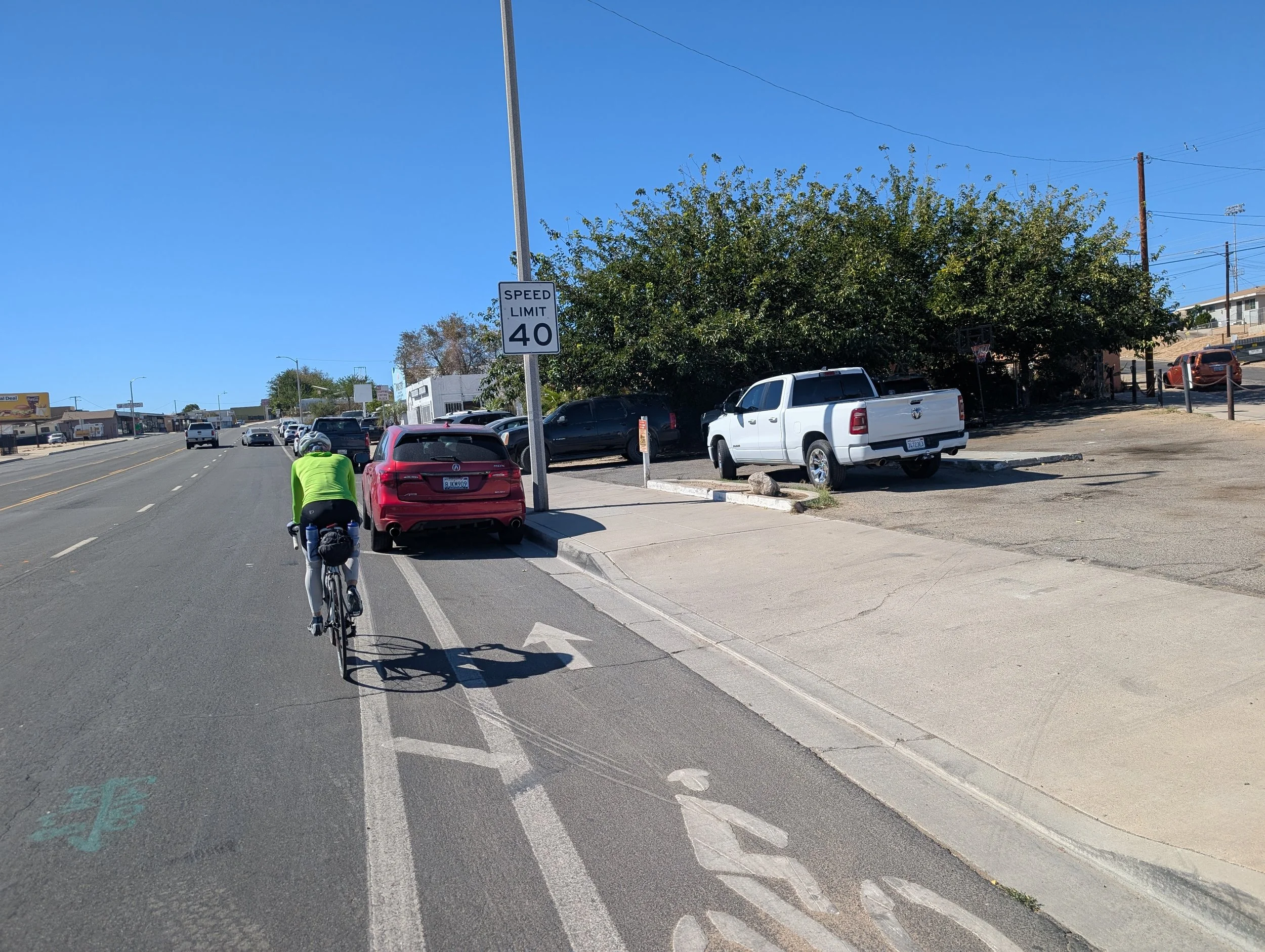
Victorville, CA: Where the bike lane is a parking area.
Barstow is a cute, albeit industrial, town. If you were to look at it from above, you’d see a dense, chaotic, woven web of steel. In fact, for train lovers, this town is a hub of activity. Its the ultimate rail junction for all freight coming and going from Southern California. When transcontinental freight trains come from Chicago and the Midwest heading west across the Mojave Desert, they hit Barstow and face a structural fork in the road heading either south to LA or north to San Francisco.
In the coming years, the railway is expanding even further with the planned construction of the Barstow International Gateway (BIG). Its a massive $1.5 billion, 4,500 acre facility designed to take international containers straight from the ports of LA via train, staging them in Barstow to be built into transcontinental trains heading east, significantly lessening truck traffic on California highways. As you know, I’ve been obsessed with how many Amazon and FedEx semi-trucks I’ve seen on the road. This investment in logistics seems very forward-thinking!
On the west side of the highway entering Victorville is an adorable touristy area dedicated to Route 66. It’s worth a stop. Since we left quite early this morning, to avoid being out in the afternoon wind, all the shops were still closed as we passed through.
The northern part of Victorville, CA
Just outside our first intended stop, Red Hen Cafe, which was also closed, is the Bottle Tree Ranch. It’s a kooky little place with lots of sculptures and structures made of empty glass bottles and various other things one might mistake as ‘trash.’
Somewhere between screaming down Cajon Pass beside semis and rolling into Rancho Cucamonga, exhaustion cracked open an absurd but strangely profound realization:
I do not have princess genes.
Stay with me, I’m veering wildly off topic.
History is written by the victors. So, unless you are a Cubs fan, most people imagine they are on the victorious side of history. They are the conquerors. The elite. The exceptions to whatever bad thing happened. If time travel existed, you wouldn’t go back just to die of dysentery on the Oregon Trail or eat your companions in the Donner Party. You’d party with Ben Franklin and TJ or wander Versailles with the Sun King. Or, if you could bring people forward through time, you’d take Genghis Khan to Burning Man, right?
Yet, as I near the completion of my ride, I’ve come to a startling realization: what about the rest of us? You know — the people in the movie standing in the middle of the street when Godzilla comes stomping through Tokyo.
It has become clear to me that I have worker-bee genes. My ancestors weren’t royalty. My body and mind come from a long succession of people who could move for hours, maybe days at a time, toiling outside in the elements. But I’m not a pro athlete who’ll be remembered for excelling at one extraordinary thing. I’m just an ordinary field worker who, if fed enough, can keep shoveling animal poop forever. How are people like us remembered?
I don’t have an answer, except to say this: we probably won’t be — unless we reach out to say something. Maybe this blog is my small contribution to life on Earth. Maybe one day it will be worthy of remembrance.
Lascaux Cave Paintings: The Unicorn Panel
RT66 Day 18: WIND!?!
What should have been an easy recovery day while cycling Route 66 through the Mojave Desert became an exhausting eight-hour battle against relentless California headwinds. After more than 1,000 miles on the second half of this cross-country bicycle journey, I finally learned that the hardest condition in bicycling Route 66 isn’t heat or climbing — it’s wind. This post covers desert riding strategy, pacing, gear problems, morale, and an unexpected milestone on a Route 66 bike tour.
What was supposed to be an easy recovery day turned into an eight-hour slog, battling 16–20 mph direct headwinds — but a big milestone was reached.
Best to watch the forecast before the ride…
Day 18: Ludlow, CA to Barstow, CA; 54 miles, 3,593 feet elevation gain
4 miles on I-40
Day 18: Planned on Ride with GPS
Intraday Stops: Chevron Newberry Springs (32 miles), Frosty Donut House* (18 miles)
I’ve been pretty strict on this ride about early nights and early starts. There are lots of reasons—avoiding the heat, less traffic, staying off the road at dusk—but the simplest is that I’m a morning person. By 5 p.m., I’m tired. And when you’re tired on the bike, mistakes happen. We were fine today, but we should have started earlier.
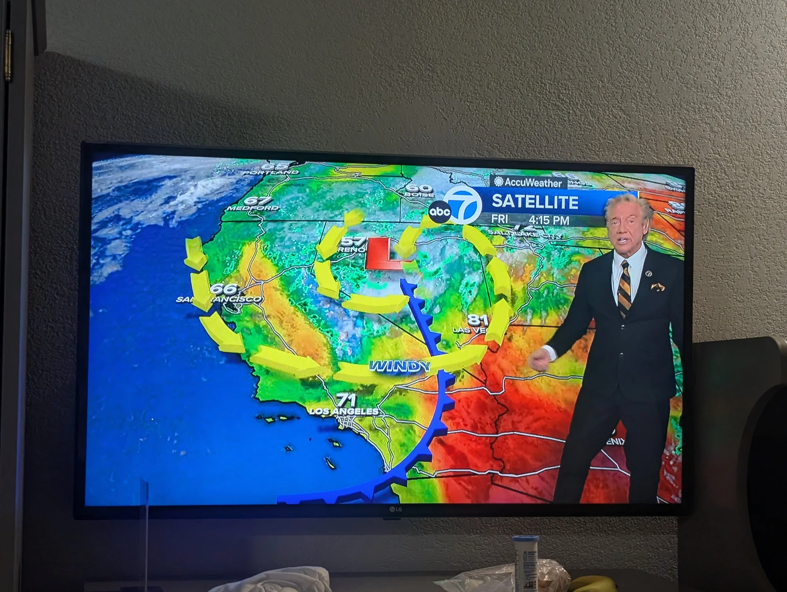
After yesterday’s brutal 109-mile push through the Mojave, we let ourselves believe today would be easy: 54 flat miles, maybe 4.5 hours with lunch. The temperature had dropped to a merciful 81°F, a huge improvement over the 104°F we’d just endured.
We rolled out at 8 a.m. into what felt like a light breeze. Within an hour, it had become a full-on 16–20 mph headwind straight out of the west.
Note for Pearl Izumi fans, her shorts are two sizes too big.
The contrast was demoralizing. After such a hard day, we were expecting a recovery ride, not a grind. When you’re fighting to hold 5 mph in places, morale evaporates fast. To make matters worse, Sara was dealing with gear issues—not her saddle this time, but her Pearl Izumi shorts, which she eventually modified for relief.
Conclusion: the worst condition to cycle in isn’t heat, rain, or sun—it’s headwinds. They don’t just slow you down; they break your will.
Still, there was a bright spot. Five miles into the day, I crossed the 1,000-mile mark for the second half of Route 66.
One final note: if you’re aiming for the Frosty Donut House—supposedly incredible—don’t go late. It closes around 1–2 p.m., and we missed it. We did, however, meet another cyclist at the hotel riding the full length of Route 66, which felt like kismet!
RT66 Day 17: Mojave Crossing
Cycling Route 66 across the Mojave Desert turned into one of the hardest and most memorable days of the entire trip. What began as an ambitious desert crossing quickly became a brutal battle against headwinds, 104°F heat, road closures, dehydration, and exhaustion. This post follows a long day bicycling Route 66 through Amboy, Roy’s Café, and Ludlow — and reflects on endurance, friendship, self-belief, and why difficult adventures are better shared with people you love.
Today was the BIG day. Mojave Crossing Day. A lot of Fun #2.
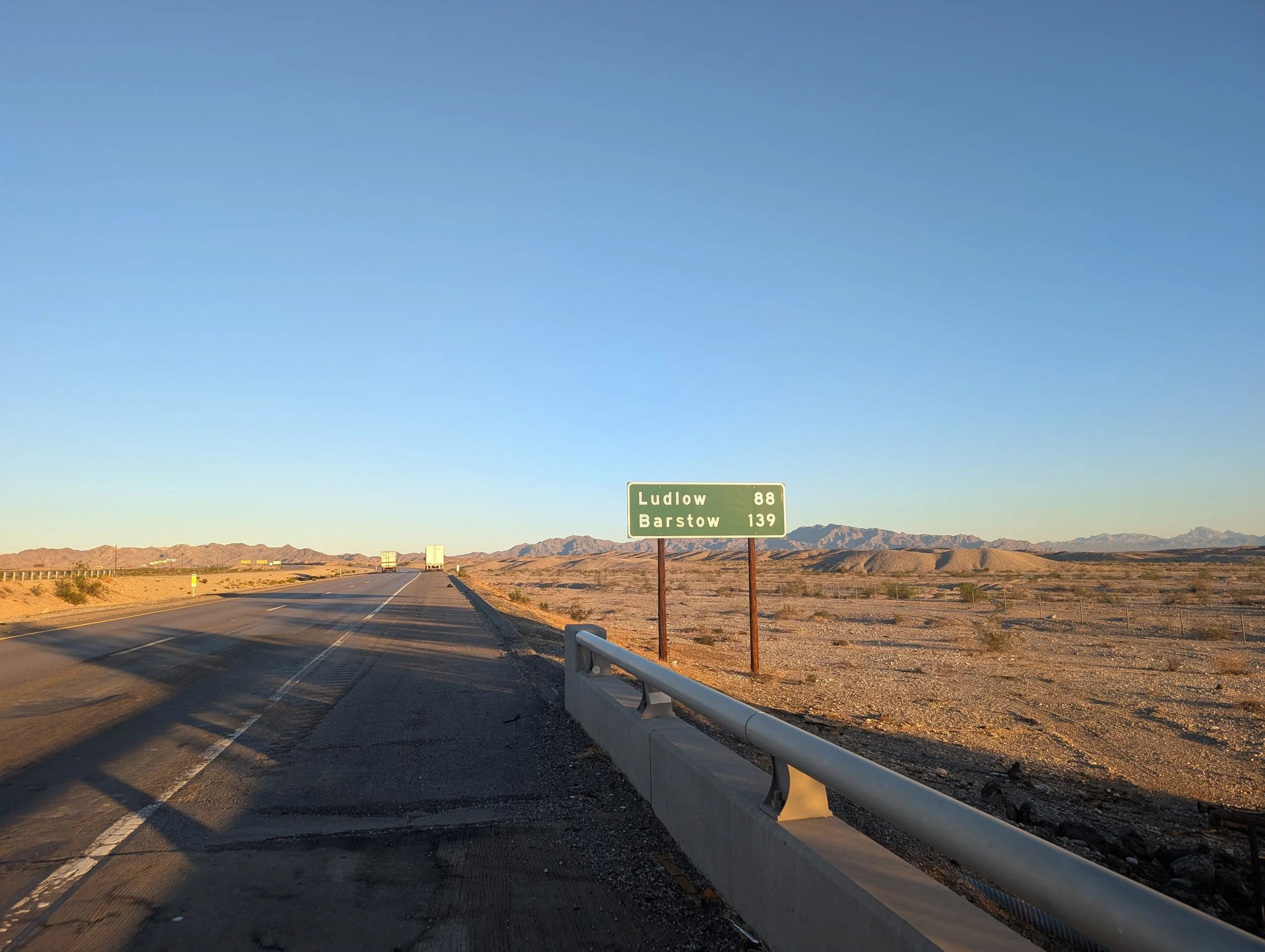
Day 17: Needles, CA to Ludlow, CA; 108 miles, 4,613 feet elevation gain
6.4 miles on I-40
Day 17: Planned on Ride with GPS
Intraday Stops: Najah’s Oasis (30 miles), Roy’s Cafe (42 miles), Ludlow Motel (28 miles)
We thought we’d smash out the first 10 miles in 30 minutes, but Nature had other ideas. A brutal headwind paired with a not-so-subtle climb dropped us to 8 mph—demoralizing and, frankly, embarrassing.
For the next 20 miles we averaged 9–10 mph, nowhere near the 15–18 mph we’d hoped for. Speed wouldn’t have mattered much, except for one thing: there’s only one café in Ludlow, our destination, and it closes at 5 p.m. Miss it and you’re eating gas-station food—not my first choice. Also, less time under the desert sun felt… advisable.
By Najah’s Oasis, our first water stop, we had finished everything we were carrying and arrived tired and hungry. The previous stretch, we hadn’t filled our CamelBak pouches (stored in our frame bags), so this time we filled all 6 liters between the two of us. We took a longer break to dial in our setup, rehydrate, and eat.
The night before, we’d bought breakfast burritos as emergency food. Sara ate ¼ of hers; I ate ½ of mine. Sara prefers gels (Huma). I prefer food that would’ve gotten you banned from swimming for two hours back in the ’80s.
After 30 minutes, we rolled out again—now averaging 11 mph. It was 11 a.m.
As we exited the parking lot, a semi rolled toward us. I pivoted, but gravel had other plans, and I went down hard on the derailleur side. No mechanical damage—just a bruised ego.
We reached National Trails Highway and saw the sign: Closed to All Traffic.
Sara declared, “We are not traffic.”
So we went.
Over the next 35 miles, we passed more than 20 road-closure signs—at least five paired with actual collapsed roads. In those spots, we walked our bikes through the unforgiving desert. Jumping barricades, dodging sandbags, trudging through sand—the miles somehow slipped by.
By 1 p.m., the heat was brutal and the wind had turned directly into our faces. My watch read 104°F. Because the road was closed, we worried our second water stop—Roy’s Café—might be shut too. When I got cell service, I called. Relief: they were open.
We rolled into Roy’s at 3 p.m., nearly out of water. We bought a gallon and split it, plus two ice creams. I finished mine, ⅓ of Sara’s (she didn’t want it), and ⅓ of her burrito. I’m fairly sure onlookers were horrified, but my system demanded fuel.
Sara said this was one of her low moments. Her crotch was chafed, she had bonked, and it was peak heat.
We didn’t linger—it was already 4 p.m. We had two hours before sunset and still 28 miles to go. The fear wasn’t just gas-station food anymore; it was finishing in the dark.
The road was mostly flat with gentle rollers and short, steep pitches. Sara hit her second low moment—and considering her longest training ride was 20 miles, she was doing incredibly well. She powered through.
Eventually, the reward came: beautiful descents into Ludlow. We arrived at 6:03 p.m.
We checked into the motel at the Chevron—easy, basic, dated but perfectly serviceable. No mold colonies plotting expansion. The gas station was open 24 hours, which felt comforting.
We dropped our bags, crossed the highway to the 76 station, and discovered a Dairy Queen inside. We devoured half our food and promptly passed out.
My Low Moment
For me, it was the headwinds and our painfully slow pace on I-40. Knowing the day would be harder, hotter, and longer than expected hung over me like a cloud.
My body never really hit a low—mostly because I kept feeding it. But mentally, what saved me wasn’t toughness. It was Sara.
The Theme of This Ride
When things are pleasant, you can do them alone. Chicago to Amarillo was fast and easy because it wasn’t that hard.
Yesterday showed me something else: I tend to get lost in the woods during the montage scenes. Left to my own devices, that’s where I’d fail.
Having the right companion—especially someone fresh and optimistic—turns difficulty into something manageable, even joyful. Could I have done this without Sara? Maybe. But it would’ve been stressful and joyless. I’d have second-guessed every decision. Every road-closure sign would’ve felt ominous. That 35-mile stretch would’ve been lonely, scary, and endless.
Poster children for mineral sunscreen?
With Sara, it was just a long joy ride.
Doing hard things with people you love—going through life with your favorite companions—that’s what makes life pleasurable, even in the shitty situations you voluntarily put yourself in. Maybe that’s the extrovert in me talking.
Faith
No, I didn’t find God. One thing cannot go unsaid: in moments of despair, you must believe in yourself. Self-doubt is as useless as it is seductive. When you’re up Shit’s Creek, your only real option is faith.
This is my second takeaway: questioning your abilities wastes time and steals focus. You have to believe—fully—that you can do the thing.
Maybe that’s what training is for — gives you a reason to believe. I don’t usually train, so this is all new to me.
Faith and friends.
I’m glad these are the lessons.
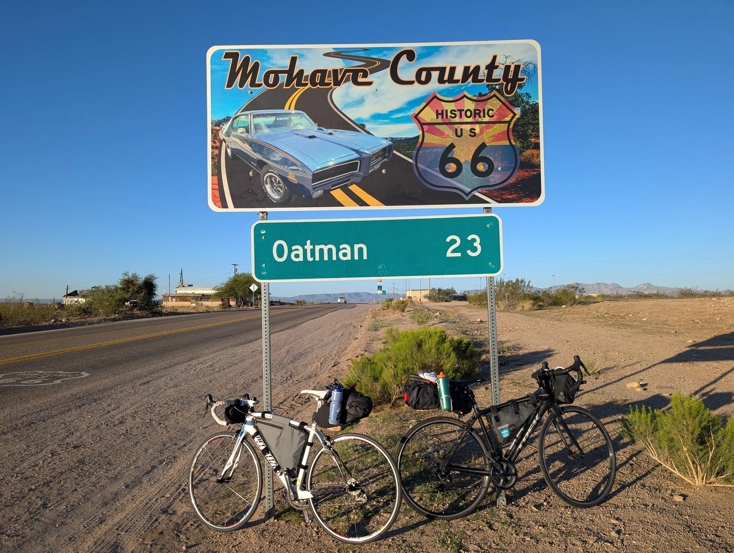
RT66 Day 16: An EPIC ride out of Sitgreaves Pass.
Welcome to California! Lots of wind and picturesque desert views. We were able to get in before the heat took hold. So. Many. Donkeys. In. Oatman.
Welcome to California! Lots of wind and picturesque desert views. We were able to get in before the heat took hold. So. Many. Donkeys. In. Oatman.

Sara was worried about being too slow, but she has fresh legs and is currently leading the way — despite some issues with her lady parts. She can explain that situation herself in the video.
Today is going to be a tough one. We’re riding from Kingman to Needles, crossing a massive stretch of the Mojave Desert. At the moment — 5:44 a.m. — it’s already 64°F. The forecasted high is 97°F by 4 p.m., so hopefully we can make it to the hotel by around 2 p.m.
The route starts with a seven-mile climb at a 3% grade — basically one mile longer than Tunnel Road at the same gradient — but afterward we’ll be rewarded with a glorious 14-mile descent. Then, inevitably, the winds will catch up with us. I’m praying for no flat tires.
One of the most atmospheric places along this route is Cool Springs Station. We arrived before it opened because we’re trying to avoid prolonged exposure to the heat, but even from the outside it was incredible: beautiful art, sweeping canyon views, and the promise of cold drinks and food. I imagine if I were crossing this route on a motorcycle, it would feel like an essential oasis stop.
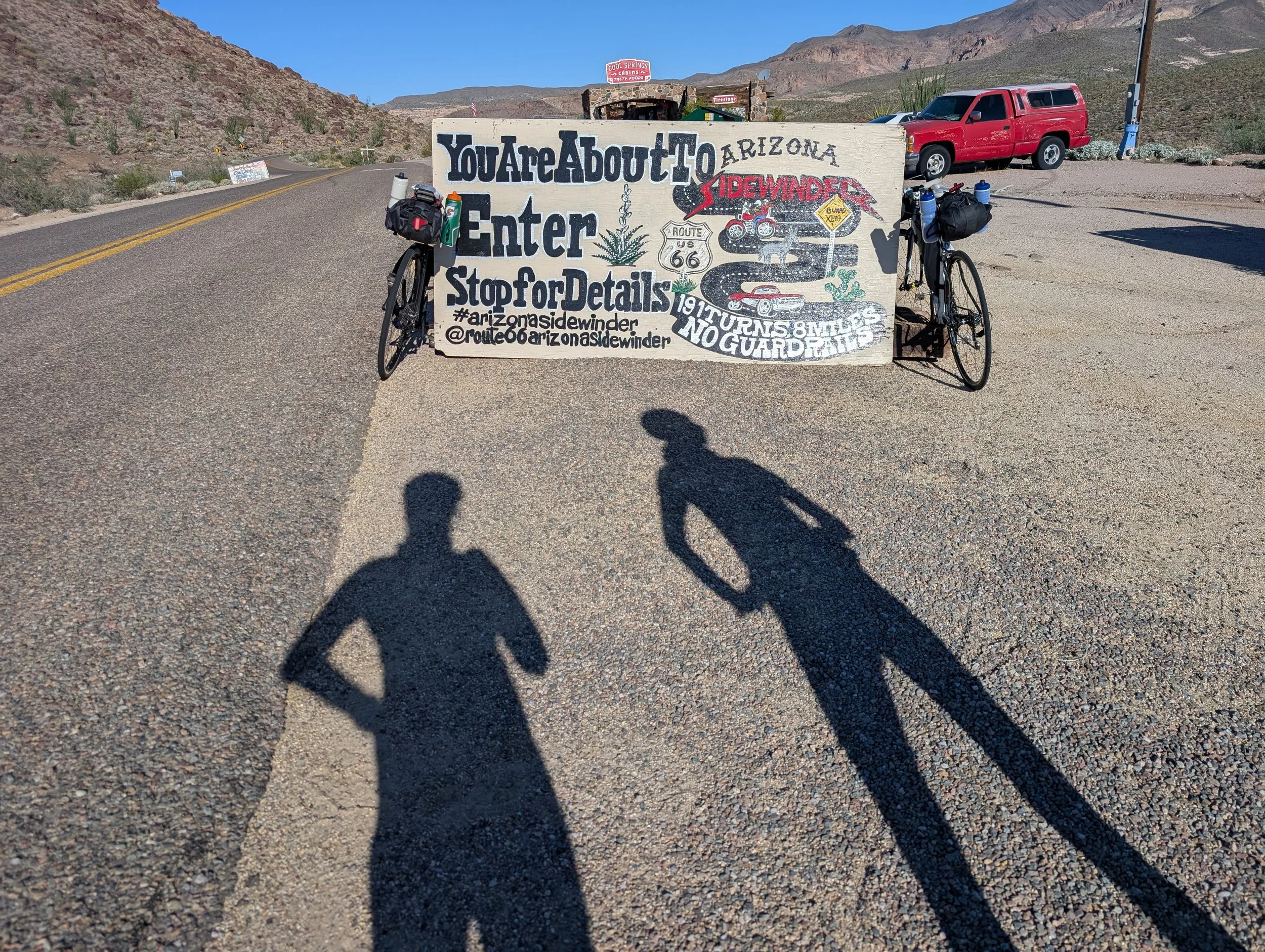
Cool Springs Station, one of the coolest and artsiest spots with great canyon views.
I had been especially excited to stop for lunch at the Oatman Hotel, but unfortunately it wasn’t open, even though the posted hours suggested it should have been. Still, Oatman itself is delightfully kitschy — like a movie set built for a Route 66 western. There are donkeys wandering all over town and throughout the surrounding hills.
Eventually, we made it to Golden Shores. Unlike the more tourist-oriented stops along the route, Golden Shores feels like a practical town where people actually live, which meant the food options were surprisingly varied. We found a great little spot called Silver Dollar Chuck Wagon. It was the perfect lunch stop because the patio had misters running, which became increasingly important as the temperature climbed.
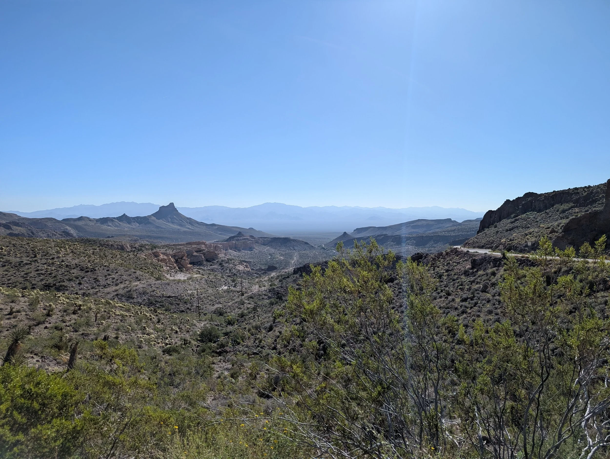
At Sitgreaves Pass looking back at where we came from.
The ride into Needles itself felt effortless for me, but Sara started experiencing some serious chafing from her saddle. In my experience, cycling requires a three-day adjustment period for the crotch area. Then, on the fourth day, a miracle occurs and the girl parts become completely impervious to suffering.

RT66 Day 15: Holy Zephyrs Bat Man!
Where I encounter the loveliest stretch of Route 66 despite the wind assaulting my face, body, and soul; flat #7; and a sandstorm.
Where I encounter the loveliest stretch of Route 66 despite the wind assaulting my face, body, and soul; flat #7; and a sandstorm.
The views along this stretch are the best of the entire trip.
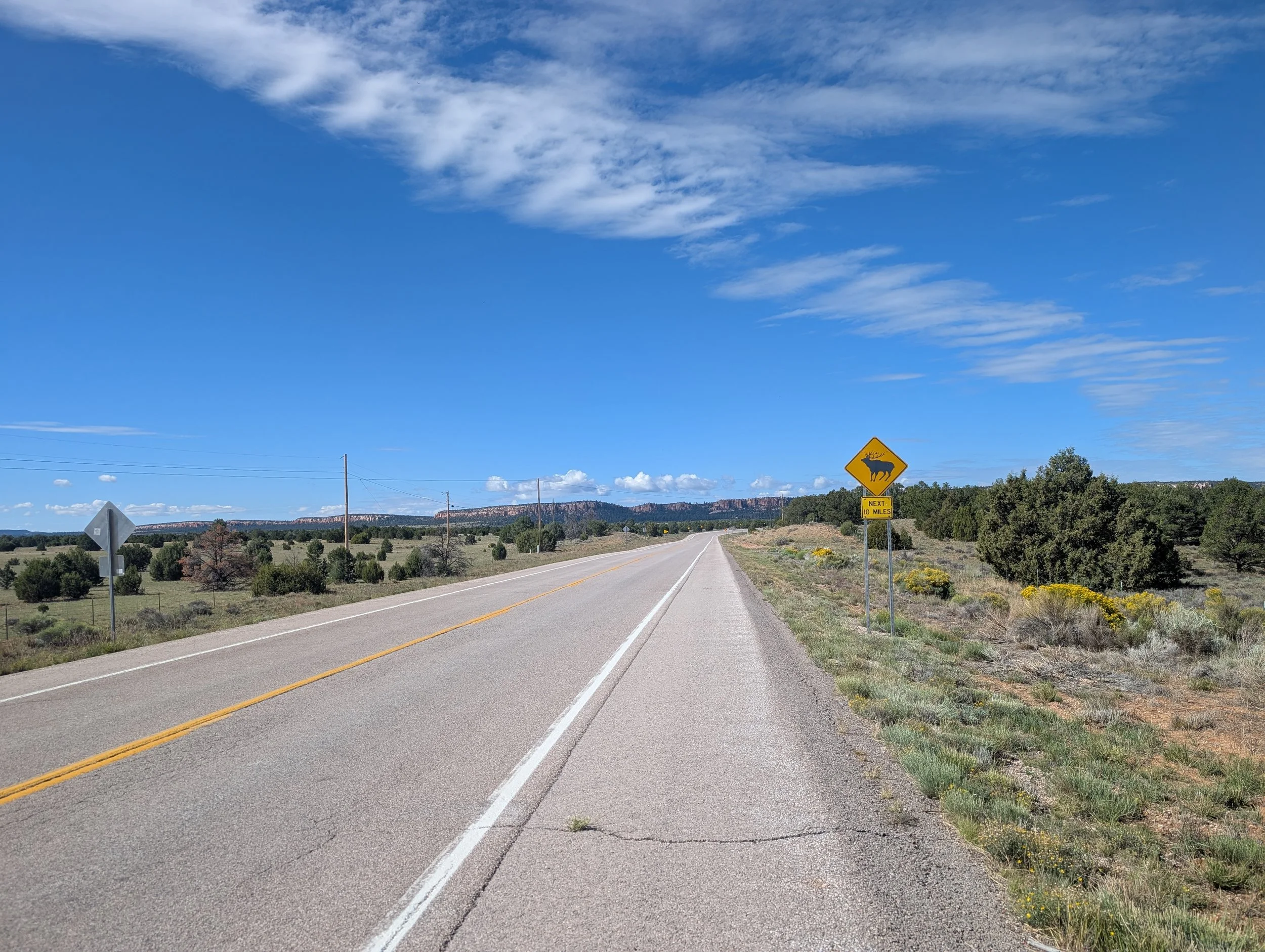
It makes sense — this is the Lower Colorado River Valley. This isn’t the dramatic, water-carved-gorge type of scenery. Instead, you’re looking out over shrubby, flat plains that rise into the chiseled mountain ranges forming the southwestern reaches of the Grand Canyon. The Grand Canyon Skywalk lies somewhere beyond those mountains, while Havasu Falls sits farther northeast.
I’m beginning to realize there is something strange about me, and perhaps this strange pull is what compelled me to embark on this journey in the first place.
When I look at the landscape above, I don’t just see scenery flashing by outside a car window or feel a passing curiosity about what lies beyond. I have a visceral daydream of myself riding — or maybe walking — across those plains beneath that enormous blue sky toward the mountains in the distance. Getting lost in the folds of the canyon while searching for water. I feel an almost magnetic curiosity to discover what exists beyond the paved road I’m currently on.
Then I remember I’m meeting Sara, so I keep riding.
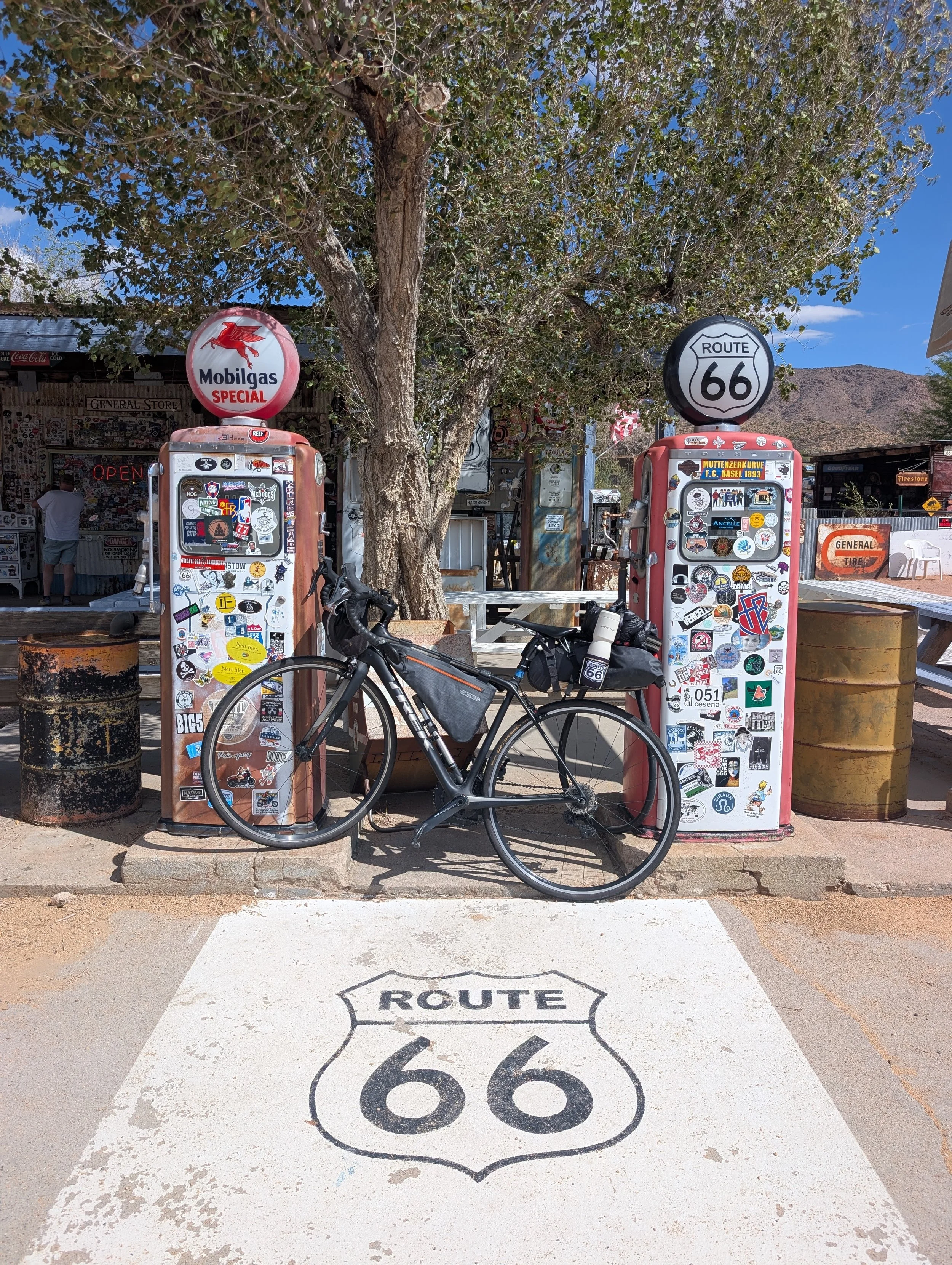
The adorable Hackberry General Store, worth the stop for the photo ops alone.
I’m not sure whether it’s the accumulation of 15 days on the road, the anticipation of beginning a three-day marathon through the Mojave Desert, or the prospect of riding 85 miles completely alone, but today was hard. My body is starting to ache, and I began the morning already exhausted. Yet somehow, the awe-inspiring beauty around me and the sense of frontier adventure continue to sustain me.
This stretch of U.S. Route 66 has been my favorite so far.
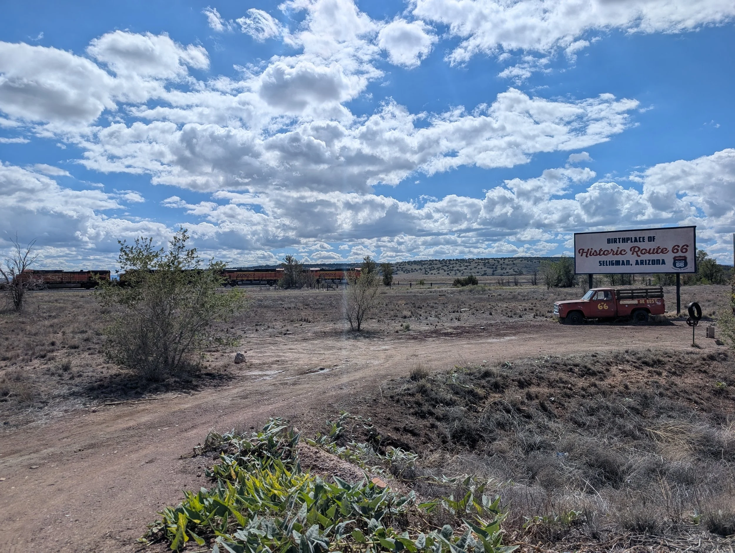
Seligman feels like a true oasis town. Don’t get me wrong — it’s not Flagstaff or Albuquerque — but it’s photogenic and clearly invested in preserving and celebrating its history. It’s just large enough to wander through while soaking in all the adorable Cars-inspired memorabilia and Route 66 nostalgia.
From Seligman, you turn onto the original Route 66, which no longer parallels Interstate 40. The ride through here, with canyons looming in the distance, feels especially magical. You gain a sense of the vastness and isolation of America as it must have once felt — boundless opportunity, immense freedom, and the feeling that absolutely anything could happen.
I can’t fully articulate it, but I imagine this must resemble the feeling experienced by Native Americans, Spanish conquistadors chasing legends of golden cities, cowboys heading westward, or even modern retirees chasing sunshine and lower taxes. Some people sought to exploit this landscape, while others sought to protect it, but everyone who passes through seems touched by the same sense of infinite possibility.
All along the road are these quirky little red Burma-Shave signs scattered beside the highway. This was what I imagined the entire western stretch of the trip would feel like — not endless abandoned gas stations and collapsing outbuildings.
The only places I actually stopped were Peach Springs and Hackberry General Store. At Hackberry, I had one of those strange moments where I suddenly knew, despite the weirdness of this journey, that I was exactly where I was supposed to be — much like the French tourists from Saint-Brieuc I had met earlier in the trip.
I’m only noticing this now, but see the vents on my helmet and how my skin is not covered by my buff? In three days, I will have a weird tan from this.
After Hackberry, though, things started getting rough, so I was grateful for that brief moment of existential certitude — assuming that’s the correct phrase.
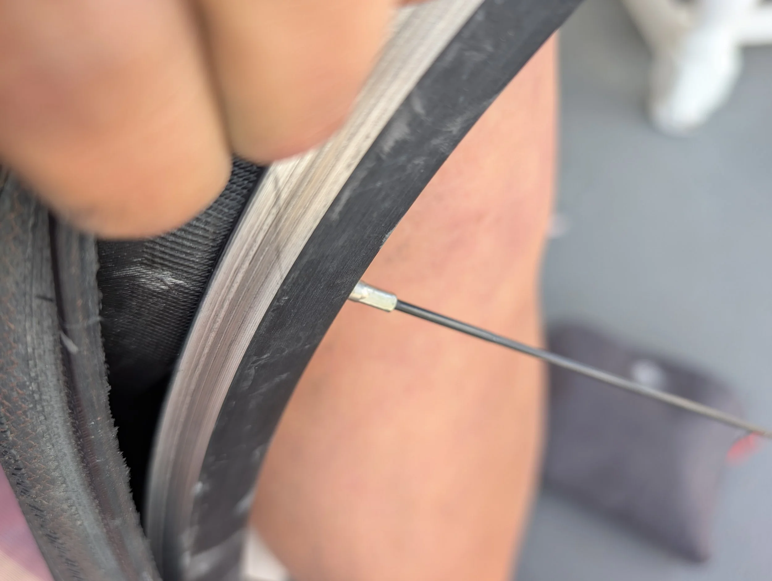
The southerly wind, which had been present all day, intensified to 10–16 mph while my route twisted from northbound to westbound to southerly and finally due south. Then came flat #7. At first I tried to solve it by simply blasting more air into the tire, but it turned out to be a proper puncture. There was nowhere protected from either the blazing sun or the traffic, so I pulled over on the shoulder and changed the tire right there beside the road.
I rode the final 15 miles at an embarrassingly slow pace of 6.1 mph.
Physically and mentally, it was difficult. The wind was relentless, I had just stopped to deal with the flat, and I was anxiously anticipating finally seeing Sara. The final four miles were the worst because it genuinely felt like pedaling through molasses.
Then, with about two and a half minutes left before I reached town, Sara suddenly sprinted out onto the road to surprise me.
Yes, she is absolutely the GOAT.
Her own travel day involved taking an airport shuttle from Sonoma to Oakland, flying from the Bay Area to Las Vegas, renting a car, and driving 105 miles to Kingman — all while hauling an enormous bike box.
When I rolled into the hotel, Sara was already assembling her bike. She’s an engineer, so naturally she wrapped the whole thing up quickly and efficiently.
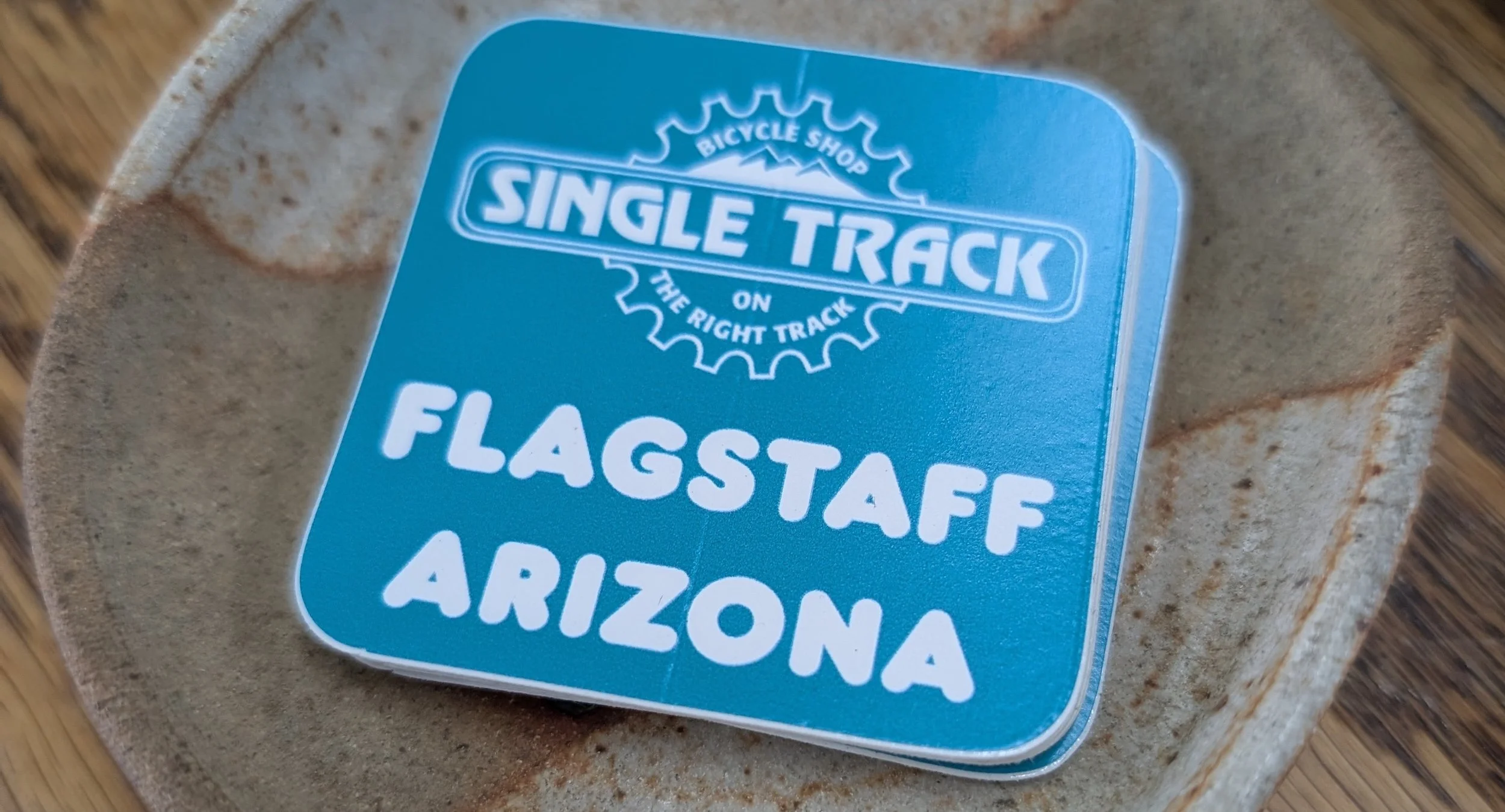
Afterward, we visited SpokesMann Bicycles to buy one final spare tube each, plus an otterly adorable water bottle holder for Sara. Honestly, shops like SpokesMann and Single Track in Flagstaff — along with many other small bike shops across the country — are indispensable for adventures like this. They have the right equipment and, more importantly, the specialized knowledge needed to keep trips like this alive. AI isn’t replacing these jobs anytime soon.
Are you keeping score Nelson? Flat #7
Later, in Kingman, we found a wonderful little Vietnamese restaurant and ate pho — a welcome break from my usual diet of fries and ice cream. Finally, we returned Sara’s rental car, headed back to the hotel, made a few final adjustments to her bike, and promptly fell asleep while watching Dancing with the Stars at the incredibly glamorous hour of 8:50 p.m.
Let me end with a video from earlier in the day showing a sandstorm. If I thought the wind was bad today, it would soon become far harsher and far more relentless on what may have been the single worst possible day for it to happen — or at least the second worst.
RT66 Day 14: It's a day to be celebrated.
Solo Riding Day 1: An epic 7mi descent, two flats, LA is starting to appear on all the signs and the official last day of riding on I-40!
Solo Riding Day 1: An epic 7mi descent, two flats, LA is starting to appear on all the signs and the official last day of riding on I-40!

A 6 mile descent? Winning!
Day 14: Flagstaff, AZ to Seligman, AZ; 73 miles, 2,959 feet elevation gain
47 miles on I-40
Day 14: Planned on Ride with GPS
Intraday Stops: Pilot Travel Center exit 185, Texaco exit 178 Parks, AZ, Williams exit 161, Shell Ash Fork exit 146, Delgadillo’s Snow Cap
Sometimes you feel like the odds are against you.
At the beginning of the day, when I left the hotel, it was a brutal 38°F. I kept my puffy jacket on for the first hour until both the air and I started to warm up. By the time I rolled into Seligman, both tires had flats.
But there were also lots of wins.
There was a seven-mile descent on freshly paved roads, still a little slick from the rain. Los Angeles has finally started appearing on the highway signs. And perhaps best of all: today was my last full day riding on Interstate 40. Truly a triumph.
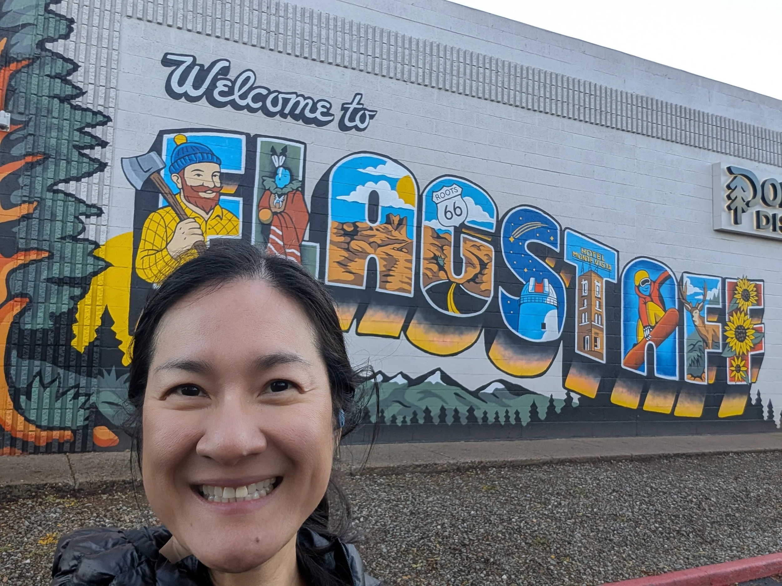
Western Arizona is beautiful. Starting around Parks — but really from Williams into Seligman, skipping Ash Fork — there are buxom green hills and gloriously wide-open skies. It reminds me a bit of southern Montana. Williams, also known as the Gateway to the Grand Canyon, is an especially adorable town. They’ve fully embraced and revived their U.S. Route 66 heritage, and the main street is charming to ride through. I would have lingered longer, but I had a long day ahead of me.
I had a lot of trepidation about riding by myself, which is ironic because this entire trip was originally supposed to be about self-reflection and rediscovering myself after spending ten years in a wine program and having two babies in the last five years. Instead, the trip has become more about strengthening relationships — which isn’t a bad thing, just not what I had imagined.
Today, though, I felt like an old cowboy.
I was just out there riding through an isolated landscape of incredible beauty on my own little adventure. There’s something about doing this that fills me with awe and wonder, which in turn makes me believe that anything is possible. In some strange way, it replenishes an empty tank inside me.
Flat #6
Once I got onto Crookton Road, it was smooth sailing — though still slow going. I had slow leaks in both my front and back tires, which I dealt with by repeatedly blasting them with air so I could keep moving. There are very few places to stop along this route, and shade — whether from trees or gas stations — is scarce.
Eventually, I spotted a tree in someone’s driveway and camped underneath it to change flat #5: the back tire. A real estate agent apparently thought it was my house and stopped to talk to me. It might have been awkward, except I was too tired to care enough to make it awkward. I mean, it’s not like I peed in the front yard. I have standards.
I didn’t bother changing the front tire because it was holding air better. After that little roadside repair, I was able to really haul butt into town.
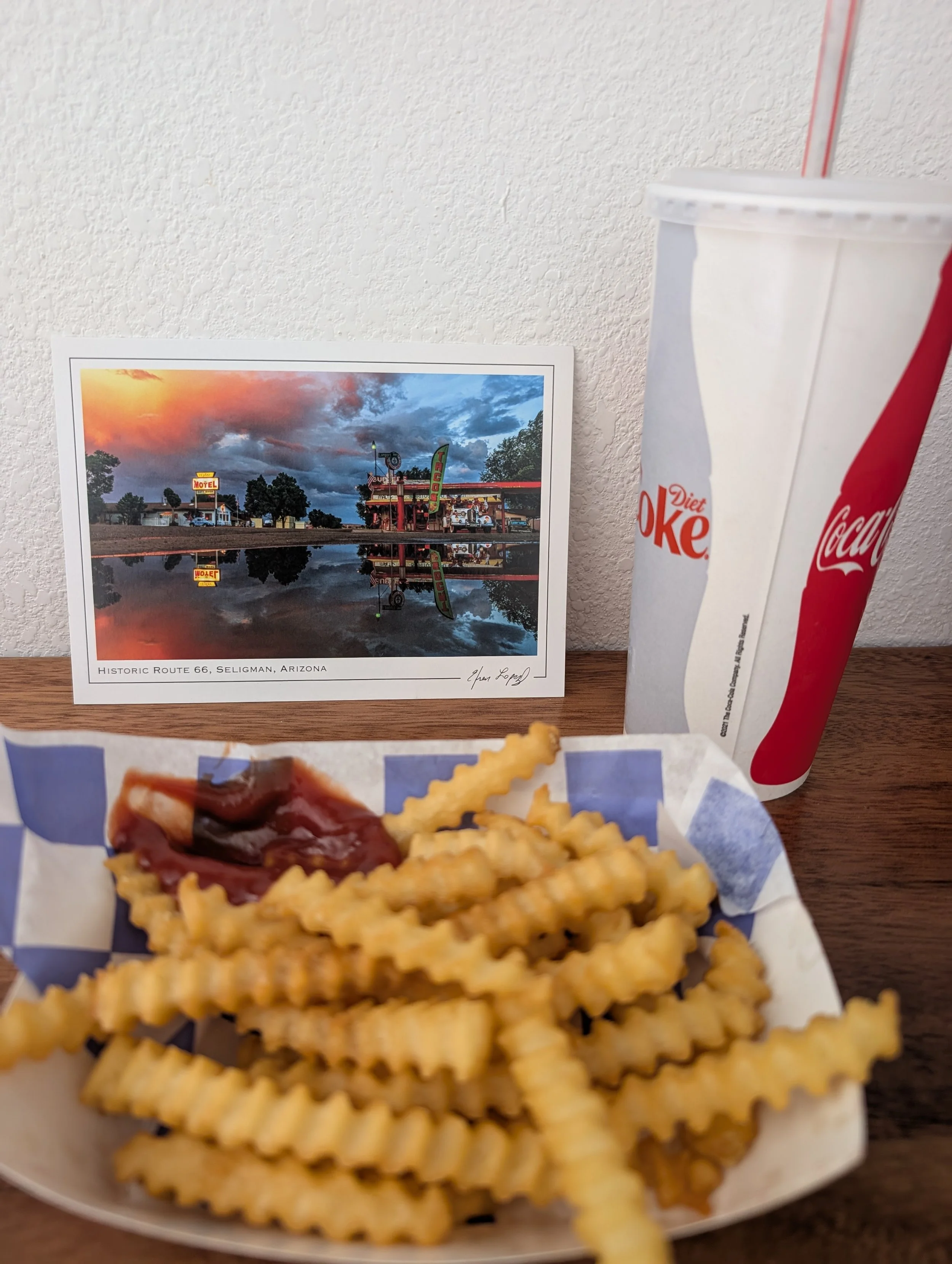
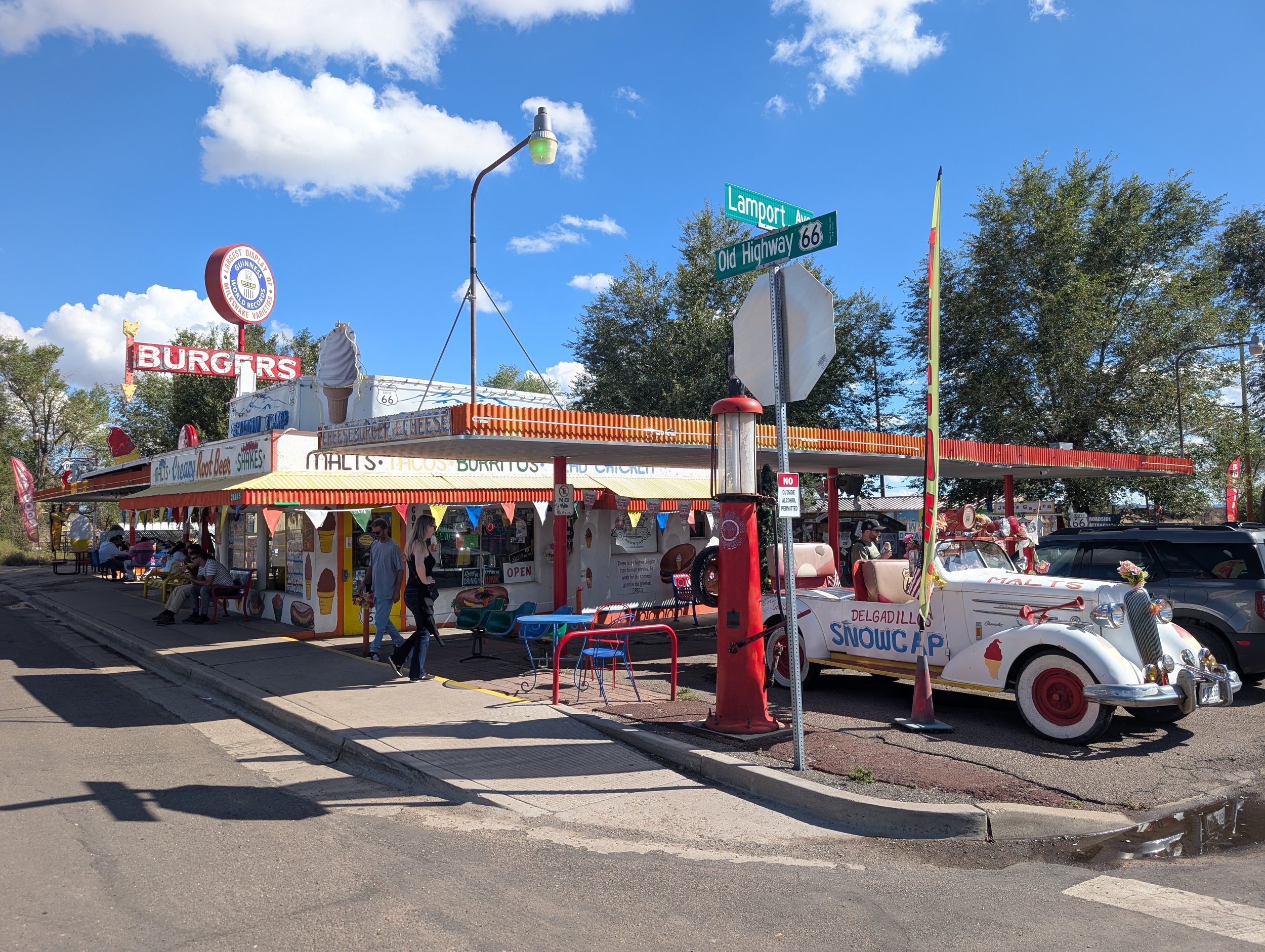
When I arrived, I went straight across the street to Delgadillo's Snow Cap, an adorable old Route 66-era burger stand, and ordered an Oreo shake and fries. As I sat there eating, I changed my front tire and texted back and forth with Sara.
I’m excited she’s coming tomorrow.
At the same time, I still have to get through one more day of riding alone. This next stretch is truly remote — supposedly one of the oldest remaining original stretches of Route 66 or something like that. It’s also going to be a long day: 84 miles. Starting around 11 a.m., there are forecasted south winds of 15–17 mph. To complete the trifecta, I’ll also be descending into the Mojave Desert, so tomorrow combines heat, long mileage, true isolation, and headwinds all at once.
Of course, it’s Fun #2 right before I get to see Sara — the person with whom I most enjoy enduring Fun #2.
The following day, we’ll have to go through Oatman Highway and over Oatman Pass. I had heard that it had been closed for over a day due to the rain, so naturally I did what any reasonable person would do: I called the historic Oatman Hotel directly for on-the-ground information. The pass had reopened just a few hours earlier, which felt like a very good sign.
I’m really excited to grab lunch at the Oatman Hotel.
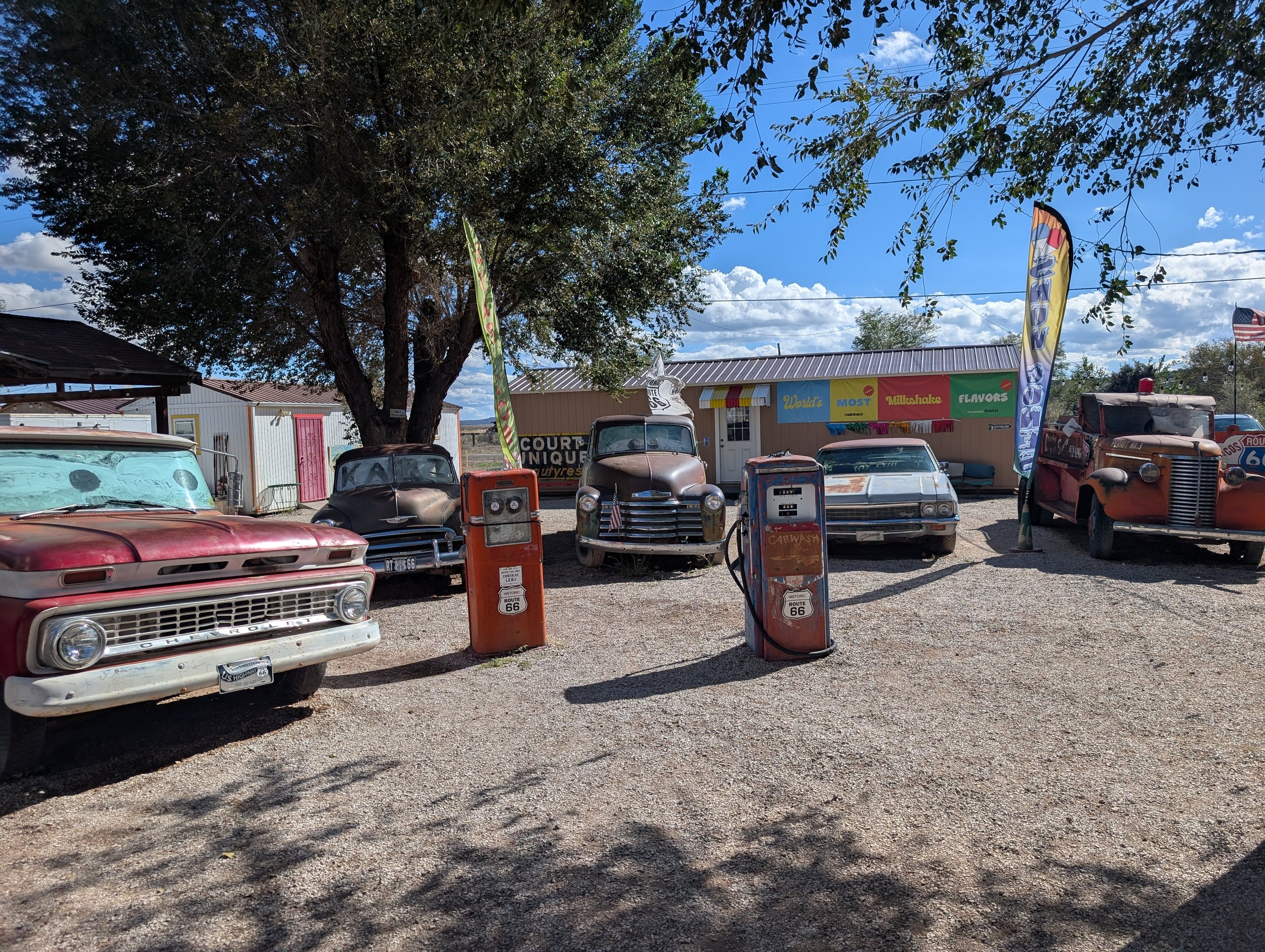
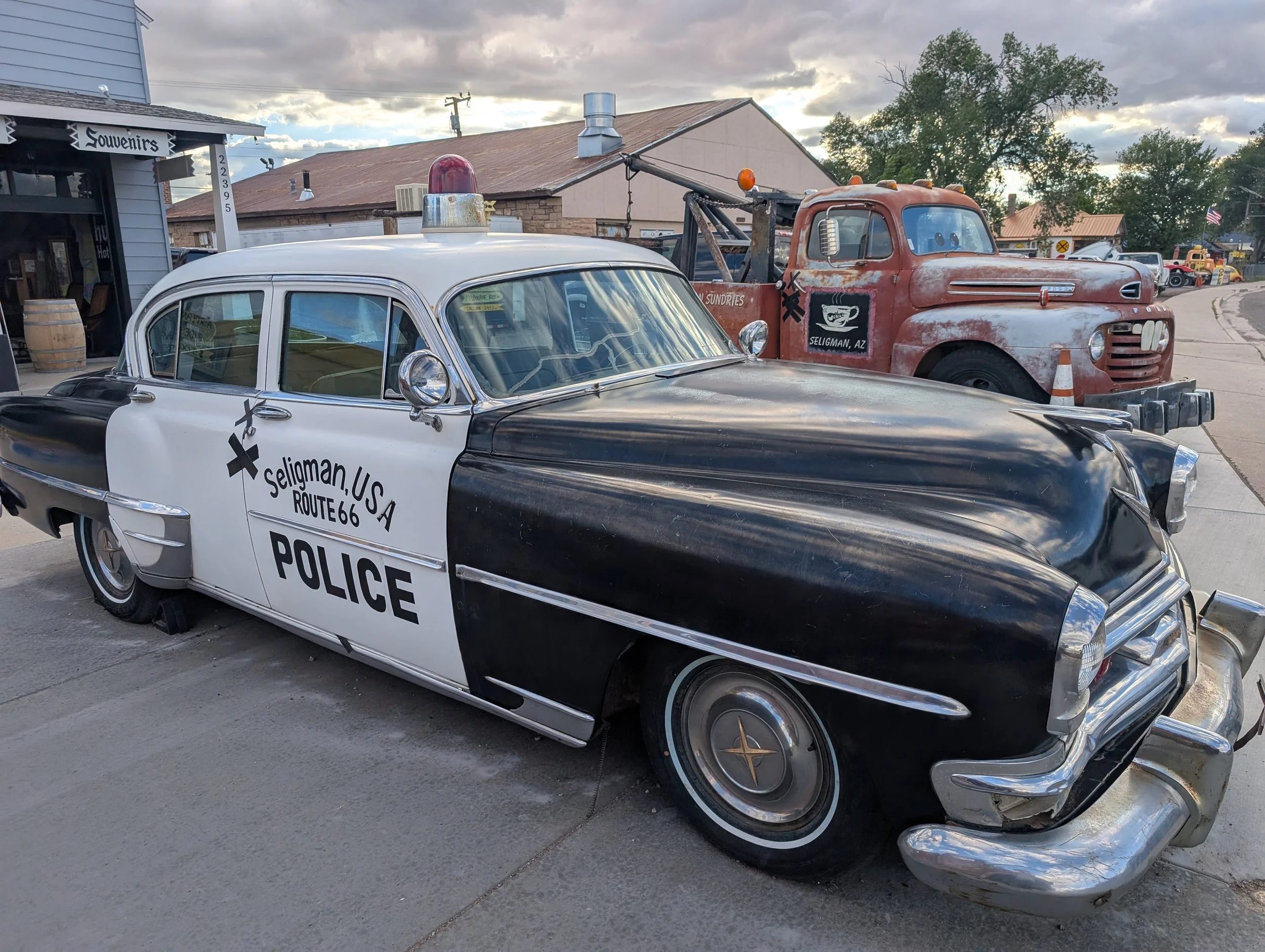
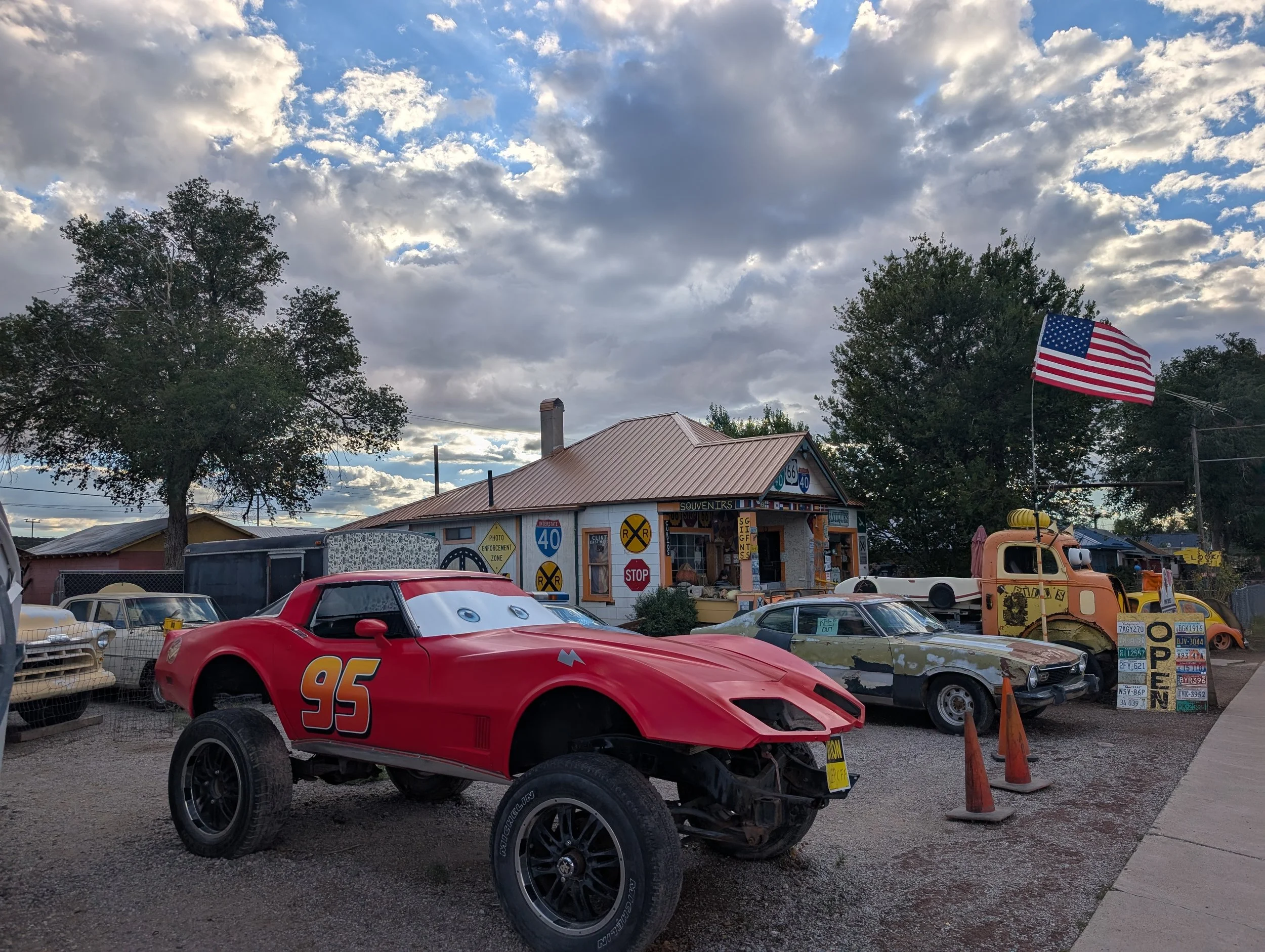
And finally: here are some very Cars-oriented photos of Seligman. This town is ridiculously photogenic and absolutely worth an overnight stay. Apparently, it’s also one of the places where Route 66 culture truly came to life.
RT66 Day 13: REST DAY #2
An inactive body leads to an overactive mind and isn't good for mental health.
An inactive body leads to an overactive mind. That’s not good for mental health.

Getting the characteristic biker tan on my face.
It was very sad to see Dan go. I didn’t know what to expect from these last few days with him. I have a debilitating fear of running out of things to talk about. The thought of spending four full days and nights with someone was honestly a bit intimidating. What if there were awkward silences between us and he discovered I’m actually super boring? Also, we are philosophically very different. What if we ended up arguing the whole time?
That wasn’t the case at all.
These four days really solidified us as friends in our own right. He was a delight to weather the storm with — both figuratively and literally. We spent every waking hour together for four straight days, and it never got old. I approve of the soulmate of my soulmate. (I forgot to mention that Dan is Sara’s husband, and Sara is my soulmate.)
It’s pouring rain outside, so this isn’t a bad day to spend indoors watching movies and taking a bath. But having this extra time on my hands, with nothing to do except stare at my toes, has made me a little too contemplative.
First, my dad made it safely back to Houston. Yay!
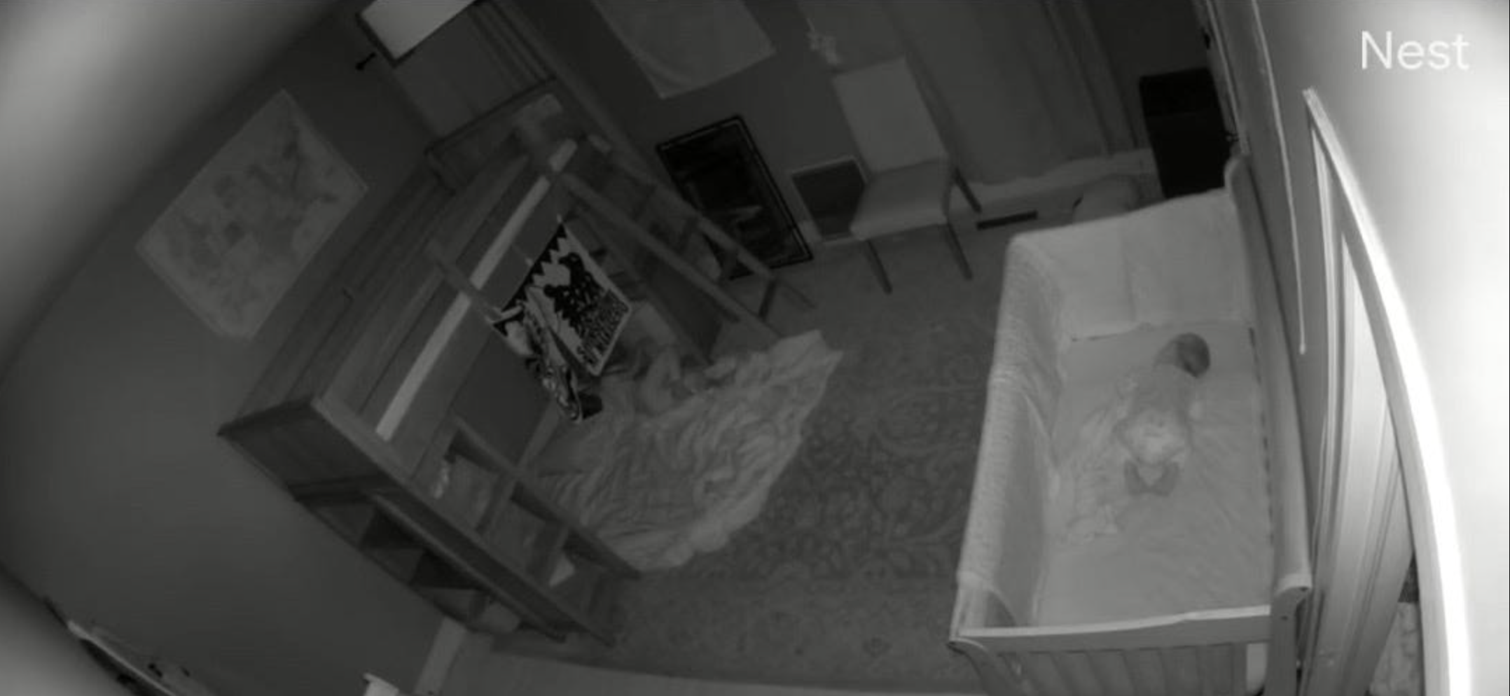
Second, talking to my mom stresses me out — a feeling shared by people throughout history. She keeps asking me who will raise my children if and when I die. That, naturally, prompts me to creepily watch Nest footage of my husband putting the kids to bed every night.
When I was in elementary school, my parents would pack me Chinese food for lunch. I remember feeling embarrassed that my lunch smelled more “ethnic” than everyone else’s bologna sandwiches. I couldn’t wait to grow up so I could be as normal as I wanted to be.
What is it about talking to your parents that makes you feel seven years old again? Why can’t my mom just be normal and stop talking to me as if a semi truck is about to hit me tomorrow?
For the record, if I die, their dad will raise them.
Also, it’s kind of ironic that all I wanted as a child was a normal lunch, and then I grew up to become the sort of weirdo who rides 1,200 miles on a bike for no reason. Maybe my parents should have wished for a normal kid instead.
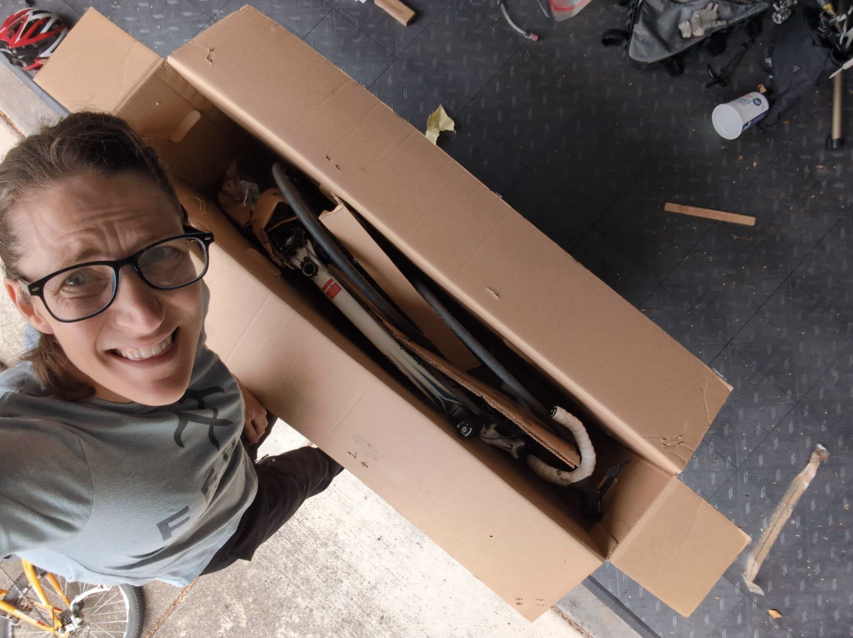
Sara, by contrast, has been sending me photos of her bike all boxed up. I’m so excited she’ll be here in two days. She is an amazing adventure buddy. When she’s around, no obstacle feels insurmountable, and simply being together makes us feel invincible. See? Soulmate.
Tomorrow, I’ll spend the majority of my 74-mile ride on Interstate 40, and it will be my last full day of interstate riding. The next two days will also be the only days I ride completely alone, and if I’m being perfectly honest, I’m scared.
Was I scared in 2019? Why am I suddenly scared now?
This proves my theory that humans were not meant to have so much idle time for contemplation. We need to move, strain, and push our bodies to the limit so we can drown out the incessant anxieties inherited from our mothers.
Unfortunately, I am one now, so I’ll have to figure out how not to drive my own children crazy. Or embarrass them.

RT66 Day 12: Flagstaff is our beacon.
We reach our hotel in the pouring rain, Dan finally dumps the fake Nutella and gets validation on his bike maintenance skills. My bike shines anew.
We reach our hotel in the pouring rain, Dan finally dumps the fake Nutella and gets validation on his bike maintenance skills. My bike shines anew.
Day 12: Winslow, AZ to Flagstaff, AZ; 60 miles, 2,661 feet elevation gain
48 miles on I-40
Day 12: Planned on Ride with GPS (Part 1) | (Part 2)
Intraday Stops: Meteor Rest Stop (18 miles), Chevron exit 219 (17 miles), Winona Trading Post exit 211 (9 miles), Chevron Flagstaff (12 miles)
We got up at 5:30 a.m. to get a jump on the day. We wanted to make it into Flagstaff early, ahead of the weather, so we were on the road by 6:30 after eating breakfast and discarding even more of Dan’s food. I finally convinced him to ditch the maltodextrin-filled fake Nutella. In the end, he was still skeptical.
The majority of the ride was once again on Interstate 40. The day was beautiful. The air was crisp, the skies were blue, and the temperature was perfect for riding. We were slated to climb nearly 2,000 feet into Flagstaff, so we wanted to give ourselves a head start. We also knew we wanted to get to REI as soon as possible to have my bike serviced.
The ride itself went smoothly. Our lunch stop was at Navajo Blue, home to the cleanest bathroom on Route 66. There was even a Native American man playing the flute. At our third stop, I noticed my slow leak had reappeared. I’ve decided to count this flat as 3B — a continuation of 3A from yesterday. Instead of changing it, we just pumped some air into the tire and kept going.
Navajo Blue on the way to Flagstaff is worth the stop. The bathrooms are immaculate, there’s sometimes live music (see the video), and there is Fizz!
We made it into Flagstaff with about 10 miles left to go just as the sky opened up and poured rain down on us. Thankfully, we were already off the highway and in town by then, and traffic was heavy enough that cars weren’t flying past us. Even though it got very dark, we simply slowed down and made it to the hotel ten minutes later. When we arrived, it felt like a shining beacon welcoming us in.
We unloaded our gear, took showers, and headed straight to REI.
There, we found out that REI didn’t stock any of the parts I needed. Everything would have to be custom ordered, which would take at least a week. My choices were either to risk riding through the Mojave Desert with questionable bike components and very few services nearby, or try an authorized Trek dealer called Single Track Bikes, which might actually have the parts on hand.
So, with 45 minutes until closing, we rushed over to Single Track Bikes.
Paul was our guy, and he managed to restore both the derailleur hanger and the shifter — without replacing either — back to full working order. He also explained tubeless tires to me in a way no one else ever has (more on that later). It turned out to be a very good thing that we hustled into Flagstaff and got there as quickly as possible, because the shop wouldn’t have been open the next day, Sunday — though REI would have been.
With the bike restored, we celebrated over beers and pasties.
Back at the hotel, we congratulated ourselves on our good fortune, ate freshly baked cookies, and watched Raiders of the Lost Ark before drifting off into a restful sleep.
Note for future riders: We did not stop at Meteor Crater, which adds about 15 miles to the total distance and includes additional climbing. Allegedly, it’s really cool. Also, get your cameras out when you exit the interstate into Flagstaff — it’s an incredibly picturesque ride into town.
RT66 Day 11: A GIANT PIVOT!
A storm, a bent derailleur, and a giant pivot! All wagons, head to Flagstaff! Also, the recipe for the perfect Arnold Palmer.
A storm, a bent derailleur, and a giant pivot! Cue the sound of screeching tires. In these stressful circumstances, we find little moments of perfection, like the recipe for a flawless Arnold Palmer. All wagons, head to Flagstaff!

Day 11: Chambers, AZ to Winslow, AZ; 83 miles, 1,591 feet elevation gain
74 miles on I-40
Day 11: Planned on Ride with GPS (big pivot)
Day 11: Chambers to Holbrook (direct) on Ride with GPS (Part 1)
Day 11: Holbrook to Winslow on Ride with GPS (Part 2)
Intraday Stops: Petrified Forest exit 311 (22 miles), Holbrook exit 289 (22 miles), Winslow exit 253 (36 miles)
This was a day of significant changes.
The day started with 22 miles of riding on Interstate 40 until the Petrified Forest National Park, yet a significant rainstorm was powering its way toward us. What we would later find out was that this became the wettest day in seven years in Phoenix. The storm just loomed in the sky above us. And for what it’s worth, wet pavement and rain would have been terrible on a day when we had to ride 74 miles on the interstate. The tractor-trailers are literally 5–10 feet away from you, cruising at 75–80 mph. That alone is daunting, but to add pelting rain to the mix? It could be deadly.
Let me rewind.
When we left the hotel, I started shifting through my gears, as I’m apt to do, and realized that my derailleur was hitting my spokes. Unbeknownst to me, during my gravel crash the night before, I had bent my derailleur hanger. As a result, my right shifter wasn’t responding when I tried to downshift. Dan told me that the hanger is designed to absorb impact and can even break, so we should try bending it back. Once we did that, I could ride again, but I still wasn’t able to shift properly until things finally got jostled back into place three or four hours into the ride.
This changed our entire day.
It meant that sooner rather than later, we needed to head toward Flagstaff. There are no bike shops in Holbrook or Winslow, though there is a Walmart in Winslow for Dan’s tire. We decided not to take the 70-mile joyride through the Petrified Forest into Holbrook. Rather than cruise around the park, we made our decisions right there in the parking lot. From there, we would either wait out the rain or continue 22 miles to Holbrook for lunch, then ride the additional 34 miles via the interstate to Winslow. That would put us within striking distance — about 60 miles — of Flagstaff the following day so I could get spare parts for my bike.
In Holbrook, Dan got his second flat.
We stopped at a diner called Tom and Tina’s, which probably had the best diner food of the trip so far. Barbara, our waitress, said her secret to an Arnold Palmer was to pour the tea first, then the lemonade, then top it off again with tea. It was amazing. We also had fried pickles, perfectly crisp on the outside and firm and salty on the inside.
The ride into Winslow was rough. It felt like the town was never getting any closer, no matter how much we pedaled. Then, out of nowhere, Dan’s buddy Noe from Arizona appeared on the shoulder of I-40 just to say hello. We decided to meet up after we all got into town. That lifted our spirits, even though we still had another hour and a half of hard riding ahead of us.
Then I discovered I had a slow leak — flat #3. We just pumped some air into the tire with a CO2 cartridge and kept moving.
We stopped by the famous corner in Winslow that inspired Take It Easy by Eagles. We finally made it to our grungy hotel — definitely the worst on the trip so far — just before my tire completely deflated.
Still, we beat the rain. Dan’s tire didn’t blow out. And my shifter had finally started working again, at least a little.
In high spirits, we got changed and headed to Walmart in search of a new tire for Dan and straps for me, since my seat-post bag kept dragging on the back tire. Afterwards, we spent a lovely evening having a beer with Noe, his girlfriend, and their Great Dane. It all felt like kismet, the way things somehow worked out smoothly despite everything.
Right before bed, I changed my third flat.
The score for the day? Dan and I are now tied at one flat each.
Finally!

RT66 Day 10: Dan's first day + his first flat + Is 70lbs of gear excessive?
We've entered Arizona and are cruising for a bruising...
We've entered Arizona and are cruising for a bruising...

Day 10: Gallup, NM to Chambers, AZ; 51 miles, 942 feet elevation gain
6.9 miles on I-40
Day 10: Planned on Ride with GPS
Intraday Stops: Speedy’s Truck Stop exit 359 (23 miles), Pizza Edge Sanders (21 miles), Exxon (7 miles)
The morning started early. My dad was awake and packing the car at 5:00 a.m. He left shortly after daybreak.
Meanwhile, Dan had driven all day and arrived shortly after 9:00 p.m. last night. He still had to unpack, set up his gear, and test everything. We didn’t leave the house until around 9:45 a.m., then had to drop off the rental car, refill the gas tank, and finally pick up something I had left behind at the house. All in all, we didn’t finally set out until 10:30 a.m. — later than I’d like.
The riding was slow going. Dan brought a lot of stuff. His packs are probably 70 pounds, which honestly shows how strong a rider he is. We were on local roads for most of the day, so it was pleasant to ride side by side and chat. For future riders, this is definitely a section you can churn out quickly. It’s downhill, and you are mostly on frontage roads that run parallel to the interstate. Just don’t pack eight apples, five pounds of oranges, a full glass jar of imitation Nutella, and 15 pounds of tools, including full-sized scissors.
It got a bit hot, and by the time we reached Chambers, it was almost 4:00 p.m. My bike slipped on some gravel as I approached the hotel, and I fell really hard on my right side. My hands and bike broke the fall.
The motel was nice and clean, and we ended up bailing on dinner at the Punjabi restaurant next door and instead ate Dan’s snacks to whittle down his load.
Now that there is another rider, here is the score:
Daphne: 0 flats
Dan: Trip Flat #1
Additionally, his back tire is really coming apart. I don’t think Dan realized how much wear and tear this bike and tire have already seen. With the additional load, the rubber on the sides is starting to fray. We may need to stop by Walmart in Winslow to get him a new tire.
On a happier note, when we arrived at the hotel, I got a message from my dad that he had reached Las Cruces.

RT66 Day 9: Virtually a Rest Day...
Finishing the last 20mi into Gallup this morning while I still have the SAG wagon. It was cooler with far less wind than yesterday afternoon. Uneventful except for some mud flinging...
Finishing the last 20mi into Gallup this morning while I still have the SAG wagon. It was cooler with far less wind than yesterday afternoon. Uneventful except for some mud flinging...
Don’t be deceived, the red dirt becomes mud, clogs up your brakes and gears and splatters everywhere!
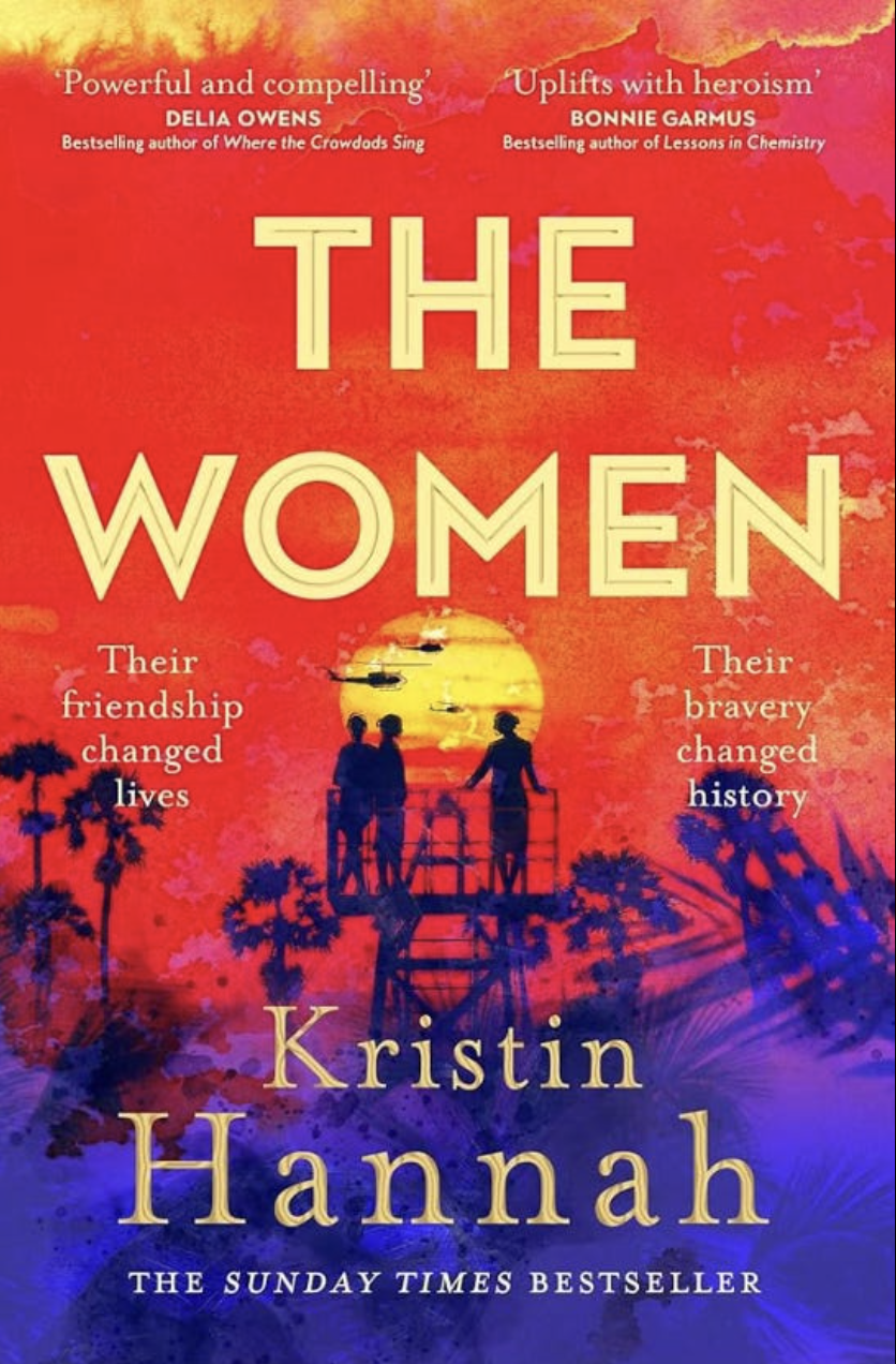
One of the guilty pleasures of biking so much is listening to audiobooks. I suppose people with long commutes can do this too, but I end up listening for five or six hours a day sometimes. The book I finished on this stretch was called The Women by Kristin Hannah, about a nurse who serves during the Vietnam War. I won’t give it away, but it’s both powerful and informative.
Today I rode 20 miles from the Winfield Trading Company, just north of Sagar, into Gallup. The weather on this stretch has been mild. I anticipate that as we move through Arizona and into the Mojave Desert, it will heat up. I’m still very worried about the long Needles-to-Ludlow day, but instead of obsessing over it, I’ve accepted that what will be, will be, and Sara and I will just have to tough it out. She is the best person to tough things out with, too.
Now that half the trip is over, as of tomorrow, what will the second half be like? What will Dan’s vibe be like? After him, I’ll have two nights alone, and then Sara arrives. It’s been interesting having different people join me. For the most part, it’s nice to have company, especially after a long day of riding.
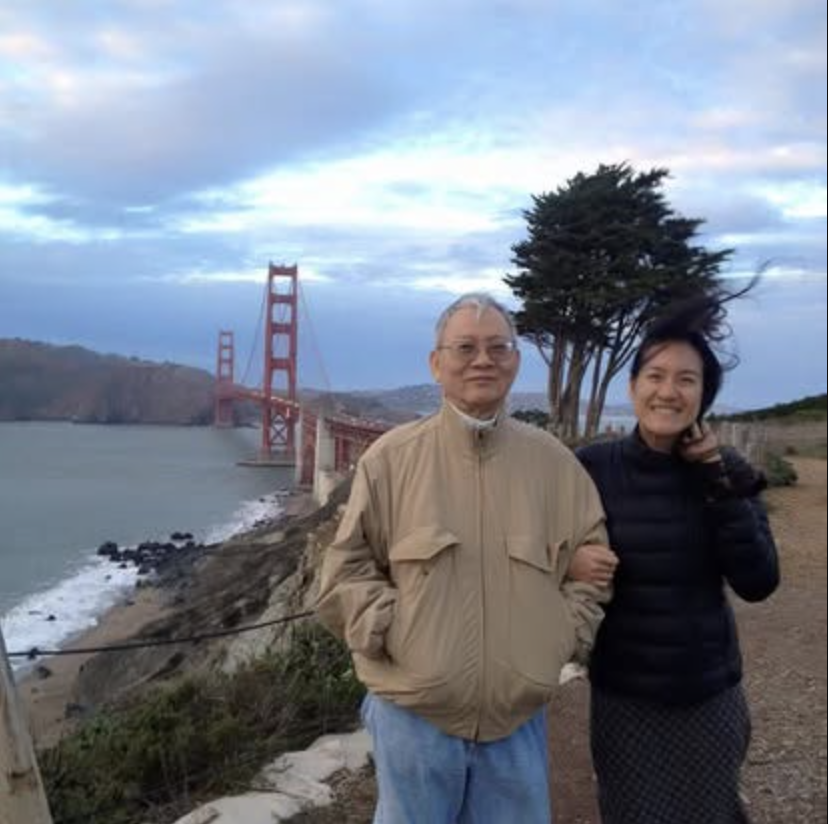
My dad is leaving tomorrow. I’m sad that he is going and worried about his drive home. I know that I can’t be too emotional because he might rally to stay, which wouldn’t be in his best interest. I’m honestly so proud that he actually came. He’s a bit of a recluse. He rarely leaves the house and always says that he wants today to be like yesterday and tomorrow to be like today. Not exactly the type of person who bounces into a car and drives 600 miles to pick his daughter up from the airport to start a wacky bike ride. Or is he?
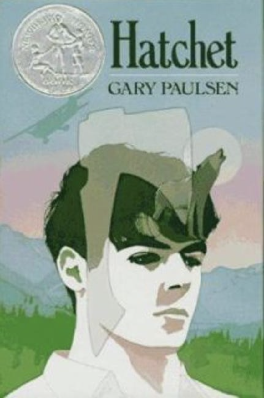
My mother often blames my father for my adventurous streak. He raised me on adventure stories, novels, and movies. Whenever we were in the car for more than ten minutes, he’d ask me what the one item I’d want to have in a plane crash would be — you know, à la Hatchet. We would go over lists of items and prioritize them. I think it even inspired my favorite first-date question: what would your apocalypse dream home be like? You’d first have to specify the type of apocalypse, the terrain around your house, and what the key defensive features would be.
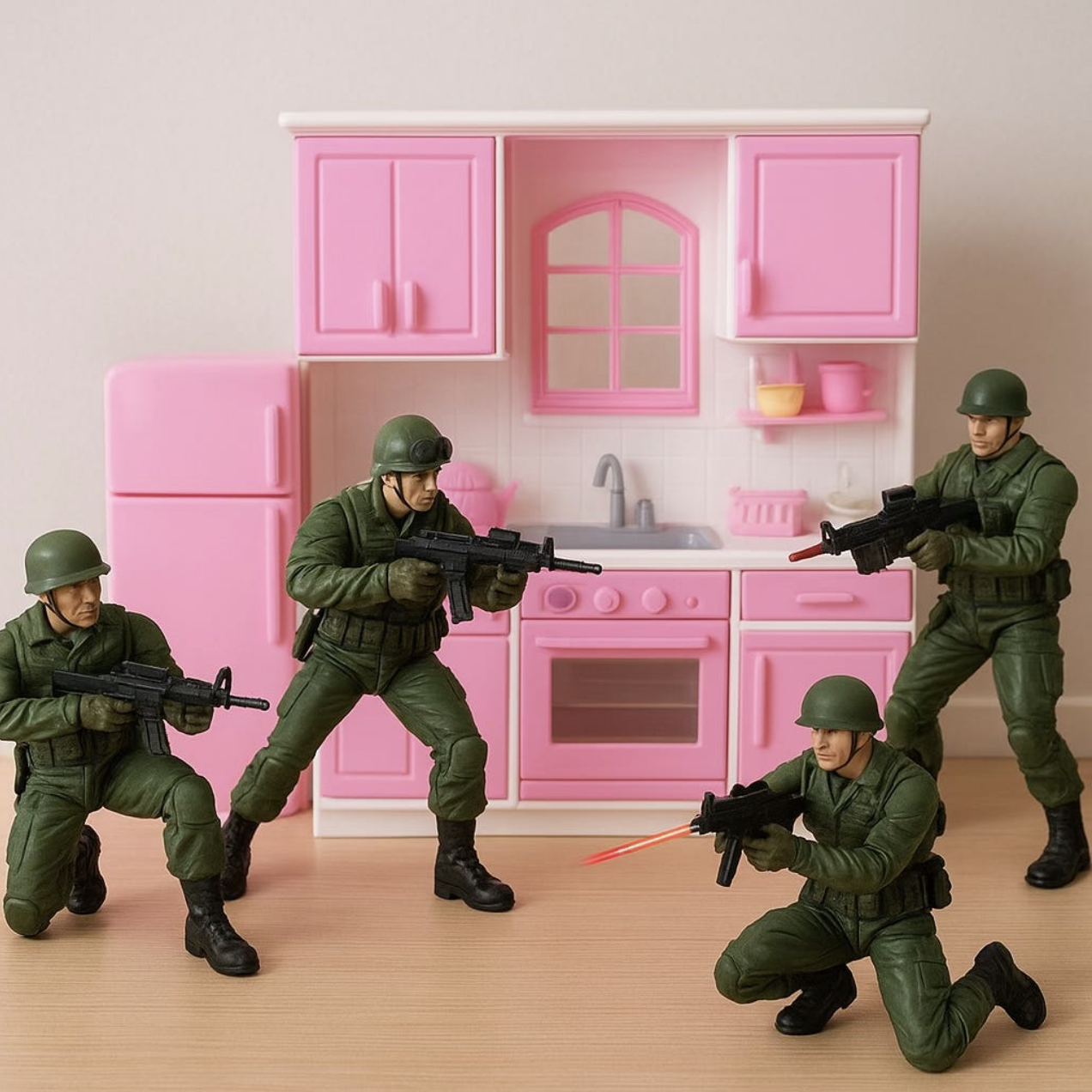
A tribute to my brother who made sure I never got too girly…
Ironically, my aunt gave me a Barbie Dream Kitchen when I was a kid, but my parents refused to buy me Barbies. So my brother and I would attack the kitchen with G.I. Joes. I suppose it fits, having a first-date question involve a “dream home” for a bunch of zombies to attack.
He raised me to believe in myself, prepare like crazy, think of contingencies, and then think of more. Not to let my guard down even when the adventure was almost over, because carelessness is the root of many mistakes. I loved camping, hiking, biking — really, pushing beyond the accepted boundaries of what is reasonable. These instincts were inspired by the adventure stories he shared about his past in China and Taiwan, or his dreams as a young man to see the American frontier.
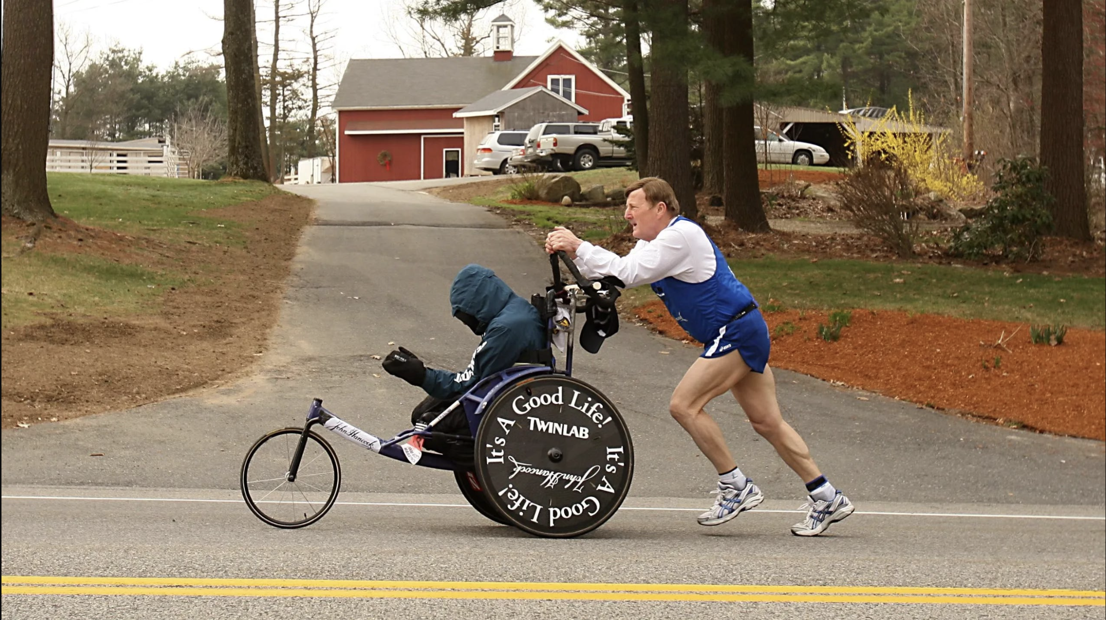
In 2009, when I first toyed with the idea that I’d ride U.S. Route 66 and eventually went from Chicago back to New York City, he drove to meet me in Ohio. At every rest stop, he’d have his handy propane stove out, cooking noodles with sauce my mother had made and sent with him. During this time, I saw a billboard of Dick Hoyt, the father who used to run marathons while pushing his son in a wheelchair. My dad is less athletically inclined, but the love is the same.
So when my dad, now 85, decided he wanted to come, I was excited by the prospect of having a reprise of a father-daughter adventure together. However, I was also hesitant because, well, he’s 85, and he’d be driving at least 2,500 miles. It’s a bit much for someone who rarely leaves the house.
Now, 1,200 miles from home, he’s got a fever and has three days of driving ahead. So we’ve decided that it’s best he rest today and leave tomorrow, even though the plan was for him to stay with us one more night in Holbrook. However, if he’s feeling strong, he’ll drive out tomorrow and try to make it to El Paso, then San Antonio, then Houston. Cross your fingers nothing happens between here and Holbrook where we’d need a rescue car!
A long time ago, in a galaxy far, far away…
RT66 Day 8: Crossing the Continental Divide!
Clear skies, light breeze, and sunny day. Its a good day to be alive.
Clear skies, light breeze, and sunny day. Its a good day to be alive.

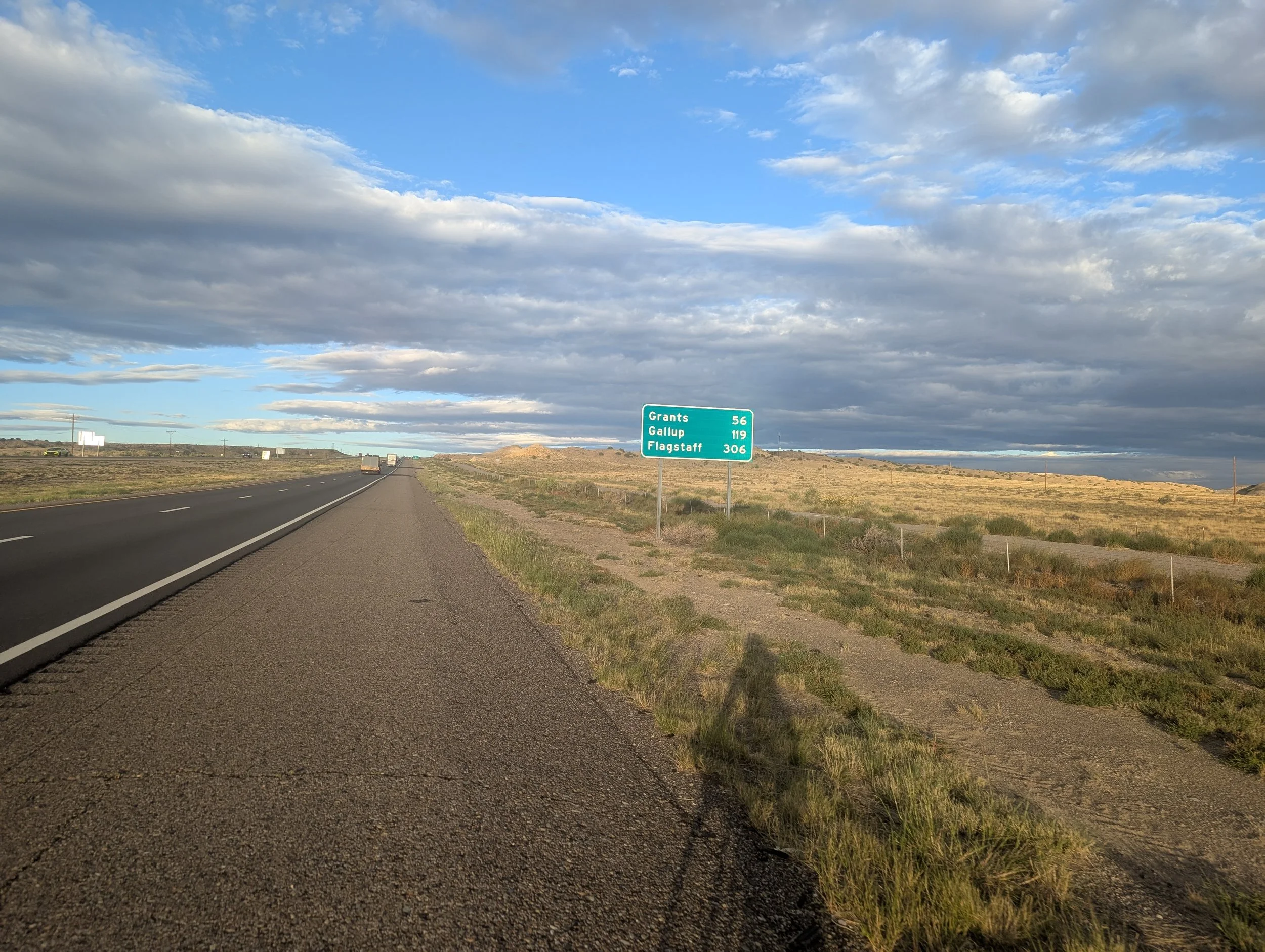
Day 8: Grants, NM to Sagar, NM; 79 miles, 3,199 feet elevation gain
Day 8: Planned on Ride with GPS
Intraday Stops:Conoco (49.7 miles), Family Dollar Sagar (26.6 miles)
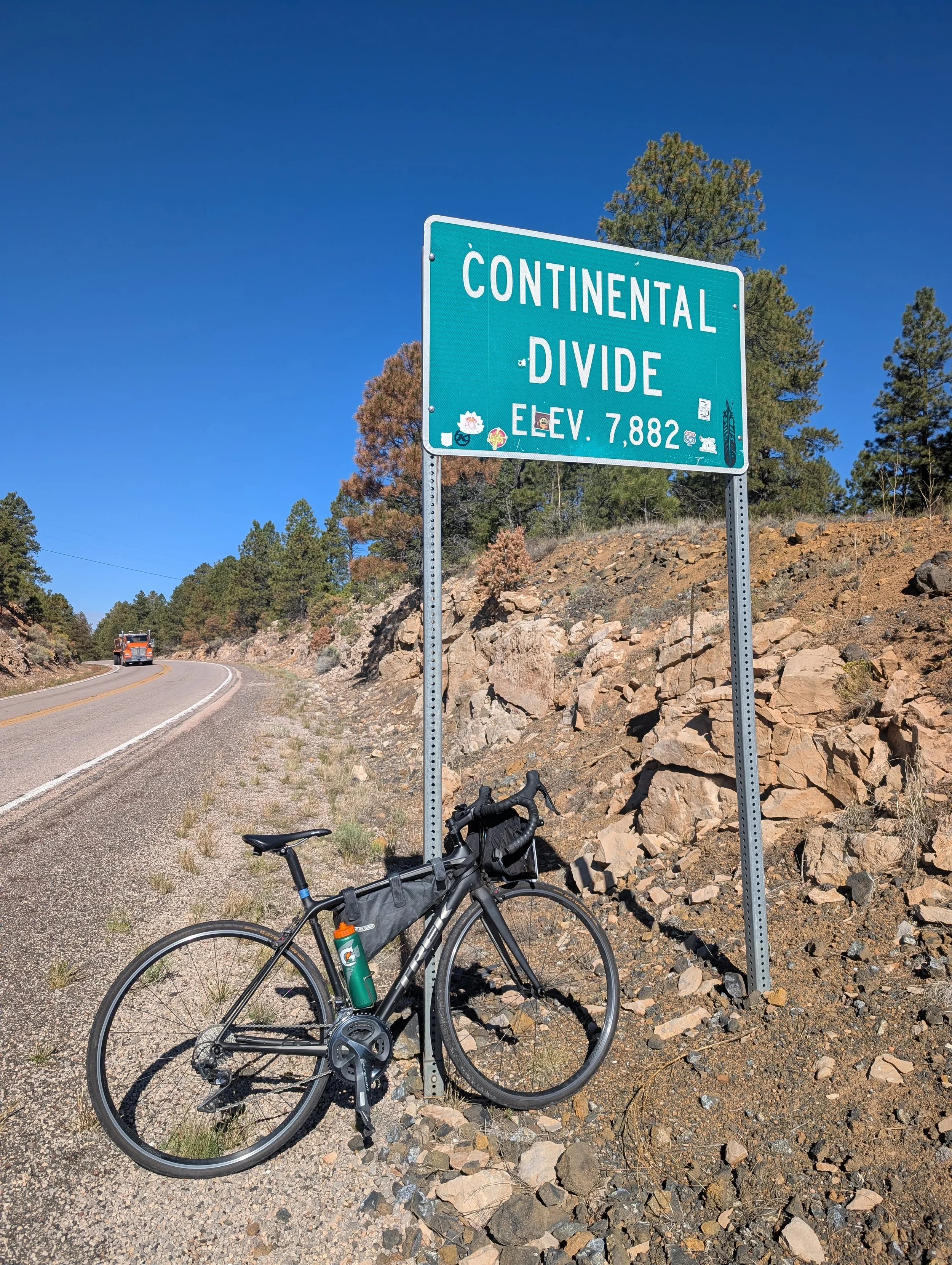
There’s no milestone quite like riding over a mountain or crossing a high pass. You are literally surmounting an obstacle in your path.
Today, I rode over the Continental Divide.
It sounds dramatic and impossibly high, but what exactly is it? The Continental Divide is a mountain ridge that separates major river basins, determining which direction water flows across a continent. On one side, rivers flow east; on the other, they flow west. In the Americas, the divide stretches from northwestern Alaska, following the Rocky Mountains southward, all the way to Patagonia along the Andes. Water west of the divide ultimately drains into the Pacific Ocean, while water east of it flows toward the Atlantic, Arctic, or Gulf of Mexico.
For this ride, the Continental Divide also represents the highest elevation I’ll reach: 7,882 feet.
For someone who lives in the Bay Area and grew up in Houston, exerting myself at this altitude was something I couldn’t realistically train for. Thankfully, the gradual elevation gain over the past week seems to have allowed my body to adapt naturally, and so far it hasn’t posed much of a problem.
After about a week on the road, I’ve settled into a surprisingly comfortable routine.
I wake up around 5:00 a.m. feeling genuinely energized and — perhaps even more surprisingly — focused. I usually linger in bed for a while, doing light full-body stretches followed by repeated piriformis stretches on both sides. Whenever I bike heavily, I develop a deep tightness through my glutes, which I’ve been told originates from the piriformis muscle.
Around 5:30 a.m., I finally get dressed and head downstairs for coffee in the hotel lobby. Like any athlete preparing for a long day of exertion, my primary goal each morning is simple: poop.
Coffee in hand, I return upstairs and settle into a stretching routine that dates all the way back to my ballet days. Meanwhile, the Weather Channel drones in the background, delivering what feels like a wildly exaggerated forecast every single day. If there’s a slight chance of drizzle, they present it like a once-in-a-decade natural disaster from which survival seems unlikely unless you evacuate immediately. It reliably scares me every morning, and then, once I finally start riding, the weather turns out perfectly manageable. Every day I swear I’m going to stop watching it. Every day I turn it back on.
Lather, rinse, repeat.
I usually stretch for 30–45 minutes before and after riding. I can’t scientifically prove this, but I genuinely believe flexibility is the reason I’m able to complete long-distance events like this with relatively little training and minimal injury.
Most hotel breakfasts begin around 6:30 or 7:00 a.m. Midscale hotels actually tend to offer fairly decent options: hard-boiled eggs, plain yogurt, oatmeal, fruit. Naturally, I gravitate toward scrambled eggs, biscuits and gravy, and occasionally a waffle.
While eating breakfast, I also assemble two egg burritos to bring along for the ride. I pack my own tortillas. During the first half of this journey six years ago, I would stop for lunch somewhere and buy two meals — one to eat immediately and another to stash away for later. This time around, the breakfast burritos function as both my “second breakfast” and lunch. I rarely snack much in the afternoon anymore before heading straight into an early dinner. If we were in Spain, it would probably still count as lunchtime.
I’ve noticed that with age, I simply don’t eat as much as I used to.
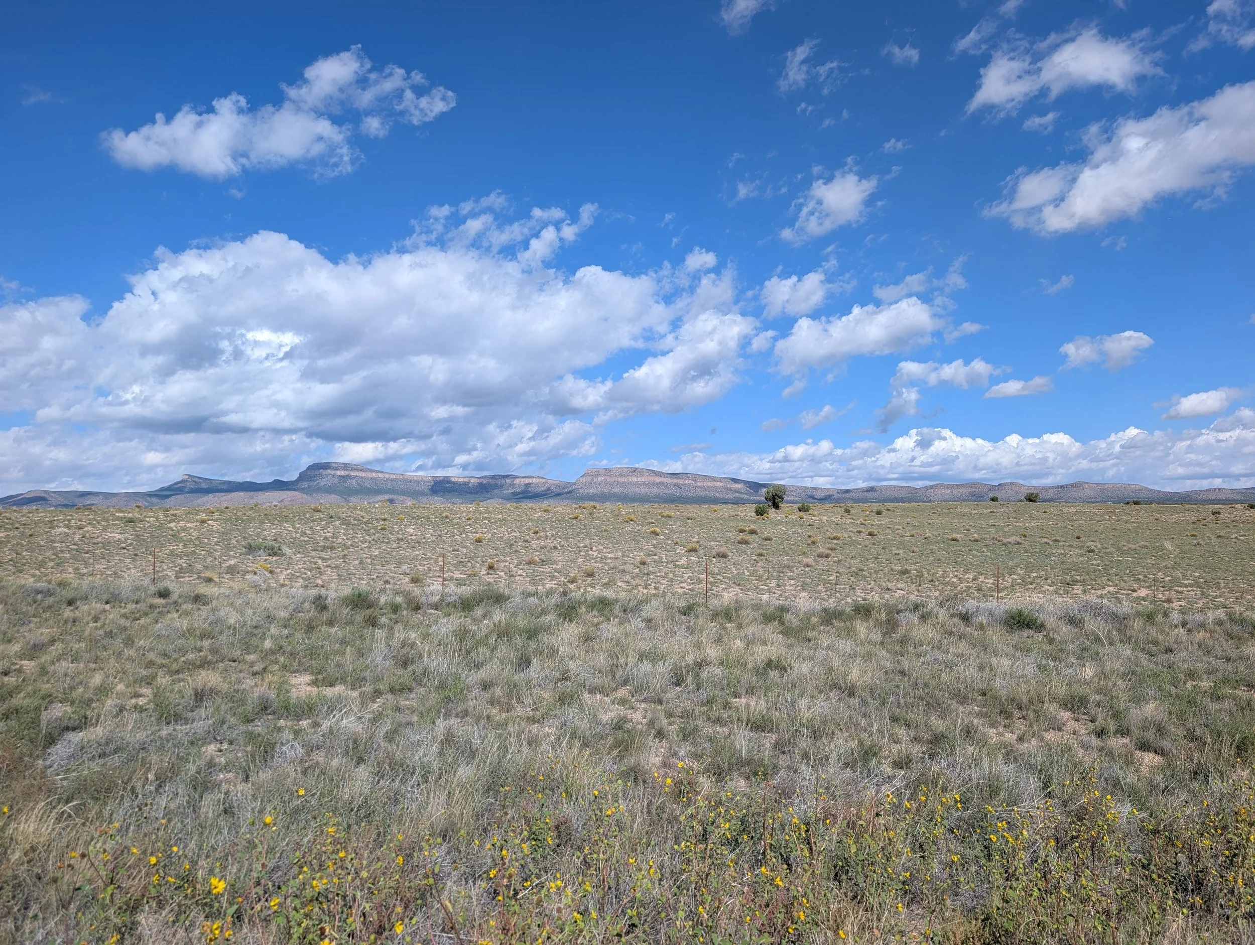
The terrain east of the Continental Divide is absolutely gorgeous — quiet, expansive, and largely empty. There are very few services or water stops along this stretch, which is one of the reasons my dad wanted to accompany me on this section of the trip.
Unfortunately, our meeting logistics did not go smoothly.
We initially planned to meet at a trailhead, but his GPS directed him to the wrong one. Then we agreed on a Conoco gas station, only to discover that it was closed. Consider this a warning to future riders: carry enough water and food because there is very little available out here until the Family Dollar, roughly 75 miles from Grants. Thankfully, there are dedicated bike paths in and around Ramah.
The weather, at least, cooperated beautifully. The morning began with almost no wind at all, while only mild 8 mph winds were forecasted for the afternoon. I’ve learned quickly that it’s wise to get riding as early as possible before the stronger afternoon winds arrive.
Eventually, I stopped at the Winfield Trading Company, still twenty miles short of Gallup. It sits uphill from the Family Dollar in Sagar, where I had originally intended to stop.
Truthfully, I still felt great physically and probably could have kept riding. My dad, however, looked awful.
He’s been sick for several days and was running a fever back in Albuquerque. Today he looked utterly exhausted, like he simply needed sleep more than anything else. I’m worried about him because in two days he plans to drive back to Houston — a fourteen-hour drive that will realistically take him at least two days.
Did I mention he’s 85?
So we decided to shut things down early for the day, check into our Airbnb, and let him sleep. Tomorrow morning, he’ll drop me back off at Winfield Trading Company before returning to rest while I bike the remaining miles back into town. Hopefully he’ll recover enough strength to start the drive home the following day.
Meanwhile, tomorrow night, Dan — the soulmate of my soulmate — arrives to escort me onward to Flagstaff.
Peter Pan always tries to catch his shadow. I’m just trying to keep up with mine.

RT66 Day 7: 3rd FLAT! Should have gone tubeless!
Twenty miles on the interstate, big, wide open skies, and then a crash. When things start to go wrong...
Twenty miles on the interstate, big, wide open skies, and then a crash. When things start to go wrong...
Day 7: Albuquerque, NM to Grants, NM; 59 miles, 2,723 feet elevation gain (Part 1) | (Part 2)
22.6 miles on I-40
Day 7: Planned on Ride with GPS
Intraday Stops: Laguna 66 Pit Stop (27 miles), Villa Cubero (11 miles), Phillips 66 McBride Rd (14 miles), Grants (6 miles)
I expected it would be hard to get back in the saddle after a rest day, but surprisingly, it wasn’t. In fact, I feel invigorated by moving for most of the day. Maybe our bodies really did evolve to stay in near-constant motion and then collapse into deep, uninterrupted sleep at night. If that’s true, though, why doesn’t modern culture embrace it? My only real discomfort seems to be temperature regulation. It’s hot. Perhaps that’s the downside of living in the Bay Area.
One thing worth noting about riding near Albuquerque — and New Mexico in general — is that it’s windy as hell. According to the fine folks at REI, springtime in April and May is especially brutal because of pressure gradients caused by major atmospheric temperature differences. Those winds usually blow west to east.
By March or April, the polar jet stream has started migrating northward, but can still often influence the southwest U.S., such that wind speeds increase dramatically with height. Meanwhile, the sun angle is getting higher in the sky and creating greater heating near the surface of the Earth. The heated surface air rises to a greater depth of the atmosphere during these spring months, often to a height between 7,500 and 10,000 feet above the surface. The rising air mixes with stronger winds aloft, resulting in stronger and turbulent winds mixing down to the surface. Strong surface pressure gradients can enhance surface winds. High wind events across New Mexico can also occur with strong surface fronts, especially those that race through the eastern plains. —NOAA, National Weather Service
Now, I realize September technically isn’t spring, but there seemed to be an unusual amount of wind today anyway. As part of my daily ritual, I screenshot the weather and wind forecasts every morning to gauge what kind of ride I’m in for. Today’s prediction called for 8 mph winds, but light precipitation pushed them closer to 12 mph. It should have been a relatively easy 60-mile ride, but instead it felt like pedaling through mud all day. Oddly enough, though, my body still doesn’t feel sore. Yet.
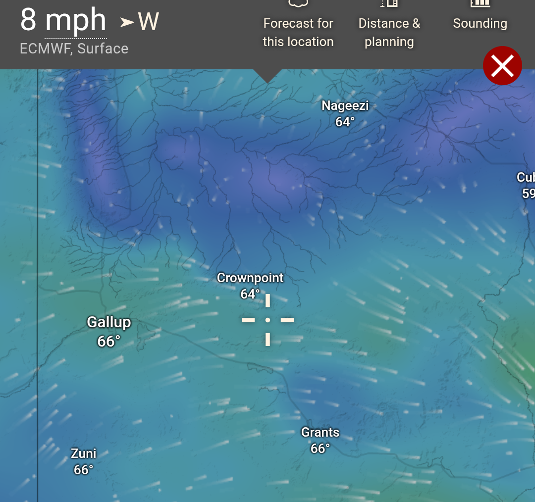
But I digress.
In chronological order, here’s how the day unfolded.
As usual, the interstate riding was harrowing. A few miles after finally exiting the freeway, I discovered my third flat tire of the trip. So far, every flat has come from tiny steel reinforcement wires shed from shredded tractor-trailer tires. At this point, I’m fairly convinced I should have gone tubeless and have already resolved to switch when I get home. Thankfully, I was only two miles from a gas station when it happened.
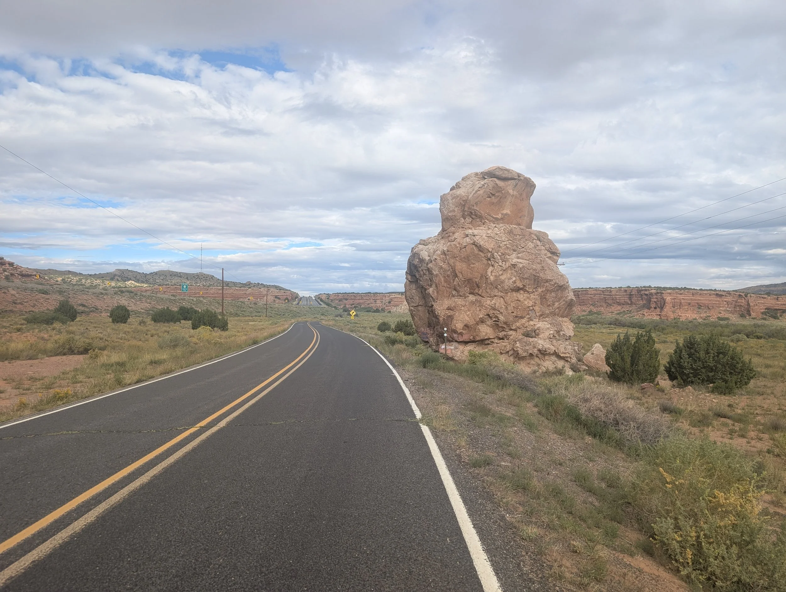
The view as I changed my flat, not bad.
I know I sound like a broken record — and wow, what an anachronism that phrase has become. How many people even own turntables anymore?
Still, this stretch of Route 66 is astonishingly devoid of services compared to the Chicago-to-Oklahoma City portion of the trip. Sometimes you just want to sit somewhere, eat a sandwich, and take a nap, but there often isn’t a decent place to do that out here. Also, there are tarantulas.
Occasionally, I’ll pass a place that looks wonderful and feel disappointed I don’t actually need to stop there. Take Villa de Cubero, for example. It looked incredibly inviting. I bet the restroom was immaculate.
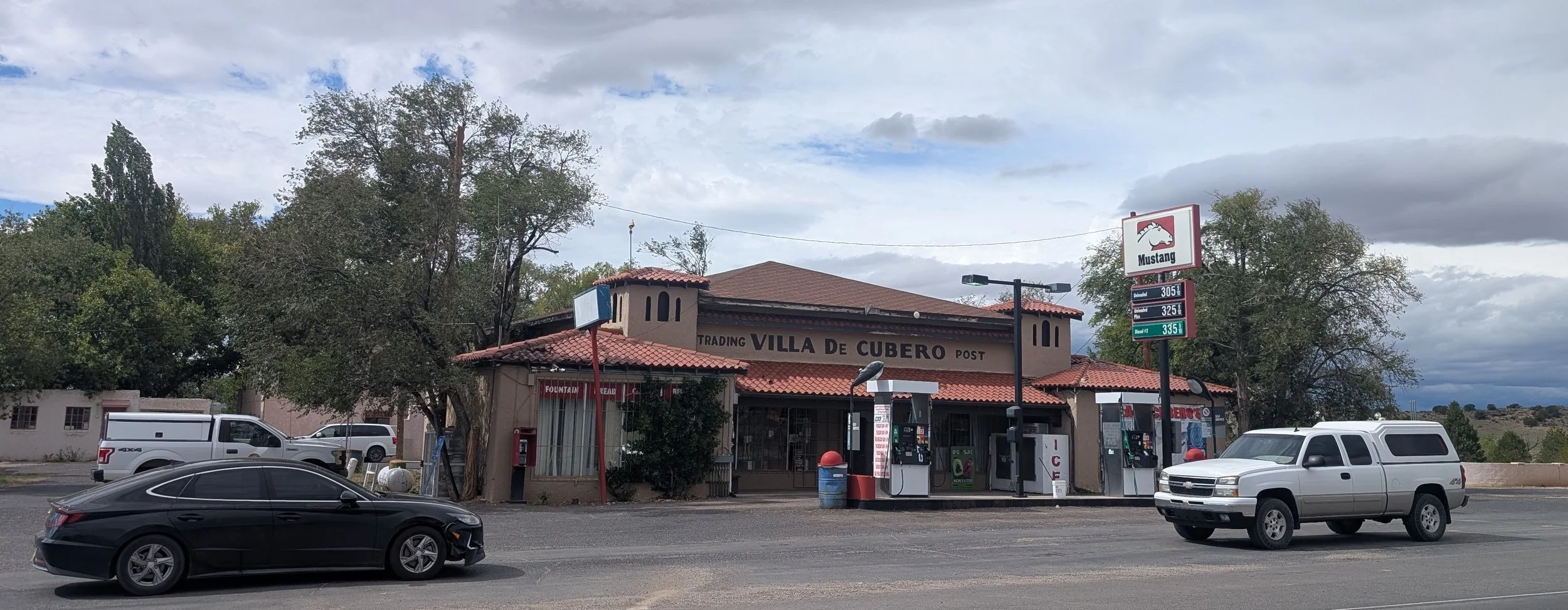
The skies out here are so wide and the cloud formations so strangely uniform that the landscape can feel unsettlingly placid — almost artificial. Like a painted backdrop or something out of The Matrix, where the sky might suddenly dissolve into a digital grid and reveal that aliens are farming us. Maybe that’s what happens when you spend hours biking alone with nobody to talk to: your mind starts wandering into bizarre territory.
Unfortunately, my wandering mind came with consequences.
While distracted, my tire lost traction on a gravelly shoulder, and I completely ate it. Hard. And the truly painful part? I was only nine miles from the end of the day.
Honestly, I didn’t even mind the crash itself that much. What bothered me more was my watch.
Before this trip, I bought a new Garmin Fenix 7 Pro after reading obsessively through product reviews — well, technically just one reviewer, but he’s THE ONLY SMARTWATCH REVIEWER YOU’LL EVER NEED. The guy is absurdly thorough and aggressively Type A. Honestly, after reading his reviews, there’s no reason to consult anyone else. He’s basically one of the original internet gadget reviewers and has apparently been doing this for more than fifteen years.
Anyway, modern smartwatches now have these wild features where, if they detect an “incident,” they automatically contact your emergency contact. So there I am, sprawled on the side of the road with my cycling shoes still clipped into the pedals and the pedals still attached to the bike, lying on an eight-inch shoulder while my watch starts shrieking at me that it’s about to notify my husband unless I cancel within ten seconds.
At that moment, all I wanted was for my very expensive glorified step counter to stop yelling at me.
My watch has a mind of its own.
The resulting message apparently confused my husband because it first texted him: “I’m OK,” followed by GPS coordinates indicating where an incident may have occurred.
In the end, I escaped with some bruises, road rash, and the knowledge that my watch is an absolute narc. Honestly, the most annoying consequence was that the crash detection stopped my activity tracking and forced me to restart everything manually.
Still, in the grand scheme of things, I’m grateful I walked away mostly intact.
Nine miles later — somewhat bruised and slightly rain-soaked — I was sitting with my dad eating a warm cup of noodles.
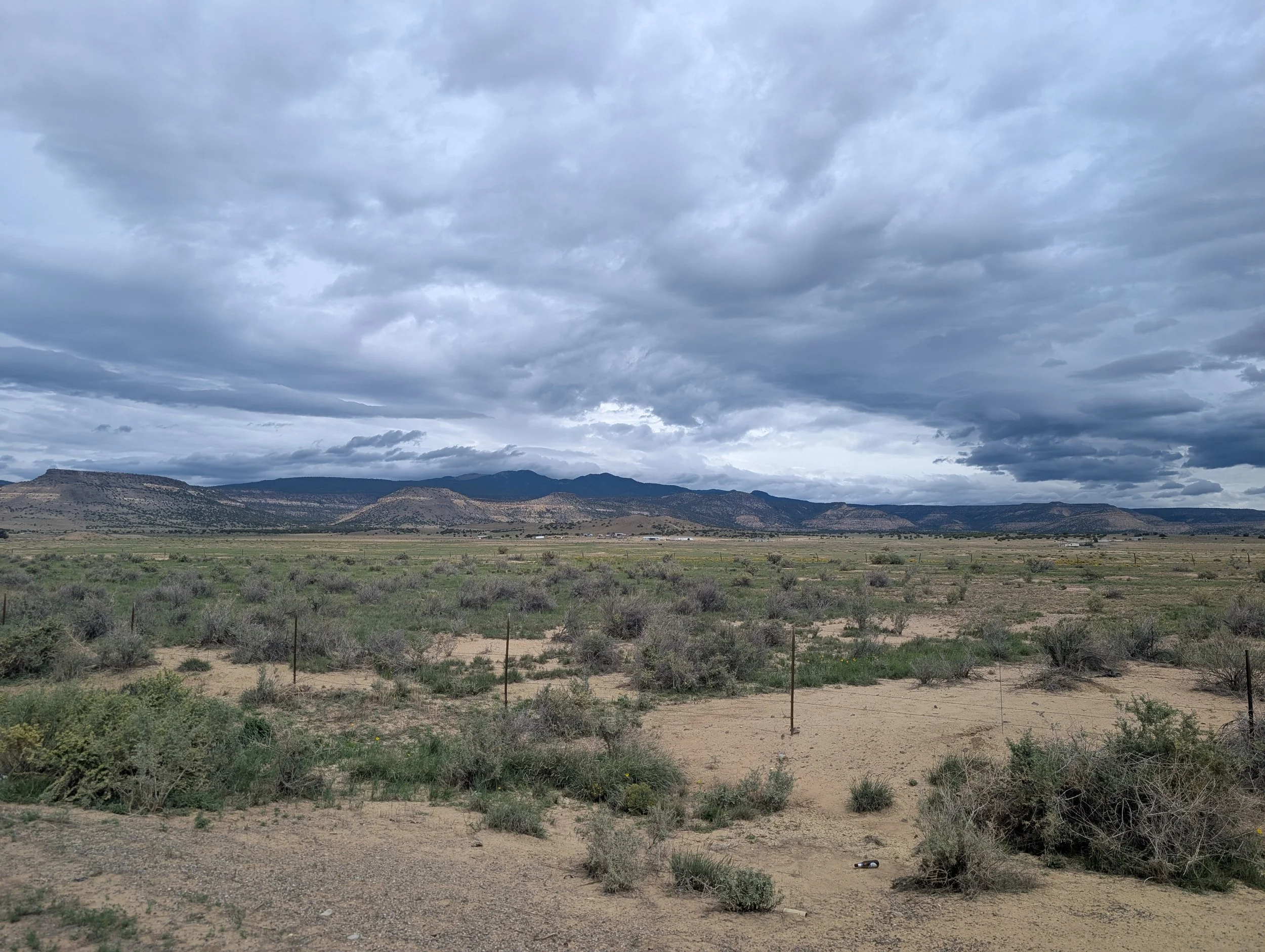
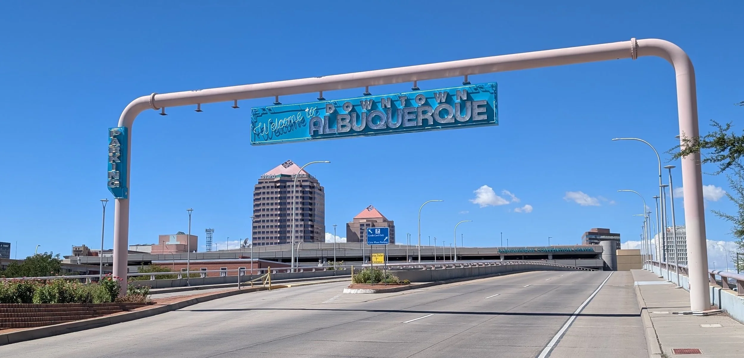
RT66 Day 6: REST DAY 1 Albuquerque
I rode for five days and rested on the sixth. I couldn't make it to seven because I'm not God...
I rode for five days and rested on the sixth. I couldn't make it to seven because I'm not God...

I love the larger towns along Route 66 — Tulsa, Oklahoma City, Amarillo, Albuquerque, and Flagstaff. They challenged a certain arrogance I didn’t even realize I carried from living in major cities like Houston, Chicago, New York City, and San Francisco.
There’s so much vibrancy in these smaller-tier cities and a kind of “culture” I mistakenly thought was reserved for top-tier urban centers. No, not culture in the traditional sense — museums, symphonies, or major art scenes. While those are commonly accepted indicators of culture, my own definition is much narrower and admittedly more self-indulgent: food and wine.
When I finished my ride in 2019, I found a bottle of COS Frappato at some random strip mall pizzeria near my hotel. In Tulsa, I discovered a wonderfully hipster wine bar pouring numerous wines on tap. This time, in Albuquerque, I stumbled upon a little grocery store called La Montañita Food Co-op. It was adorable — full of fresh organic produce, wild-caught salmon, and bulk dry goods — and reminded me so much of Berkeley Bowl back home.
So what did we do on our first rest day?
I cooked and stretched. My dad rested and slept.
We also made a trip to REI to buy extra inner tubes and look for sun protection for my legs. In the end, I couldn’t find anything that fit properly, so I improvised and bought extra-large arm warmers that somehow fit my meaty little thighs.
While at REI, I also learned about goatheads — those nasty little thorn-covered seed pods that apparently plague mountain and gravel bikers far more than road cyclists. Given my recent flat tire adventures, this discovery suddenly felt very relevant.